3D maps for your apps
Access detailed OS MasterMap Topography Layer buildings in new ways
With the release of OS Vector Tile API and OS Features API, you can access detailed OS MasterMap Topography Layer buildings in new ways – and the height attributes are ready to be used!
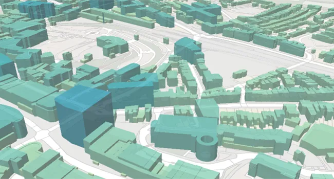
2D maps are often preferred as they present a simplified view of the world that is easy to interpret. However not only is 3D data eye catching, it can offer a new dimension to your map – quite literally. OS MasterMap building footprints are detailed and accurate and can benefit many use cases. These footprints can help inform decision making, add confidence to reporting, and take visualisations to the next level.
Building heights at your fingertips
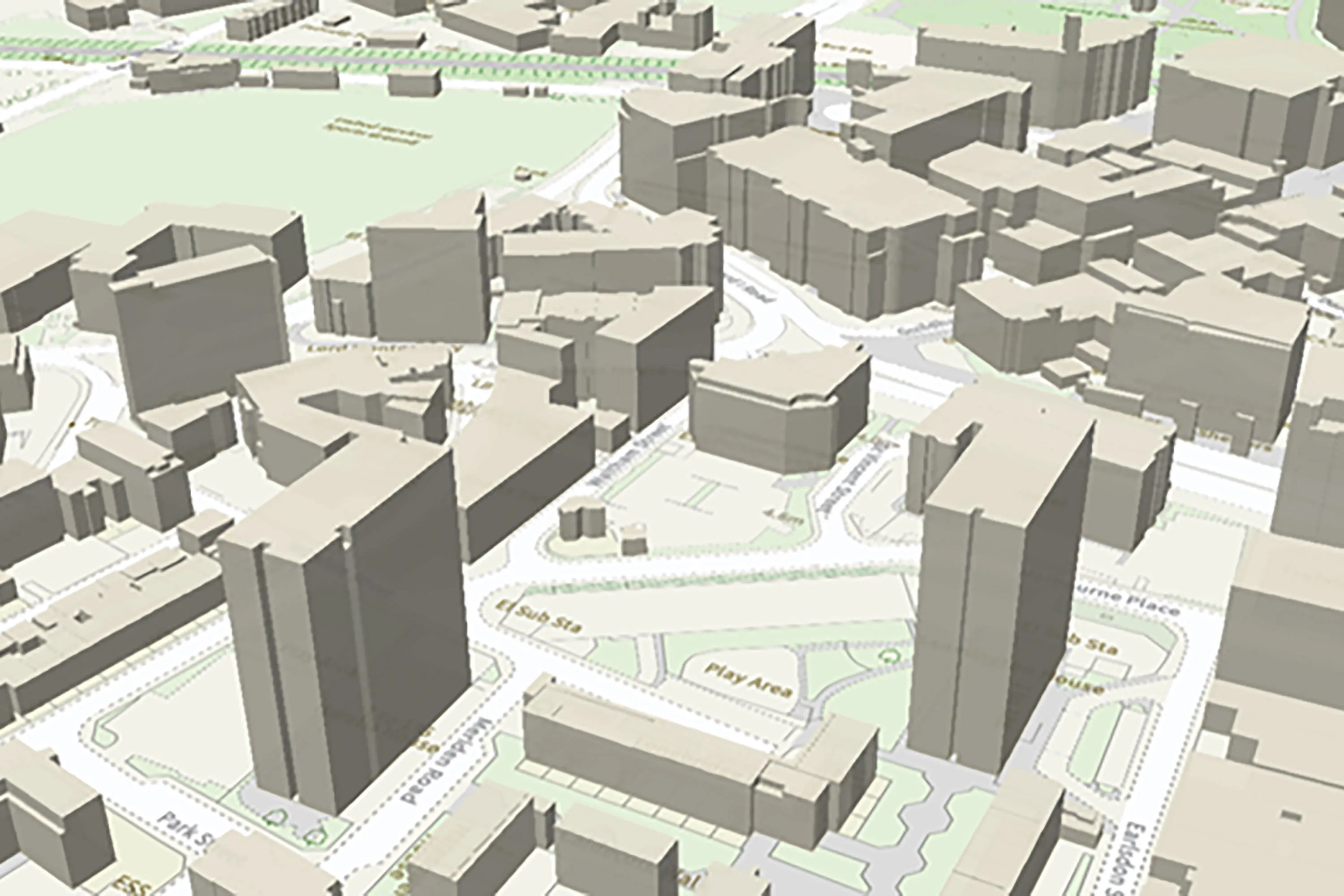
This code example shows how you can extrude the buildings in OS Vector Tile API. We even have stylesheets ready to use with the option to customise them to suite your needs. The same building height attributes are also available via OS Features API. 3D maps can add extra real-world context to your own data.

Using multiple OS APIs together (in this case OS Maps API, OS Features API and OS Linked Identifiers API), we can chain requests to create compelling solutions that help answer complex questions. With this new functionality, it would be possible to search for a UPRN, discover the corresponding TOID and therefore identify the building which then could be extruded to its true roof height.
Unlocking the power of 3D
Prefer to have all your data downloaded locally? In this webinar, Richard Martin (Technical Relationship Consultant) discusses various implementations of the height attributes in various desktop GIS software including QGIS and ESRI ArcGIS Pro. Live demonstrations explore key features including 3D models and cartographic styling.
Check out os.uk/developers for more support and keep in touch with us on Twitter using #OSDeveloper.
Explore the OS Data Hub
With over 20,000 updates to our databases every day, you have access to a comprehensive and up-to-date set of authoritative data through the OS Data Hub

Our highly accurate geospatial data and printed maps help individuals, governments and companies to understand the world, both in Britain and overseas.
Products and solutions featured in this blog
OS MasterMap Building Height Attribute
OS MasterMap Topography Layer is a dataset showing building heights for Great Britain.
OS Maps API
Accurate, up-to-date maps that offer the most convenient way to add detailed OS data to your application.
OS Features API
An API to filter Ordnance Survey data for buildings, roads, rivers, hospitals, playing fields, greenspaces.
OS Linked Identifiers API
Access the relationships between properties, streets and OS MasterMap identifiers for free.