Spring Is In The Air And So Is Our Flying Unit!
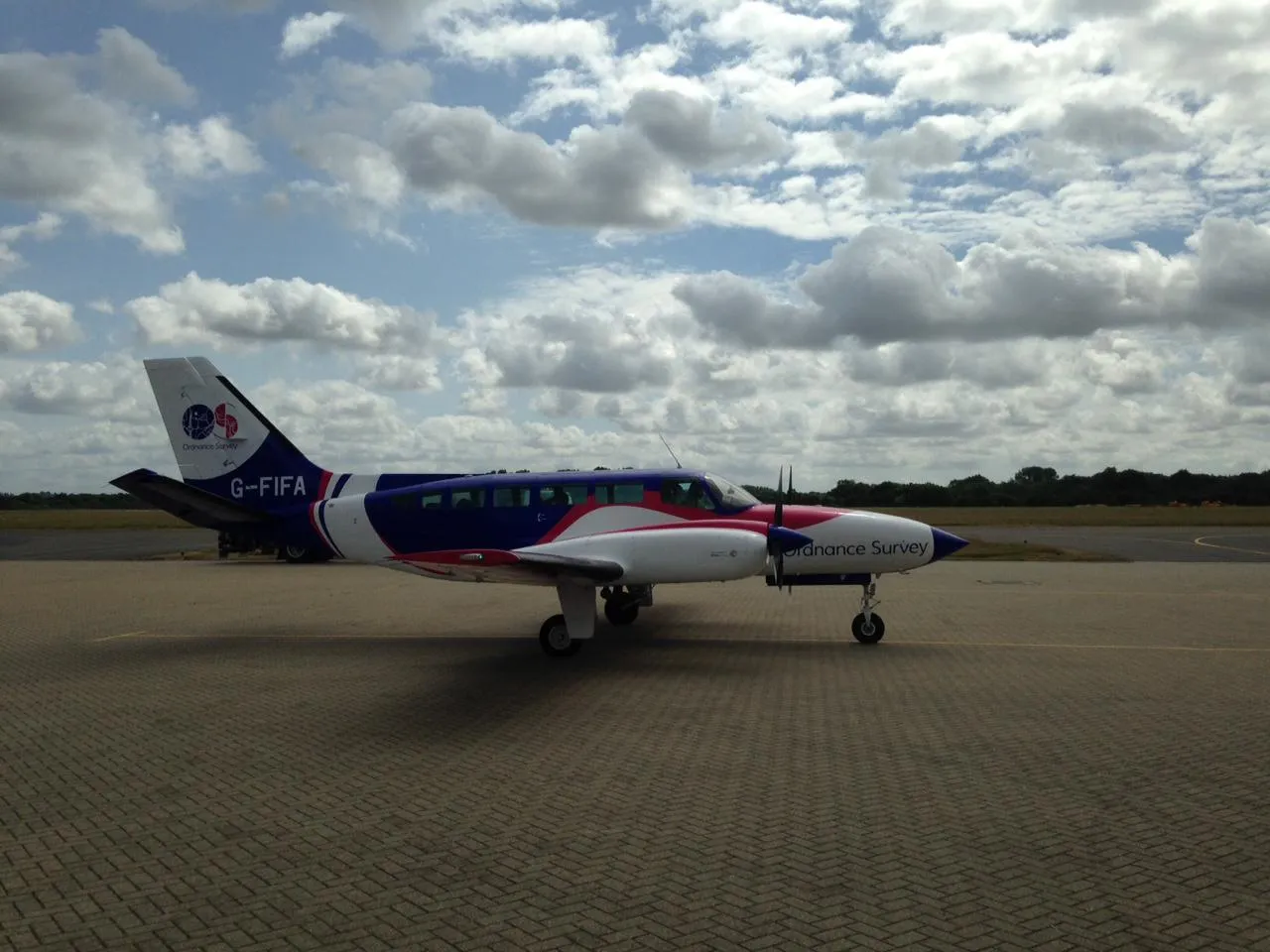
This year, we’re excited to be adding two Vexcel Mark 3 UltraCam Eagle cameras and a Pressurised Beechcraft B200 King Air aircraft to our kit! In a bid to capture more imagery than ever before and to test efficiency with flights, the new cameras and plane are being flown higher and at faster speeds.
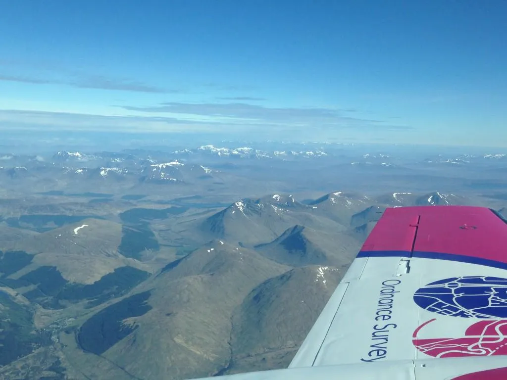
This will be the first time we are using aircraft which can go over the 10,000 ft limit and plan to fly around 13,000 ft. We are flying at that height to give us our output 15cm Ground Sample Distance (GSD) when using our new cameras. These flights complement those being flown in the existing Cessna aircraft, the OS ‘workhorse’, which flies between 8,000 and 9,000 ft.
Both leased from Vexcel Imaging and just off the production line, the new cameras have the latest digital multi-spectral camera technology. At 450 megapixels they have a very high resolution with over 26,000 pixels across the flight strip as well as interchangeable lenses. We have one for the King Air of 100mm lens and 80mm lens for the Cessna.
A fleet of four aircraft is flying over Britain this year, aiming to capture about 90,000 km2 of imagery data (over 180,000 individual images). The team works on a three-year cycle, so we are currently updating areas flown in 2016 or before.
At this time of year, we carry out preparation work to get the aircraft and cameras ready, plan where flightpaths should run and apply for access to restricted airspace from National Air Traffic Control (NATS teams).
We have already taken to the skies over Wales and central England and will continue to do so through to the end of October. Areas that are difficult to capture will be targeted by our air camera operators this season. The Shetland Islands, Outer Hebrides in Scotland and urban areas across the south of England through to West Wales will be photographed.
The team also supports our field surveyors by flying over about 100 bespoke targets where there is restricted ground access. Obstacles such as railway lines, motorways, and industrial chemical works can be overcome by using aerial imagery to keep our mapping updated.
Currently we have six air camera operators who cover the flying season and when they are not up in the air they are out surveying, both in the field and for our Remote Sensing Services team.
We’re looking forward to some clear skies and favourable flying weather this spring and summer, we’ll see you out there!
Background on the team
There are currently six air camera operators who, when not on flying duty, carry out surveying work both in the field and for Remote Sensing Services (RSS). Jean Martin, Operations Production Manager, manages the Flying Unit in RSS with daily contact as well as visiting the Flying Unit at East Midlands.

Our highly accurate geospatial data and printed maps help individuals, governments and companies to understand the world, both in Britain and overseas.