UPRNs and the property lifecycle
What is a UPRN?
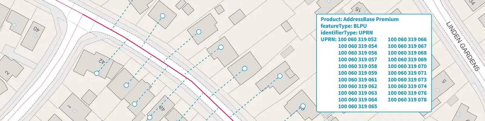
UPRN stands for a ‘Unique Property Reference Number,’ and it works in a similar way as a National Insurance number, or car registration plate. Except rather than serving as a unique identifier for an individual, it refers to an addressable location – a building, a bus stop, a post box, and so on.
A UPRN can be up to 12 digits in length, and they are allocated to properties at the earliest possible stage of their life cycle, either as soon as construction of a property begins, or street naming and numbering has been carried out – whichever happens first. UPRNs are assigned by local authorities and Ordnance Survey, with guidance from GeoPlace.
The lifecycle of a property
Consider how many processes and people a single property must go through during its lifetime; starting with landowners/agents/valuers, local properties, surveyors, consultants, architects, and developers – and that can all be before the physical building actually begins.
There are still so many stages one property can go through during its lifecycle; the different industries – financial, property, construction etc – that will play a part in its existence; and overall, just how much data it stands to accumulate. Numerous organisations, departments, teams, people will be involved and will need to collaborate with one other.
In the end, one property (which could be one flat in a block of twenty or more) will have amassed so many documents, emails, letters, and pieces of correspondence.
Every property accumulates data, and the UPRN allows the accumulation of that data, and makes it possible to link all these different data sets for different use cases. Having a single, unique identifier creates a means of ensuring consistency across various processes, and acts as a universal language between all these different sectors and industries as one simple, numeric code.
For example, a UPRN could be used to link the following about one property or location:
- What materials were used to build it?
- Who is the assigned owner/land authority?
- Is the property at risk of flood or subsidence?
- Does the property comply with local licensing e.g. is it gas safe?
Every piece of data is then ‘attached’ to that property by the UPRN. And it can be used at any stage during the lifecycle. If the property is then planned to be demolished or rebuilt, does it contain sustainable materials which could be reused?
Using the UPRN makes it possible to find this out, in less time. Everything relevant to that one property can be bound together to provide insights at an asset/property level
From start to finish
An allocated UPRN will remain a constant for an addressable location, never changed or reused, and will follow the lifecycle of that location, up to and including its demolition. Even if a property is changed or removed, its original UPRN is kept as ‘historic’ information and remains available.
Then, if the land is purchased and the land is built upon again, the new property (or properties) will be assigned a new UPRN. And the cycle begins again.
Overall, this makes it easier to understand, maintain, and manage the address data for any given addressable location. The entire history of the building or object, regardless of whether it is still there, will be recorded and identified by the UPRN.
Key benefits of UPRNs
Verification
Are you talking about the right property?
A UPRN guarantees which property or object is being identified. This can be especially useful when distinguishing separate flats in a tower block, or telling identical post boxes apart.
It also makes it possible to identify a property without needing to use personal data, such as the names and details of any people living there. If the building is unoccupied, an unsold new build, or a non-liveable location such as a substation, the UPRN can always be used.
Confidence
The UPRN is almost a level of detail beneath an address. A postcode on its own can only get you so far, and many address-based discrepancies can be caused by simple human error. Adopting the UPRN presents much less risk of errors in data exchange.
Then, the UPRN makes it possible to link different information and multiple datasets. The data which a local government authority uses may be of a different format or quality to, say, a gas and electricity supplier. However, by both using the UPRN, there is a common denominator between the two that can link sources together. And they can be reassured in the knowledge that they are speaking about the same property.
Imagine a series of links in a chain. Each link is a different organisation and/or different process in a property’s lifecycle – the UPRN is the key link connecting them all together.
Insight
Once data becomes interoperable, and users can use UPRNs to share data in a way that is usable and understandable, it opens new opportunities for data insight and analysis.
For example, local authorities can ensure safer communities by using the UPRN to easily identify any properties with no electrical check certificate, or a live gas meter and no gas safety report, to then raise the issue with landlord or resident, accordingly.
It could also monitor locations where unsafe cladding has been used on blocks of flats. Every part of the replacement process, starting with identifying the locations, the organisations involved, the average cost and time to replace, could all be managed more effectively through using UPRNs.
And once the UPRN is in place, it is possible to link additional information to that property. It could be used in the rollout of new telecom and/or internet networks; or linked to patient numbers to better monitor the distribution of vaccinations, for example.
"Data accumulates across a property’s lifecycle, and having a consistent identifier, assigned at the earliest opportunity, is a key factor in unlocking the value of data and encouraging better data management principles."
Adopting the UPRN
Recent insights suggests that there shall be an eventual shift, towards a system of property data files, or log book. Effectively, a property or addressable location has its own allocated data set, which contains everything relevant to that location. This creates a valuable lookup service, resolving the kind of requirements exemplified above. Adopting an accurate identifier, and discrete level of geography such as the UPRN, makes that possible.
A widespread adoption of UPRNs creates ease and simplicity, making it possible to fetch whole datasets with just one click, and gain data insight against one single asset.
The power of addressing
Get further information on the power of addressing data and the UPRN

Our highly accurate geospatial data and printed maps help individuals, governments and companies to understand the world, both in Britain and overseas.
Products and solutions featured in this blog
OS Open UPRN
An open dataset enabling linking, sharing and visualisation of data related to UPRNs.
