CASE STUDY

How councils can make the most of their access to OS mapping

From fundraising for more greenspace, to creating a public art trail, Histon and Impington Parish Council show how councils can make the most of OS mapping.

From fundraising for more greenspace, to underpinning neighbourhood planning, to creating a public art trail, Histon and Impington Parish Council show how councils can make the most of OS mapping.

Supplied under the Public Sector Geospatial Agreement (PSGA), councils across Great Britain can access a range of OS services and expertise.

Histon and Impington Parish Council have teamed up with a local charity to raise funds for further greenspace, both for the benefit of the local community, and the environment.

|2 MIN READ
  • AddressBase

Challenge

Histon and Impington Parish Council have also used OS data to underpin their neighbourhood planning.

Whether it’s highlighting areas at risk from flooding – so that members of the community can make sure they’re protected – or gathering local views on a development proposal, location data is key to informed decision-making.

"It’s really important to know you’ve got good coverage of the community, so it’s neighbourhood planning made by the neighbourhood. That means you need a map."

Solution

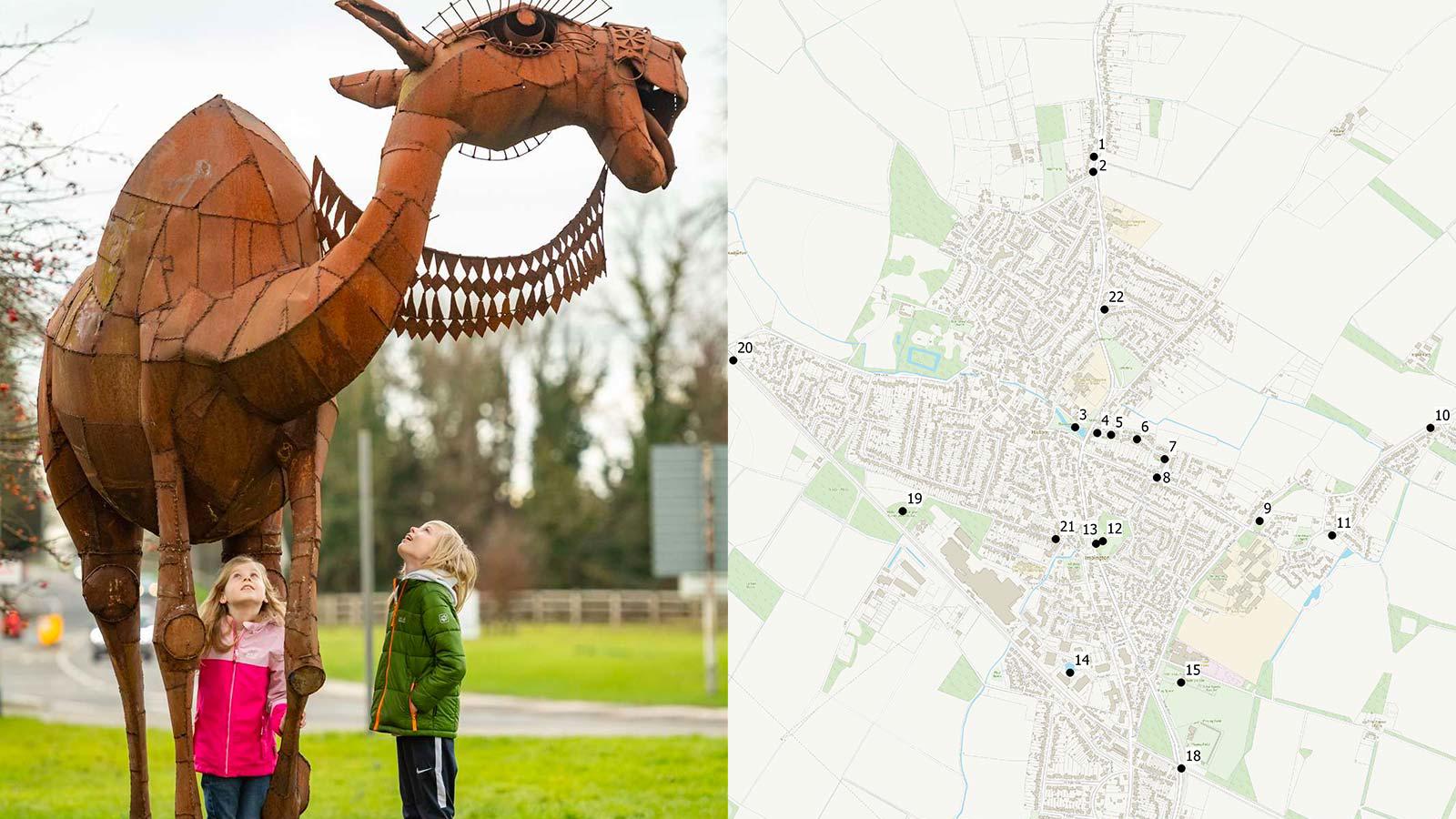
To get members of the local community outside and help improve their wellbeing, Histon and Impington Parish Council have found a creative use for OS data – producing a public art map.

They mapped the location of over 20 outdoor art pieces, including work by nationally recognised sculptors.

"There was so much interest, we had to see to the footpaths. We’d consider that a pretty good success."

Histon and Impington Parish Council

Result

Using AddressBase data, the council have been able to effectively reach out to members of the local community, record the response, and map out those who’ve made contributions, to help in planning the next stage of their campaign.

One of the art pieces has since been used as a navigation aid for those visiting the village, visitors advised to “turn left just before the camel”.

Camel (dromedary) sculpture on the Histon and Impington Parish Council art trail

"It’s easy to use. Fast. And always up-to-date. Every time I map something, it’s using OS mapping."

Histon and Impington Parish Council

Solutions for public sector organisations

Discover how your organisation can access world-leading location data and expertise

The Public Sector Geospatial Agreement (PSGA) supports the delivery of critical infrastructure and services, as well as working to help protect our environment.  

Learn more about the PSGA

Products and solutions featured in this study

  • AddressBase

    AddressBase matches 29 million Royal Mail postal address to unique property reference numbers, bringing a new dimension to the matched records.