Built Up Areas
A dataset representing Built Up Areas of Great Britain designed to underpin statistical analysis and contribute to policy enablement across the public sector.
Statistical analysis underpinning delivery of government policy
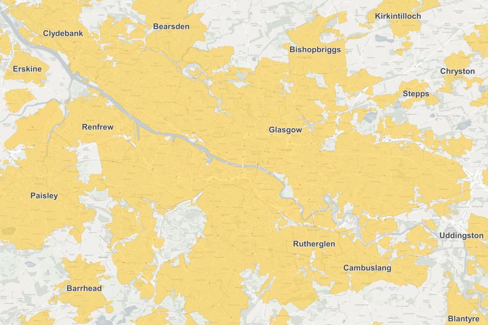
Built Up Areas are used to analyse census data to understand their characteristics and output a range of statistics, informing government policy.
GSS codes deliver value across government departments
GSS codes enable you to link statistics across government departments to Built Up Areas, improving consistency and accuracy for decision making and planning
Monitoring change over time
Monitor your data related to Built Up Areas over time to improve your understanding of economic, social and environmental factors. You can also track changes or policy delivery to improve your planning and services.
Unique and interoperable
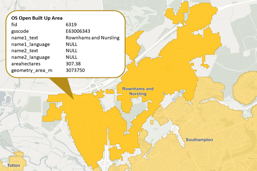
Built Up Areas contains three unique datasets, each linked using the GSS code and name, offering maximum flexibility to meet your needs.
Informative
Built Up Areas allow policy makers and analysts, both nationally and locally, to conduct analysis corresponding to actual urban extents such as those of towns, cities and villages. They allow economic, social and environmental issues to be understood on the basis of the actual settlements that most people in Great Britain live in and in doing so aide in the design and implementation of policy areas such as levelling-up and net-zero.
Accessible
A new product available from the OS Data Hub means it's available to anyone interested in Built Up Areas, maximising accessibility and delivering huge value. The data will be maintained and updated every two years and you can link your data using the GSS codes which are recognised and widely used across Government.
How to get this product
Download from the OS Data Hub
Our open data products are covered by the Open Government Licence (OGL), which allows you to:
- copy, distribute and transmit the data;
- adapt the data; and
- exploit the data commercially, whether by sub-licensing it, combining it with other data, or including it in your own product or application.
We simply ask that you acknowledge the copyright and the source of the data by including the following attribution statement:
- Contains OS data © Crown copyright and database right 2022
- Where you use Code-Point Open data, you must also use the following attribution statements:
- Contains Royal Mail data © Royal Mail copyright and Database right 2022
- Contains National Statistics data © Crown copyright and database right 2022
Technical specification
| Key Features | What this product offers |
|---|---|
| Format | Geopackage, CSV |
| Data structure | Multipart polygons |
| Attributes | Name, Language, GSS Code, Area hectares, Area m2 |
| Scale | 1:1250 – 1:250,000 |
| Update frequency | 1st publication Nov 2022, 2nd publication April 2024, then every two years in April |
| Supply | Download only |
| Coverage | Great Britain |