Why has OS updated three key basemap styles?
Ordnance Survey's base map styles are created by our very talented GeoDataViz team and save customers time and money by providing stylesheets that work seamlessly with OS's vector products and API’s.
OS's three house styles were built to satisfy a number of customer use cases. But as requirements and design trends change its important to periodically review those styles to ensure they remain fit-for-purpose.
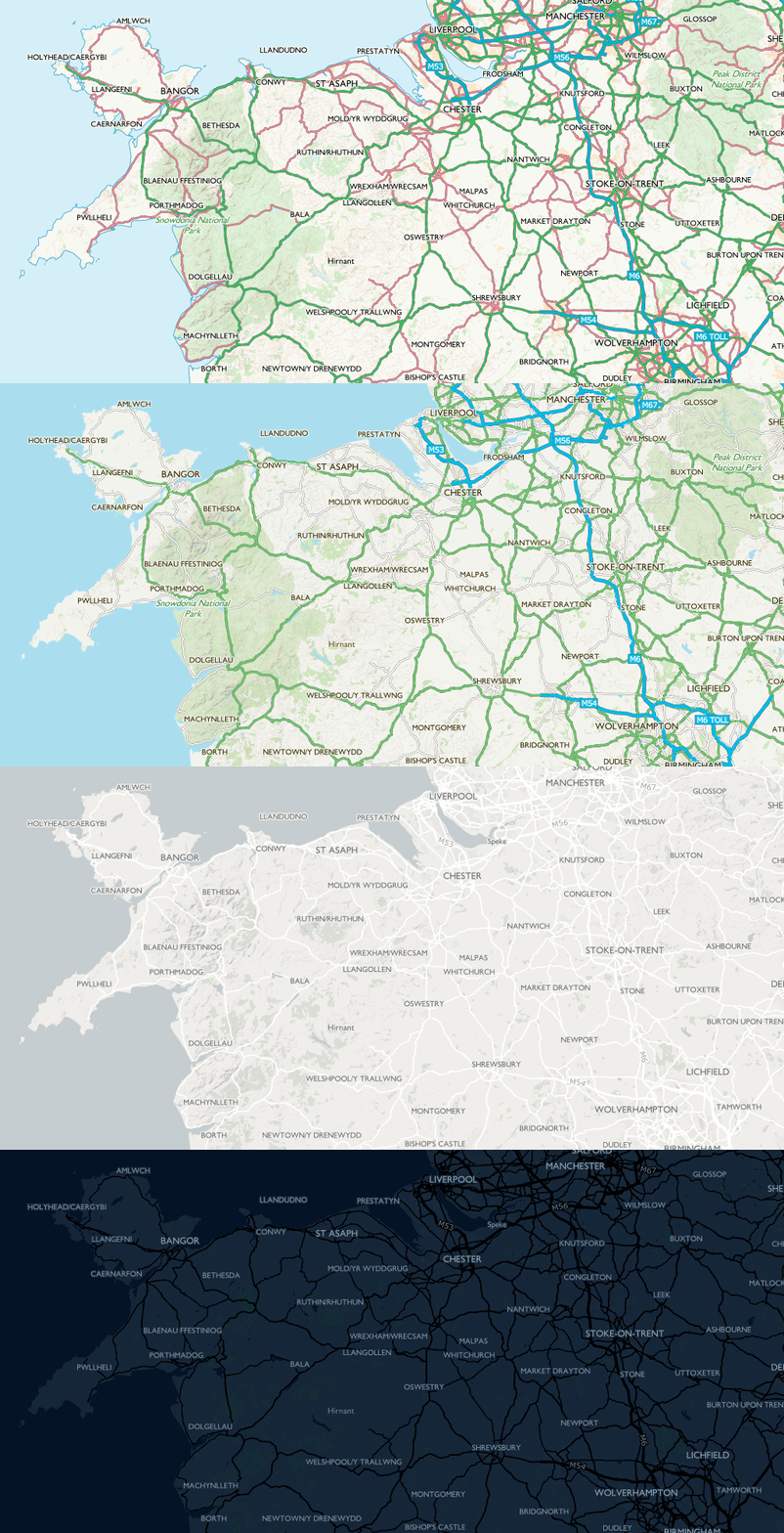
The OS range of base map styles
Road: A familiar style with a focus on transport networks - specifically highlighting the Great British road network. High in contrast with lots of detail and colour, this style will fit many uses and satisfy those who are familiar with traditional OS maps.
Outdoor: Designed for outdoor leisure and used within our OS Maps desktop and mobile application. Borrowing certain design elements from our traditional paper maps this style focusses on terrain and land cover, has a minimal colour palette and contains familiar symbology.
Light: Designed specifically for data visualisation, this style has a subtle palette and is simple and clear. Use it to add geographic context and make your own data shine.
*Night: Night mode mapping that's great in dark environments. It's at its best on a mobile device, and the dark pixels can help save your battery. See your own data really pop using this style.
*currently only available for using with OS Zoomstack. Please look out for more products having a night style available later this year.
To help with the update of our styles we wanted to engage with our customers to find out what they liked or did not like about our current basemap styles but also what map styles they might like to see introduced to our offering. We therefore undertook some internal and external customer engagement and based on that feedback and our own design decisions have made some great updates to three of our basemaps.
OS Road Basemap
The Road style is primarily used by those working in the transport sector, as an aid for navigation, and to easily pick out key infrastructure sites and buildings. We know that the highly contrasting colours in this map style, and the clear distinguishment of roads are really popular amongst users – and took this into consideration when making edits to the style.
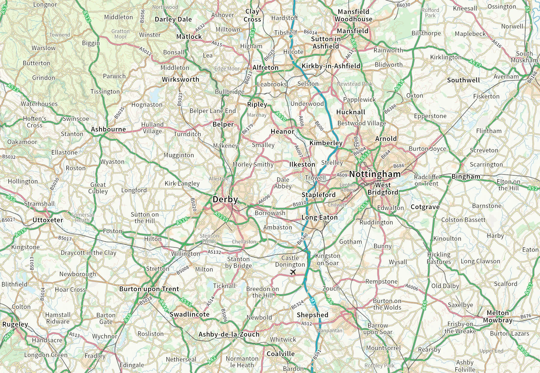
At the smallest scales, place names were originally in bold - which unnecessarily cluttered the map and obscured key transport information. We have removed town names, and pared down the vibrancy of other labels to ensure that roads stand out, whilst maintaining legibility. We also made the decision to remove the topographic hillshade effect from the Road style altogether, as user feedback showed that it was not as important for customers using this style, but it is still available in our Outdoor style.
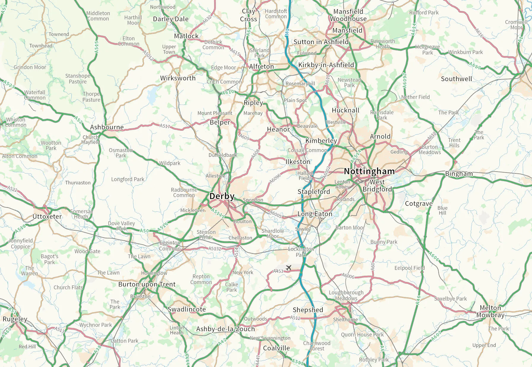
To reduce clutter at the mid scales, features including village labels, B road labels, natural landform labels and contours now come in at a slightly higher zoom level. The basemap has also been toned back, with National Park and urban area fill shades now a little lighter to allow the overlying transport network to stand out. Labelling for motorways and primary roads has been improved by switching the fill and casing colours so that they are less disruptive to the road network lines on which they sit.
At the smallest scales, the colouring of features such as gardens has been amended, to make it consistent with colours used in the Road style at smaller scales.
OS Outdoor Basemap
For our Outdoor style we wanted to ensure that terrain and land cover remained the main focus so we have improved the saturation of woodland and ensured that the hillshade is present across all zoom levels.
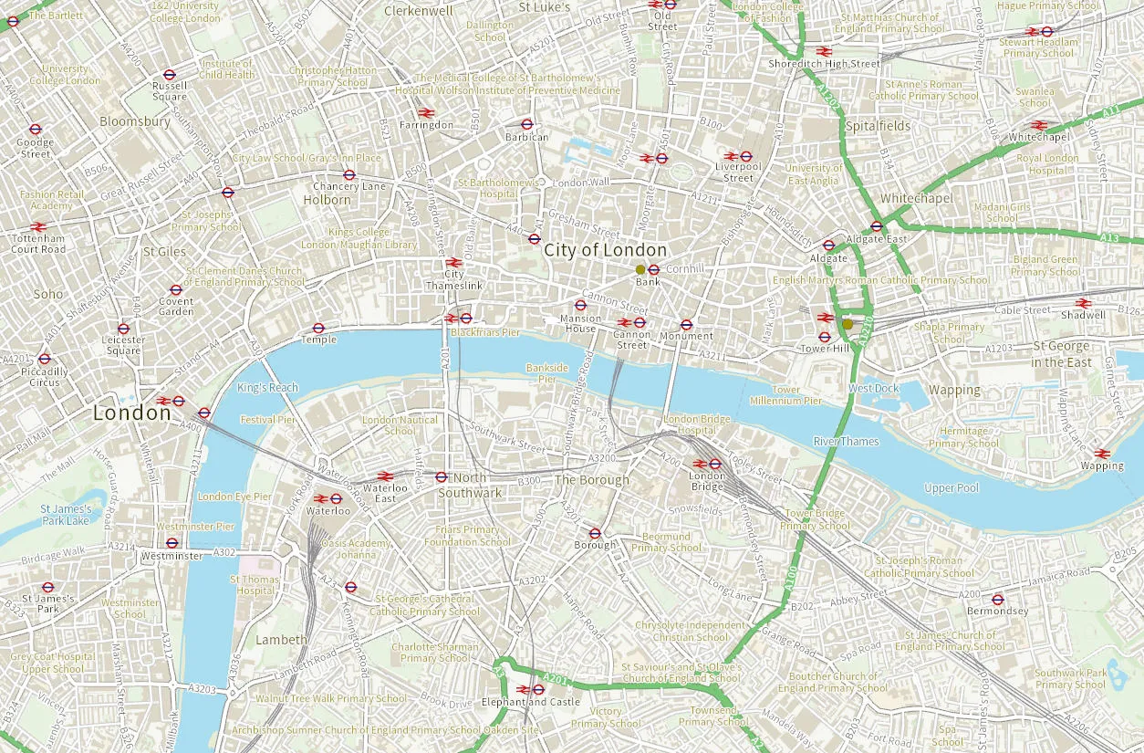
Feedback from our users indicated that footpaths were quite difficult to see at larger scales so we have improved the contrast of these to help emphasise this styles main user case.
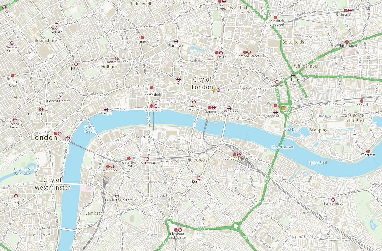
We have also worked on making sure the map style is less cluttered by reducing the size of some text and adjusting at what zoom levels some text appears or disappears.
For all three of our basemap styles we have changed the Railway Station symbol to match that used in several of our other products.
OS Light Basemap
Our light basemap is primarily used as a base for data overlay. Following feedback from our customers we have lightened the overall colour palette to help ensure that any data overlay has a better contrast with the basemap. We have tweaked the saturation (in addition to lightness) of features such as national parks, greenspace and water to give the basemap a fresher and less grey appearance.
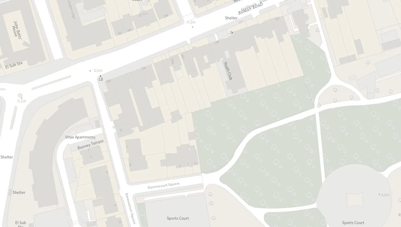
We have also worked to simplify the basemap across all zoom levels, thinking carefully about which labels and features are important at each level. At the mid zoom levels, we have removed select place name labels, road labels and minor roads to give a cleaner, less cluttered appearance. This will improve the legibility of any data overlays, letting your data shine.
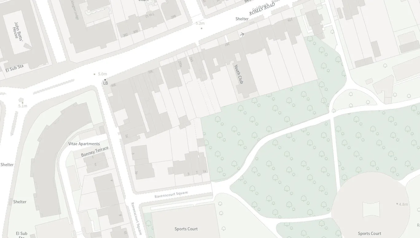
To help with user orientation at the higher zoom levels, we have increased the contrast between urban areas and the land fill colour, allowing urban areas and key places to become easier to identify.
At the lower zoom levels, we have adjusted the colours of our OS MasterMap Topography Layer data to improve the visual consistency as you move from the OS Open Zoomstack data to the OS MasterMap Topography Layer data. We have also improved the styling of some of our area fills such as woodland fill to provide a clearer depiction of land cover.
Selecting the right basemap style
If you are not intending to add any data overlays or if the road network is of particular importance, then use the Road style. If your application is Leisure focused then you should use Outdoor. If you want to overlay additional layers of data and you are looking for a basemap to simply add context then you should use Light (or Night) – the decision as to which is purely an aesthetic one however, using a dark basemap can be arguably more 'eye-catching', yet Light can be more 'practical'.
These new redesigned styles are currently available when using our OS Maps API, but will, over the course of the next few months filter through to our other products and services.
We will also be shortly releasing a Black & White and Night style for our OS NGD API - Tiles.
Map toolkit for developers
Find out more information about OS data and our products

Our highly accurate geospatial data and printed maps help individuals, governments and companies to understand the world, both in Britain and overseas.