Building a better world with sustainable urban development

Geospatial information and technology helps government organisations become smarter, collaborate better, reduce costs and improve services.

2 minute read
Urbanisation is very much the story of our time – half the world’s population live in cities, increasing to two thirds by 2050, with some of the fastest urbanisation taking place in Africa.

Building better cities with geospatial capabilities

Urbanisation can put pressure on resources, infrastructure, the natural environment, and public health. While this poses serious challenges, cities can also be powerhouses for sustainable development and a catalyst for change, according to the United Nations (UN).

Geospatial capabilities are a vital tool for lifting cities out of poverty and driving efficiency and sustainability. With cities accounting for 70 per cent of global emissions and 60 per cent of resource use, urban sustainability is an urgent priority. In this article we look at just a few ways that geospatial data can help cities thrive.

Group of people taking selfie
Smart cities aim to be more sustainable by making them inclusive, safe and resilient.

Minimising infrastructure maintenance disruption

Geospatial data can drive efficiencies in construction, planning and infrastructure – improving access to services, reducing disruption and helping to move people around cities more effectively. Minimising disruption to transport infrastructure is a key consideration for the City of London, where 1% of the UK’s total workforce commutes into an area scarcely bigger than a square mile every weekday morning.

Every year in the City there are 400 road closures, more than 3,000 utility excavations and, at any one time, over 70 building sites in operation. All highway maintenance must be meticulously planned to minimise disruption to London transport and prevent gridlock on congested streets.

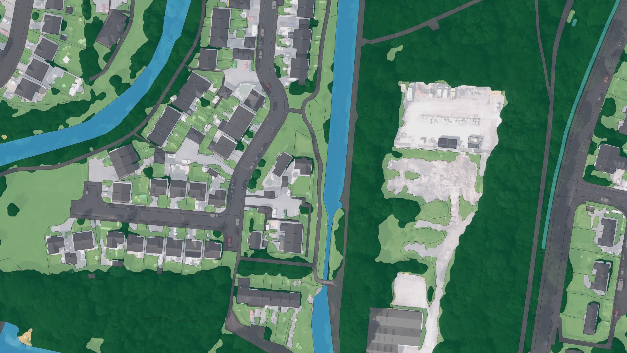
To help ease the impact of this, City of London authorities use reliable and detailed OS data, available free through the Public Sector Geospatial Agreement (PSGA), to calculate the extent of works and impacted areas to a sub-metre level of accuracy. This is essential, as even the smallest error in measurement could cause huge disruption for the City’s businesses and residents.

Ian Hughes, Assistant Highways Director, City of London says: “The new works planning tool has minimised disruption and streamlined the process for managing planned work in the City. Mapping data from the PSGA underpins the tool’s visual approach which makes it easy to use and useful for communicating complex issues with senior staff."

Lights of the City of London from above at night
City of London authorities are using reliable and detailed OS data to calculate the extent of works and impacted areas

Building smart cities using geospatial data

Geospatial data can help your city move beyond basic service provision to begin to provide innovative digital services that improve the lives of your city’s residents. Projects that use data to manage cities more effectively are sometimes described as ‘smart city’ initiatives.

Despite the futuristic images the term conjures, a ‘smart city’ is merely a well-managed city aided by digital technologies, according to Dr Jennifer Schooling, director of the Cambridge Centre for Smart Infrastructure and Construction.

Ordnance Survey has helped Dubai and Singapore deliver their smart city initiatives by undertaking geospatial readiness assessments to help them understand their needs and capabilities, and delivering strategic consultancy based on its 200 years of geospatial expertise.

The Happiness Meter is one of Dubai's first strategic 'smart city' initiatives. Dubai has adopted a unique metric for measuring success in contrast to GDP. Since 2016, the city has had a Minister of State for Happiness, as part of the city’s Happiness Agenda, which aims to make the city the happiest place on Earth. As the world’s first city-wide, live sentiment capture engine, the Happiness Meter represents a measurement gauge for the happiness goal.

Dubai required an up-to-date approach to geospatial data capture, management and dissemination to achieve its aim. To help deliver this, Ordnance Survey undertook a geospatial readiness assessment to identify the next steps that Dubai Municipality needed to take. Working with NXN, a leading smart city consulting and digital service provider for the Middle East and Africa, Ordnance Survey developed a smart solutions strategy for the Smart Dubai Government Establishment (SDGE).

"Geospatial data is a valuable tool for any smart city strategy, and by partnering with a leader in this domain, Ordnance Survey, we definitely demonstrated its effective usage through the Smart Dubai platform," says Kaveh Vessali, Senior Partner, NXN.

In Singapore, Ordnance Survey helped the National University of Singapore and the Singaporean government achieve their aim to make the city a world leader in smart technology.

Ordnance Survey developed data processing and 3D data modelling to help Singapore plan its future more effectively.

Digital models, sometimes referred to as digital twins, can help cities plan and evaluate interventions – work done by Ordnance Survey has shown that a national digital twin in the UK could save eight billion pounds per year across all sectors.

“Using location to link and visualise all the relevant information removes technical complexity, simplifying the case for investment to senior decision-makers,” says David Henderson. “Above all, it provides evidence to explain why it is worth investing in technologies that improve collaboration and the benefits this brings when planning cities for the future.”

"Geospatial data is a valuable tool for any smart city strategy, and by partnering with a leader in this domain, Ordnance Survey, we definitely demonstrated its effective usage through the Smart Dubai platform."

Kaveh Vessali, Senior Partner, NXN

Invest in your city’s future

Whether your city’s goal is more efficient services, more effective infrastructure and planning, or creating sustainable jobs, investing in geospatial expertise gives your city an advantage. Thanks to Ordnance Survey’s international offering, it is now easier and quicker than ever to build your own geospatial data capabilities.

Ordnance Survey’s centuries of experience in building base maps that underpin growth and empower communities can help give your city the edge over others.

Improved geospatial capability

We help countries all over the world benefit from our geospatial expertise and experience


Headshot of Rhian French
By Rhian French

Contributing editor