The latest additions to the OS NGD include new postcode and retail location data, complete GB coverage of bus and cycle lanes data and an enhancement to bridge information within our Structures collection.

Ordnance Survey National Geographic Database
A single store of our authoritative data for Great Britain
What is the OS National Geographic Database?
The OS National Geographic Database (NGD) is a single store of Ordnance Survey’s authoritative data for Great Britain. It’s built for analytical uses and is designed to be the bedrock of more intelligent solutions. It reduces the complexity towards insight and getting the answers you need.
Data from the OS NGD can be accessed via the OS Data Hub using our OS Select+Build configuration and download service or via APIs.
Discover the latest data release
OS GB Postcodes
A new collection providing an improved and consistent view of Great Britain's postcode geography.
OS NI Postcodes
A new collection providing an improved and consistent view of postcode geography across Northern Ireland.
OS Functional Areas
A new collection providing a consistent view of retail location data across Great Britain.
OS Transport Network
We have extended bus and cycle lane data coverage across the whole of Great Britain.
OS Structure Features
Third-party bridge information has been added to help identify the location of bridges more accurately.


Preview OS NGD data
Get a flavour for what OS NGD data could help you to achieve by accessing sample data.
Download the sample data you need using OS Select+Build.
Customer stories
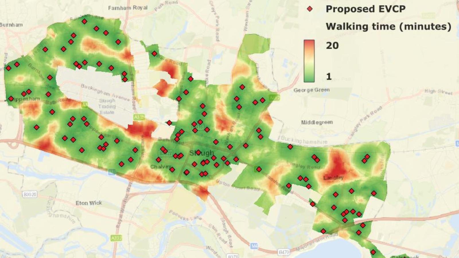
Modelling electric vehicle charging for a more sustainable Slough Borough Council
Slough Borough Council is on a mission to increase coverage of electric vehicle (EV)...
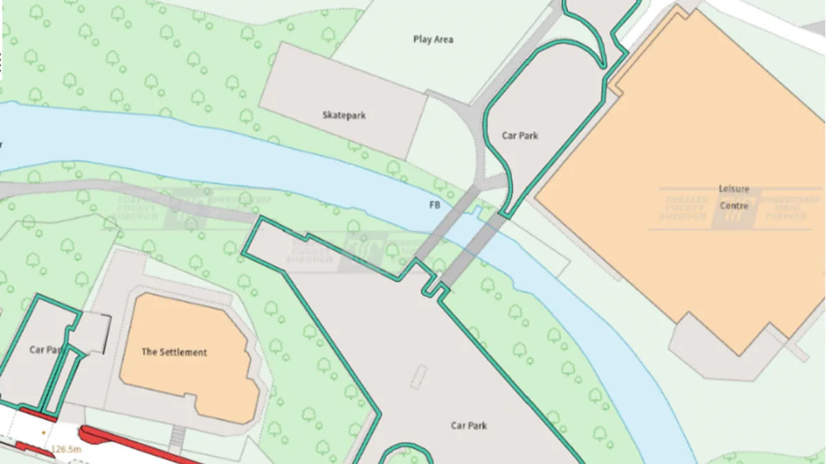
More efficient land management with OS NGD data
Torfaen County Borough Council is using OS NGD data to maintain the areas of land it...
Navigating the OS NGD
OS NGD data can be filtered and configured to your requirements so you can find the data you need without having to download whole datasets. Its data structure is designed to help answer questions and develop intelligent solutions, with quicker access, loading and implementation.
The database comprises nine themes, including Address, Buildings, Land, Transport and more, and these are made up of one or more Collections, each of which contains a set of Feature Types. You can determine exactly what data you want to access using our download service OS Select+Build or our API service OS NGD API – Features. In addition, our OS NGD API – Tiles service provides a detailed and customisable basemap to help you create stunning and interactive web maps.
Key benefits
Discoverable data
Data structure and categorisation makes the data you need easy to search for, find and analyse.
Easy access
Use OS Select+Build to download only the data you need and access data online using OS NGD APIs.
Up to date
The data you rely on for crucial analysis, delivered with daily updates.
Improved connectivity
Easier than ever before to link, share and analyse our data.
Richer data
Detailed attributes and enhanced feature information give greater context and insight to answer more complex questions.
Access OS NGD data via the OS Data Hub
PSGA members and OS Partners can get direct access to the OS NGD through the OS Data Hub using our download service OS Select+Build, OS NGD API – Features and OS NGD API – Tiles.
OS Select+Build and OS NGD APIs are available through the Public Sector Plan and Premium Plan on the OS Data Hub through the existing pricing and licencing frameworks for each plan.

OS NGD collections
OS Boundaries
Access the administrative and electoral boundaries for England, Wales, and Scotland.
OS Building Features
Access data on buildings and building features, including building heights, lines, and access points, across Great Britain.
OS Functional Areas
A new collection providing a consistent view of retail location data across Great Britain.
OS GB Address
A complete address data collection for Great Britain, including UPRNs, property classification, postal status, and construction status.
OS GB Postcodes
OS GB Postcodes provides a consistent view of postcode geography that aligns to real-world buildings and streets across Great Britain.
OS Islands Address
A complete address data collection for Northern Ireland, the Channel Islands and Isle of Man, including UPRNs, and property classification, postal and construction status.
OS Land Features
Explore detailed land cover data, and visualise the land cover make-up of Great Britain, including both manmade features and natural land features.
OS Land Use Features
Visualise and analyse geometric representations of different types of land use, land use sites, and site access data.
OS Named Features
Our list of named features and places, as identifiers for locations in the real world: cities, towns, beaches, reservoirs, and more.
OS NI Postcodes
OS NI Postcodes provides a consistent view of postcode geography across Northern Ireland.
OS Routing and Asset Management Information
Access a fully routable network of Great Britain, including hazards, restrictions, and speed limits, for in-depth route planning and asset management.
OS Structure Features
Our comprehensive list of structure features - manmade constructs that are not buildings: dams, bridges, chimneys, post boxes, and many more.
OS Transport Features
Visualise transport features including roads, tracks, railways, and paths across Great Britain. Analyse streetlight coverage to support safe, well-lit, active travel routes.
OS Transport Network
A visual representation of Great Britain's transport networks including road, ferry, rail, and path networks, and the connectivity between them all.
OS Water Features
See water network and river network data across Great Britain, including water area features such as watercourses, lakes, drains, springs, and intertidal watercourses.
OS Water Network
Conduct water mapping with a three-dimensional structured link and node network of watercourses across Great Britain.
OS NGD APIs
OS NGD API – Features
Perform powerful geospatial analysis. Filter the data to receive exactly what you need, as and when you need it.
OS NGD API – Tiles
Create beautiful, responsive, and interactive vector maps powered by the OS National Geographic Database (OS NGD).
OS NGD data powering specialist data products
OS NGD data also underpins specialist data products that support the Transport and National Security & Resilience sectors, and further OS NGD‑derived propositions are being developed for the future roadmap.
OS Emergency Services Gazetteer
The OS Emergency Services Gazetteer (ESG) provides a national, consistent, and maintained view of the locations and names of places and objects.
OS Multi-modal Routing Network
OS Multi-modal Routing Network is a fully connected network dedicated for the multi-modal routing of people and goods, designed for use in routing applications.

