Content and context
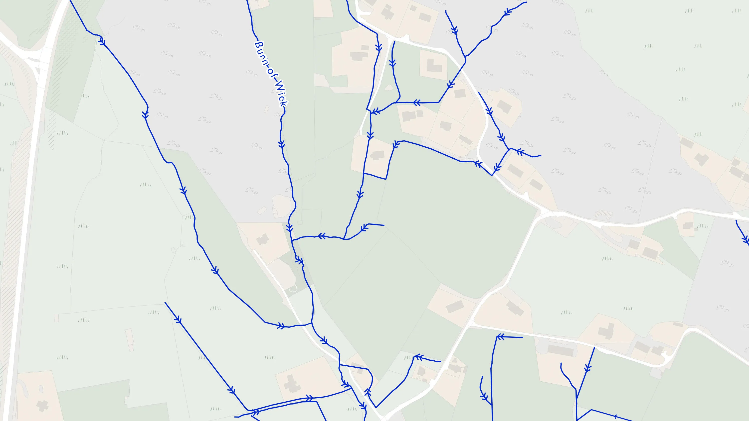
With this water network data, you can look up the height of any water course, along with its flow direction, gradient, length and width anywhere along its length.
This product will become End of Life on 31 March 2026. Further information and details about the recommended product migration pathway are available on the End of Life product notices page.
OS MasterMap Networks - Water Layer provides a detailed centre line following the curve of the waterway precisely. It includes the coordinates of watercourse sources and where they meet, exactly. OS MasterMap Networks – Water Layer will become End of Life on 31 March 2026. As of this date, Ordnance Survey will cease to maintain or publish updates, and access to the product will be removed from the OS Data Hub, OS Features API and OS Vector Tile API.
This product is updated every three months


With this water network data, you can look up the height of any water course, along with its flow direction, gradient, length and width anywhere along its length.
As an island, water defines Great Britain. No other visualisation of our nation’s watercourses details the heights of watercourses in relation to sea level with this level of precision.
For planners, for surveyors, for engineers – this Layer offers the potential to model in 2D and 3D like never before, thanks to the clarity of river flow, gradient and river widths.
From aqueducts to tunnels, with annotations of flow direction, OS MasterMap Water Network Layer provides the detailed mapping that’s most useful – including underground watercourses (inferred from entry and exits).
OS MasterMap Networks - Water Layer provides a detailed centre line following the curve of the waterway precisely. It includes the coordinates of watercourse sources and where they meet, exactly.
This product will become End of Life on 31 March 2026. Further information and details about the recommended product migration pathway are available on the End of Life product notices page.
Technical information
This product will become End of Life on 31 March 2026. Further information and details about the recommended product migration pathway are available on the End of Life product notices page.
Get this product
Ordnance Survey's commercial network of Partners can help you with bespoke location solutions, derived from OS data
Ranging from global giants to single entrepreneurs, our Partners all use our location data to create innovative products and services. Their expertise ensures customers can benefit from using our data for a range of services. Find a partner for network mapping requirements.
Ready to get started with our data and APIs?
Choose your plan and create your account. Take the next step by signing up to the OS Data Hub and create your first project today.
Download Premium data from the OS Data Hub
If you're an OS Licensed Partner you can use the OS Data Hub to access OS data products and manage your account all in one place.
OS Data Hub for PSGA members
If your organisation is a member of the Public Sector Geospatial Agreement, access the OS Data Hub to access our products.
For further help about how our data can transform your organisation, contact us today
Contact us