Synthetic Aperture Radar data in the geospatial sector
A niche but unique tool with great potential for commercial applications
Synthetic Aperture Radar is a niche and underutilised type of satellite imagery. It can provide insights that can’t be easily identified by the human eye or by traditional types of satellite imagery.
While it has been around for decades, historically, it was exclusively used by the military. It’s now being used more often in the commercial sectors, due to an increase in open-source providers, and a development in applications.
I wanted to give SAR a spotlight, to explain how it can be used, and why the demand for it is increasing.
Applications of Synthetic Aperture Radar data
When we think of Earth Observation or satellite imagery, we often think of photos of the Earth taken with a high-resolution camera – like an aerial image, but from space. Synthetic Aperture Radar images are a little bit different.
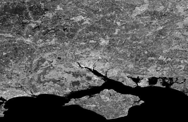
SAR is a type of satellite imagery where the sensor directs a pulse of energy towards Earth, then records the amount of energy reflected back to the sensor. The sensor moves along a path, scanning the Earth, creating high resolution images which reveal information undetectable by the naked eye or even traditional methods of image capture. SAR produces a monochromatic image of the intensity of energy reflected back to the sensor.

SAR can’t provide information on everything, as it strongly depends on the electromagnetic properties of a material. However, it isn’t affected by cloud cover or atmospheric interference, and can be collected day and night. That is a key advantage of SAR; it can penetrate clouds, receive data in poor weather conditions, and it can be used at any time, enhancing its capability for continuous monitoring.
Appropriately, SAR has a multitude of applications including change detection, flood mapping, classification, and ground movement time series analysis, which can be used for subsidence, infrastructure, and landslide monitoring. Additionally, SAR can create a rich time series, meaning you can monitor changes or ground movement over time, which is critical for monitoring the environment, or for disaster management.
SAR was originally used by the military for identifying tanks or ships, after which it became increasingly studied in academia. Now we’re seeing it being used commercially. New organisations are appearing, dedicated to using SAR, to support use cases in the utilities, insurance, and infrastructure sectors.
The future of SAR
Adoption of SAR is advancing, for two reasons: the improvement in technology, such as higher resolution imagery; and improved accessibility to datasets, since NASA and the European Space Agency made their data free to use.
In the near future, we expect to see more high-resolution satellites being launched. Just this year ICEYE announced that they plan to launch up to 15 satellites by the end of 2024.
Additionally the market is projected to experience 11.8 percent compound annual growth between 2023 and 2030, according to a recent report from Consegic Business Intelligence (The SAR Satellite Revolution Brings 24/7 Imaging Possibilities (esri.com)). It’s envisioned that there will be increased demand from the agriculture, forestry, utilities, and environmental monitoring sectors.
Talk to an OS expert
SAR is a relatively niche but unique tool and the potential of SAR is immense. We’re literally only just starting to scratch the surface of commercial applications.
OS’s geospatial data can help to unlock the value of SAR by providing accurate location data and contextual mapping, allowing for the creation of advanced analytics.
If you’d like to speak with an OS consultancy expert, please use the link below.
Technical Geospatial Consultant
Let's talk
If you’d like to hear from an OS consultancy expert, you can request this below. Whether you’re facing challenges, new to the industry, or need advice – we'll put you in touch with the right people