Ordnance Survey and Mountain Rescue England and Wales join forces
Official partnership promotes responsible walking and safe navigation.
Press Office
OS and MREW have announced a new partnership to emphasise the importance of navigation skills and having the right equipment when enjoying days out in the hills, mountains and countryside.
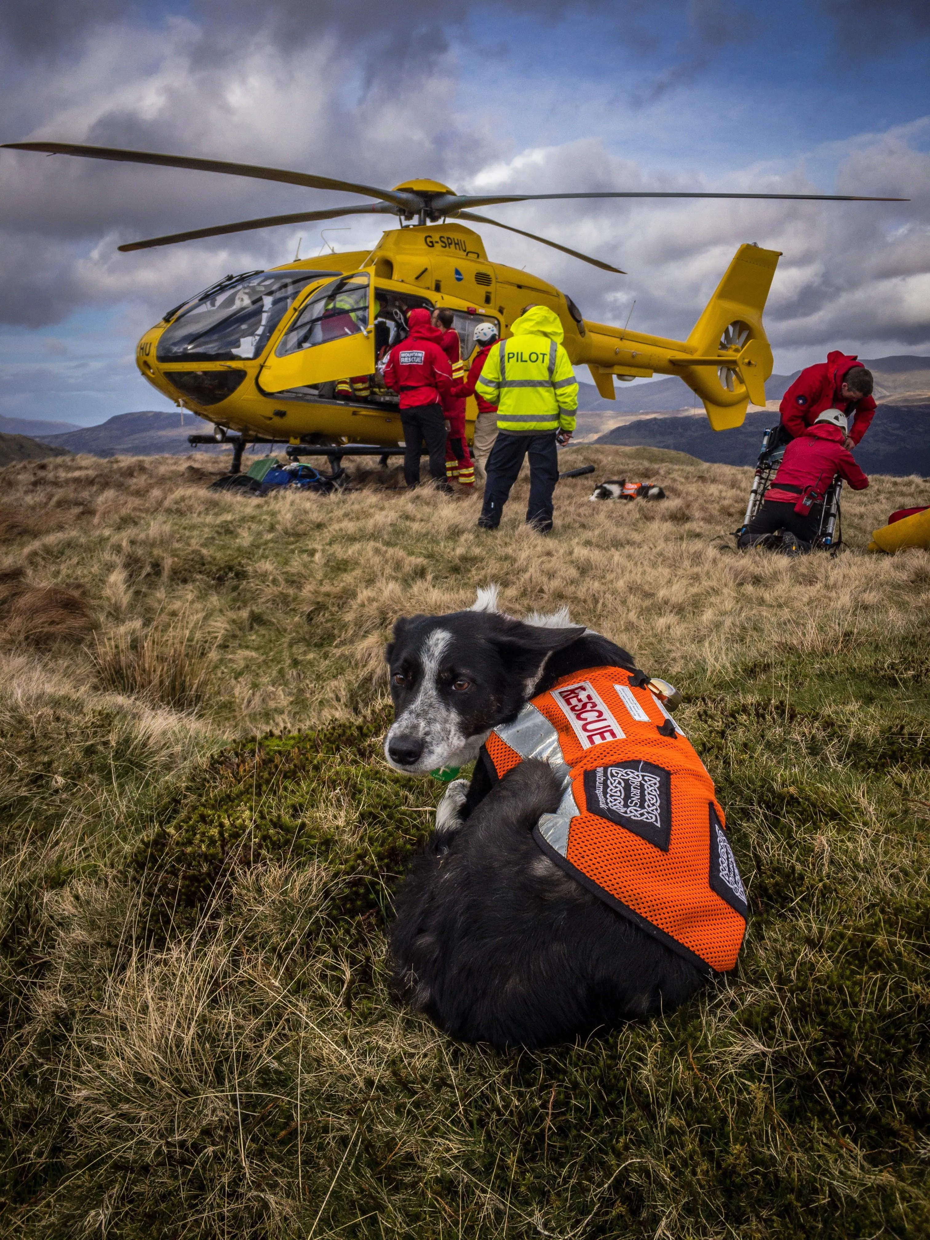
Rescue volunteers are readying themselves ahead of the Easter holidays for an influx of visitors coming to explore remote areas and want people to stay safe, avoid getting lost or into difficulties and enjoy their time in the outdoors.
Mountain Rescue’s figures from 2022 showed that over one in three callouts in England and Wales were due to basic mistakes and poor planning, with 17% caused by human error, 9% by bad decision making and 9% by inexperience.
One of the biggest issues is people not having an OS Map to navigate the environment.
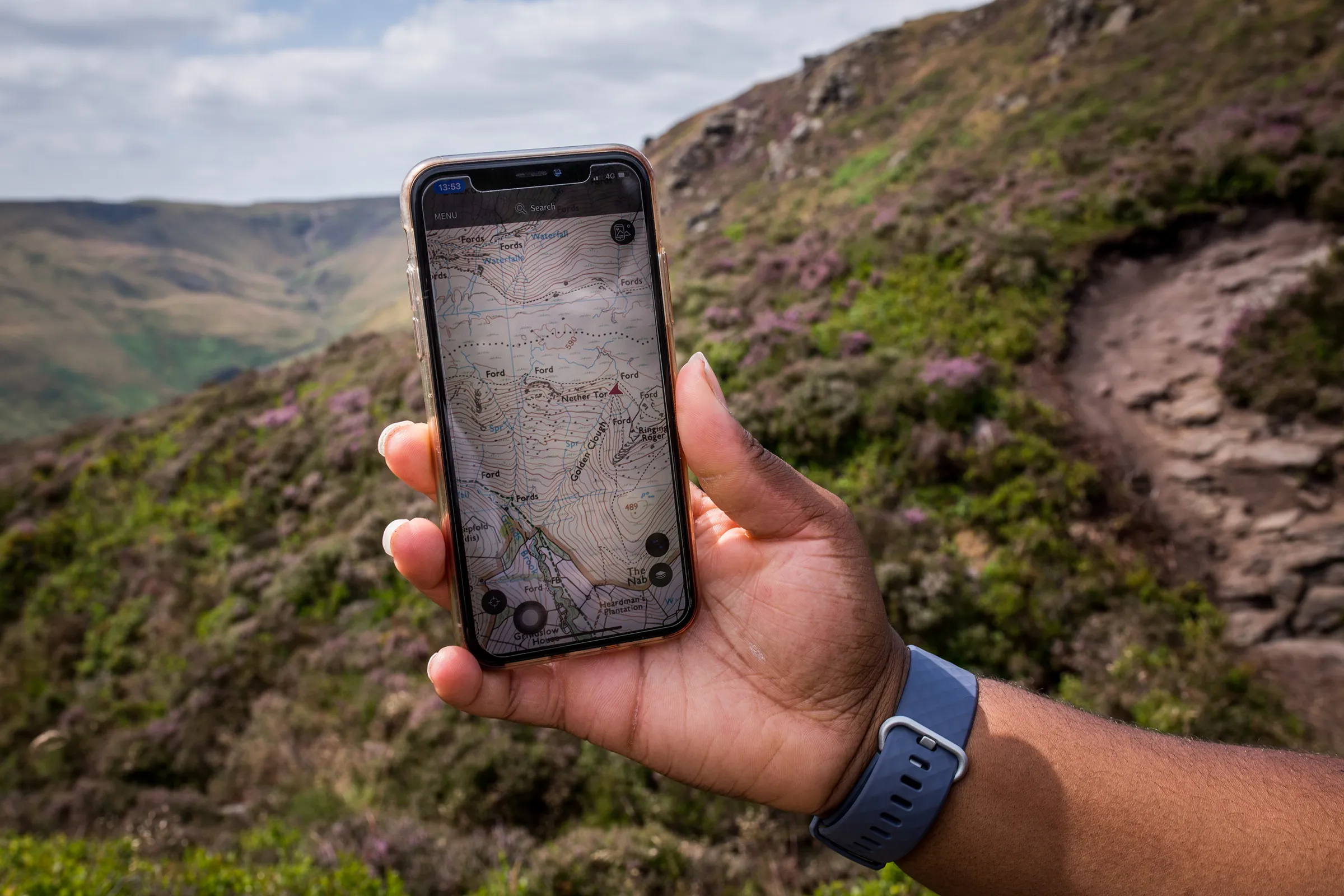
Increasingly, more and more people are relying on mobile phone apps to navigate. But very few mapping apps have the accurate detail required to navigate safely in remote areas.
Mountain Rescue England and Wales has recommended the OS Maps App as the navigational phone app of choice when heading out to National Parks such as the Lake District, Snowdonia and the Brecon Beacons.
Mountain Rescue England and Wales Chief Executive Officer Mike Park said: “Far too often we’re seeing people in very remote and potentially dangerous locations using mapping apps better suited to towns. It's vital that people have detailed maps, whether paper or digital, to understand the landscape, hazards and follow established paths.
“There has been a shift to online tools and apps in recent years, with many of our volunteers’ using maps on their phones, but we would always recommend carrying a paper map that doesn’t need battery power as a back-up."
"OS Maps is the best app out there for navigation, given its heritage and resources, and we recommend it. This partnership means that our volunteers have access to accurate and comprehensive mapping and our feedback and input to OS can help to shape an excellent app that enables people to enjoy the outdoors safely."
Case study - Mountain Man James Forrest
Hiker and author James Forrest, also known as “Mountain Man”, is a record-breaking adventurer who climbed all 446 mountains in England and Wales in just six months. During this epic challenge, time and time again when lost or in trouble, he turned to the OS Maps app to steer him back to safety.
James said: "Lost in a Carneddau whiteout, disorientated in a blizzard, off-course in the rocky labyrinth of the Rhinogs - in times of jeopardy in the unforgiving mountains, the OS Maps App has often helped get me out of a hole. Its GPS capabilities have pinpointed my location and helped me get back on track. Of course a paper map, compass and good navigational skills are still vital in the hills, but OS Maps is a wonderful safety net and extra tool in your navigation toolbox."
OS Maps App
Through the new partnership, OS has made OS Maps App available to every one of the 47 local volunteer teams of Mountain Rescue England and Wales so that they have access to detailed mapping when answering rescue call-outs.
According to OS data, last year’s Easter holiday saw an 81% increase in walks compared to the rest of January, February and March. With a surge of people expected to get out and about this Easter bank holiday weekend, both organisations are calling for walkers and leisure app users to ensure they plan ahead and have the right navigational tools to hand.
Nick Giles, Ordnance Survey’s MD for Leisure, said: “The last three years have seen an increase in people walking more and discovering Britain, which is fantastic as we are always looking to help more people to get outside more often.
“However, we are starting to see some of these people venturing further afield and unfortunately not taking the correct steps in planning and being prepared with the right mapping and outdoor kit. Our advice is to always plan ahead and make sure you’re venturing outside in an accessible and safe way.”
“Don’t ruin your day outdoors by having to call Mountain Rescue. It’s miserable being stuck up a mountainside in the rain waiting for someone to come and fetch you.”
Nick added: “Making the outdoors enjoyable accessible and safe for everyone is our top priority and the perfect combination of OS Maps and the right paper map coupled with learning some skills, can really help ensure you stay safe and hopefully never need to call on the Mountain Rescue teams to help you in an emergency.”
OS provides detailed mapping at 1:25,000 and 1:50,000 scale within the premium OS Maps App subscription. With that subscription, OS users gain access to features including route mapping, 3D mapping to help visualise routes before going out, AR tools, and hundreds of thousands of shared routes.
Sharing the latest news about OS. We can license you to use OS maps in print, online and film format. For more information and resources for journalists, bloggers and media professionals, email pressoffice@os.uk or call 023 8005 5565.
Explore OS Maps
You can share your walking, cycling or running routes in Great Britain by downloading the OS Maps App on your phone, PC or laptop
Find more news
- Leisure
- General public
- Consumer
- Great Britain
- United Kingdom