OS Open Linked Identifiers
What OS Open Linked Identifiers provides you with
Better visualisation
Connecting addresses with road features enables more related data to be joined together which simplifies a number of valuable workflows. Linking these features to graphical elements of OS MasterMap products enables better visualisation of the data related to them.
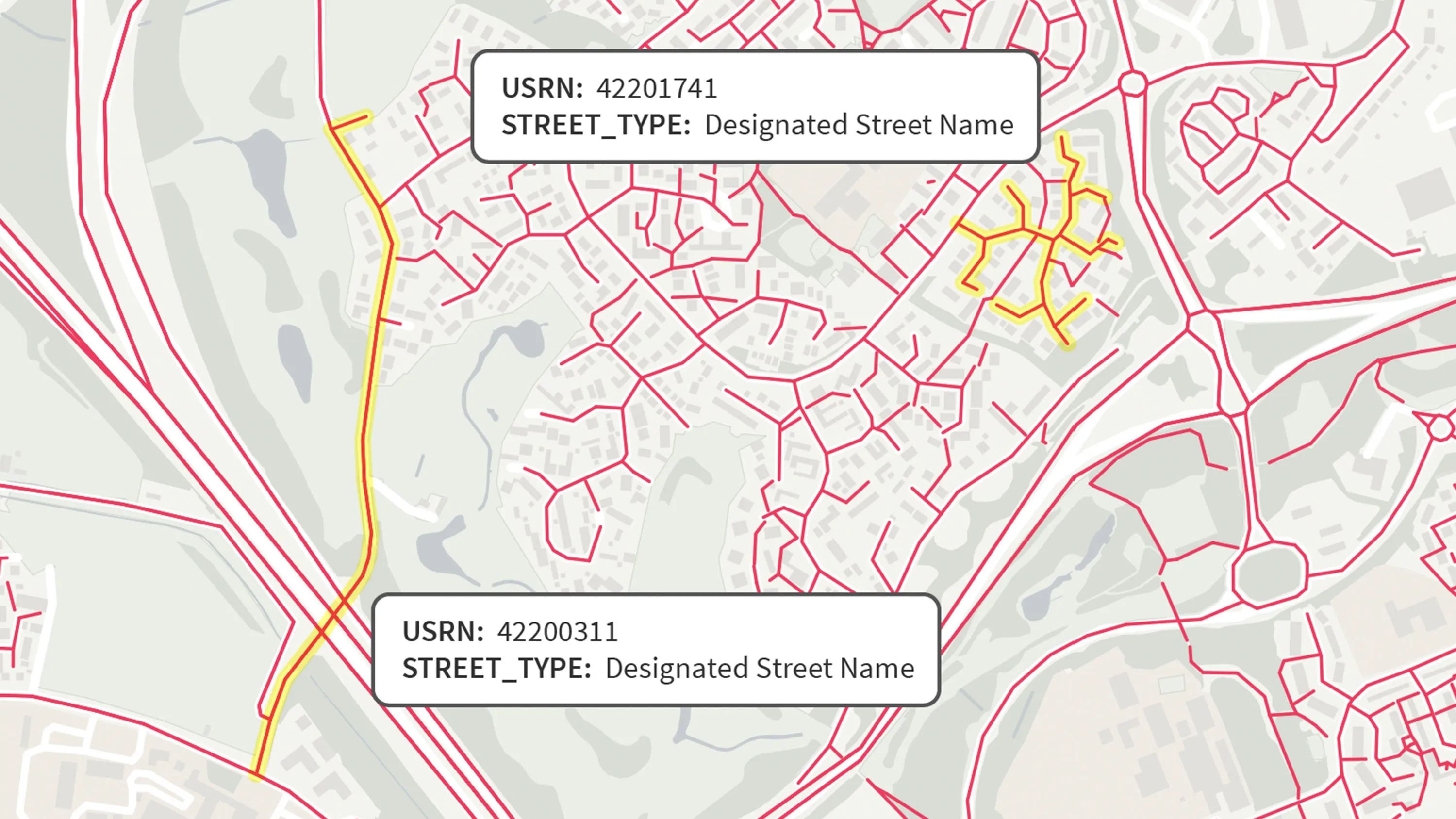
Find all addresses on a road
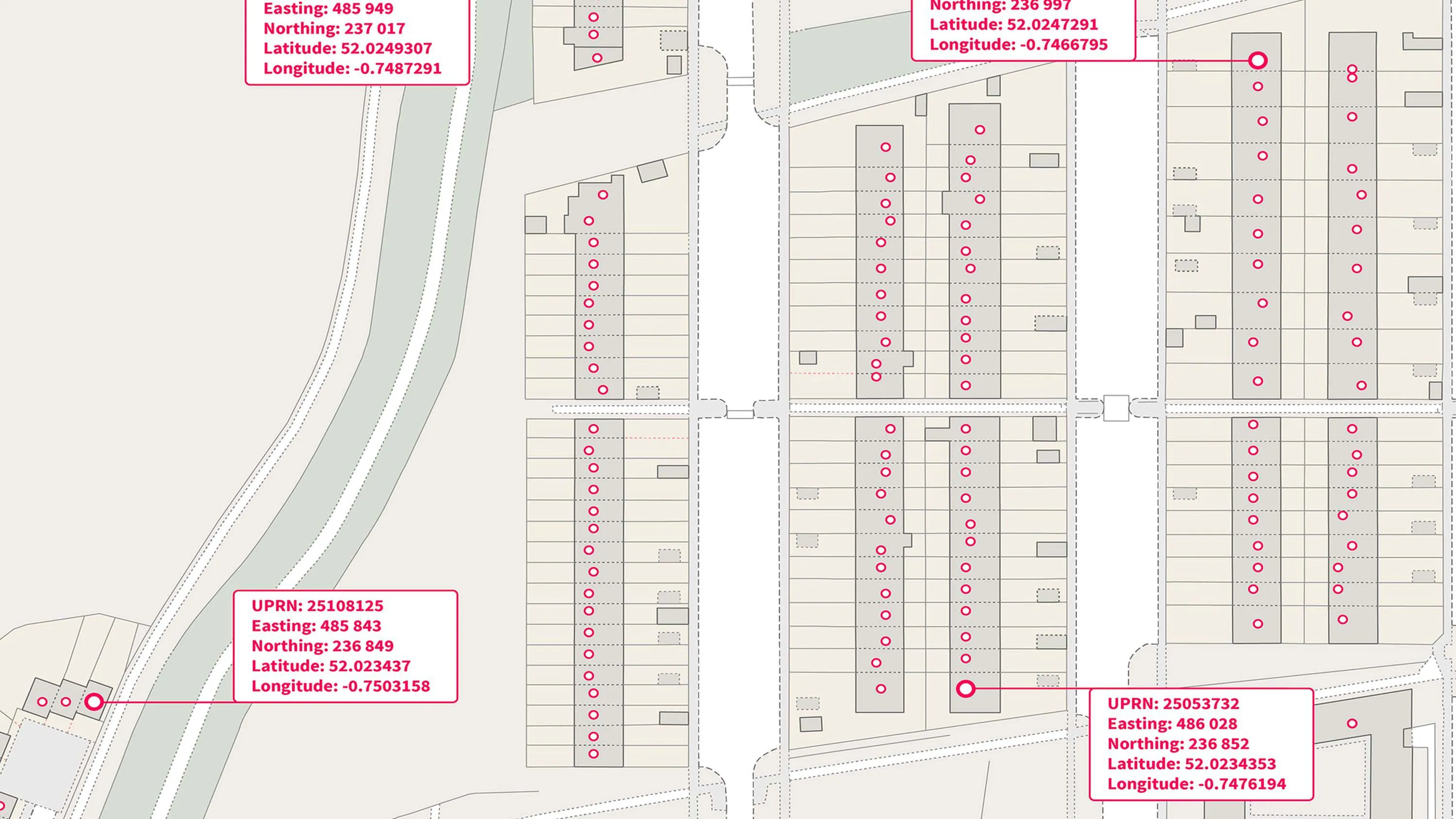
Link data related to an address with its building footprint. Validate an address’s UPRN with the name of the road that accesses it. Validate a street’s USRN with the name of the road it relates to.
Authoritative source
The relationships UPRN and USRN are provided by the bodies responsible for the identifier schemes; and these are spatially matched to OS MasterMap features by Ordnance Survey.
Authoritative source
The relationships UPRN and USRN are provided by the bodies responsible for the identifier schemes; and these are spatially matched to OS MasterMap features by Ordnance Survey. This means you can have confidence you're accessing an authoritative source of these relationships.
Relationships you can trust
The relationships are taken from our premium data products and being made open for the so everyone can access them from one trusted source.
Use cases
- Link datasets that use different Ordnance Survey identifiers.
- Enables spatial analysis between buildings, roads and administrative areas.
- Local authorities can use to align public services such as waste collection, emergency response and planning.
OS Open UPRN
An open dataset enabling linking, sharing and visualisation of data related to UPRNs.
OS Open USRN
An open dataset containing all USRNs from OS MasterMap Highways Network with a simplified line geometry.