Try our new OS Open Zoomstack styles for colour blind users
We’re looking for your feedback on our new styles for OS Open Zoomstack
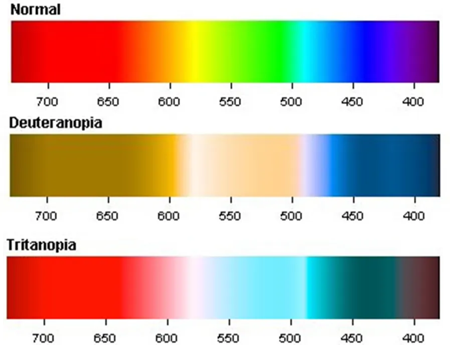
Unless you’re colour blind, you are unlikely to be aware of the problems which cartographic styles and colour schemes cause for those affected by CVD. Colours usually easily distinguishable to the human eye, such as red and green, appear very similar and can make elements of map reading more difficult. The issue is often overlooked, with traditional spectral rainbow colour schemes kicking up several difficulties for those with colour blindness.
During my first few weeks at OS on the Graduate Development Programme, I learnt how we can improve the accessibility of data. I started by developing free downloadable styles for our popular OS Open Zoomstack product – an exciting project to work on.

Source: https://www.color-blindness.com/deuteranopia-red-green-color-blindness/
https://www.color-blindness.com/tritanopia-blue-yellow-color-blindness/
What is colour-blindness?
Colour blindness comes in several forms – meaning one colour scheme is unlikely to be suitable for all colour-blind people. The most common form – red-green blindness (also known as deuteranopia and protanopia) affects around 8% of men and 0.4% of women. The gender imbalance is caused by the number of X chromosomes in men compared to women. People with this form of CVD have trouble telling red and green hues apart.
Blue-yellow blindness (tritanopia) is much less common, affecting <1% of men and women. This makes it hard to distinguish between blue and green colours, as well as yellow and reds.

Although this may seem like a small portion of the population, online maps are likely to reach tens of thousands of people with CVD. We know that people depend on OS data and wanted to maximise accessibility and ease of use both for people with CVD, and those without. I created these styles with both groups in mind, making changes to the traditional styles we all know and love that will work much better for colour blind people.

Creating CVD-friendly maps
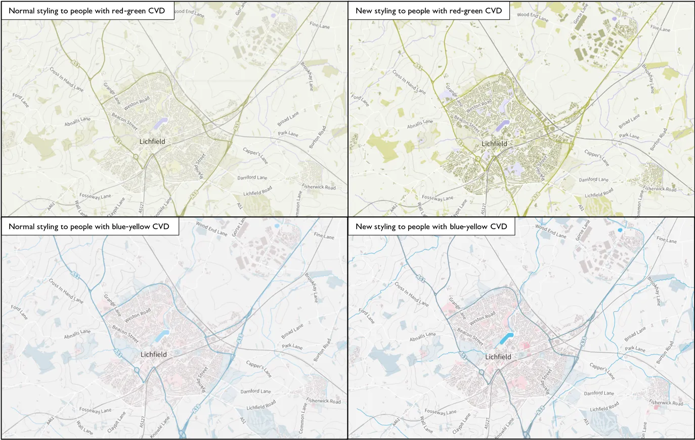
I started the process by assessing the layers which could be easily confused. Key layers causing issues included woodland and greenspace, as well as motorways and waterways – not ideal if mixed up! I tested several colourways alongside colour-blind colleagues as I’m not colour blind myself. The process was really enlightening as to how OS products can be made more CVD-friendly. I found that increasing the contrast between layers worked well, as distinguishing between different contrasts of the same hue is something that those with CVD tend to manage.
"All of the built-up areas are easier to distinguish…and the water in the images has a better contrast in the red-green styling…particularly clear with the rivers as they stand out more against their backdrop."
- Feedback from a colleague during the consultation process
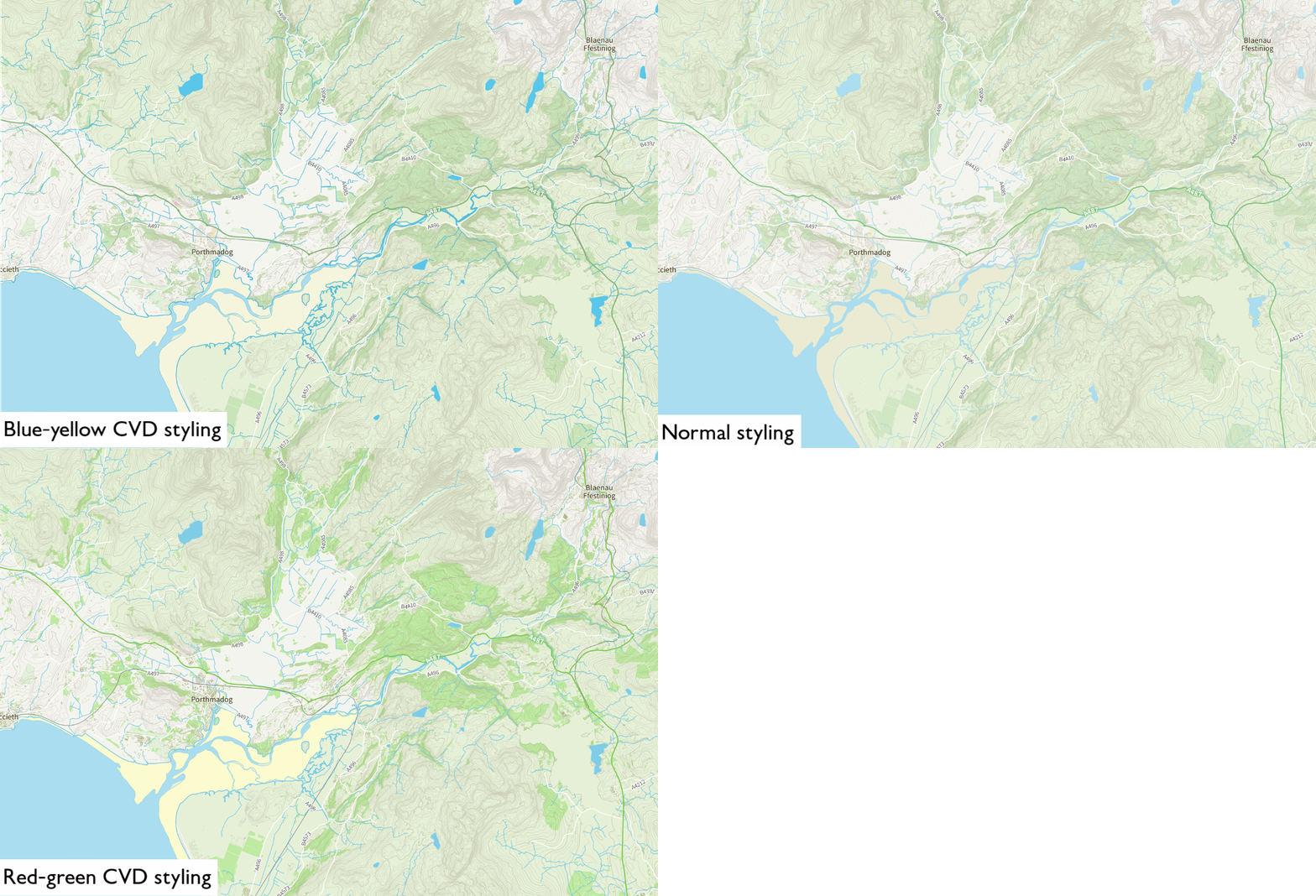
After this analysis and internal testing, we created the first version of two new CVD-friendly styles. One is targeted towards those with red-green blindness, and the other towards blue-yellow. These styles are available in .lyr .qml and .sld formats and you can download them from GitHub for free.
Download our new CVD-friendly styles and give us your feedback
We want your feedback on these new styles, to help us make further improvements, for potential future releases.

Developing these initial styles is a real push forward for accessible open mapping. OS Open Zoomstack is a flexible mapstack covering the whole of Great Britain, providing scope for a plethora of different applications. The vector tiles make it is easy to manipulate, allowing for seamless extraction of data tailored to your needs. You can download it and use it in a range of GIS software via our website.
Please let us know what you think of the new styles – whether you are colour blind or not. We’re keen to know what you think so that we can continue to improve the quality and accessibility of our data.
Download the new CVD-friendly styles: https://github.com/OrdnanceSurvey/OS-Open-Zoomstack-Stylesheets and https://github.com/OrdnanceSurvey/OS-Open-Zoomstack-Stylesheets/tree/master/GeoPackage
Send us your feedback to cartodesign@os.uk

Our highly accurate geospatial data and printed maps help individuals, governments and companies to understand the world, both in Britain and overseas.
Products and solutions featured in this blog
OS Open Zoomstack
Ordnance Survey's OS Open Zoomstack is an open vector basemap showing coverage of Great Britain from a national level, right down to street detail.