Building a resilient future
How Ordnance Survey underpins the nation’s positioning infrastructure
What is positioning and why is it important?
Positioning services underpin so much of what we rely on — often invisibly. It means knowing exactly where something is on Earth, usually in geographic coordinates like latitude, longitude and height.
It's what allows systems to track movement, guide navigation, or align data across different technologies. Whether it’s a delivery van, an ambulance or a piece of national infrastructure, accurate positioning ensures everything is where it’s supposed to be — and that decisions based on location are reliable.
In the public sector, resilient positioning supports national infrastructure and essential services. From coordinating emergency response and managing transport networks, to supporting national resilience and environmental monitoring — these systems depend on knowing exactly where things are, and when. As threats like signal jamming or space weather grow more likely, having a stable, UK-based reference network helps ensure continuity and reliability.
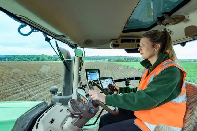
For the private sector, especially in industries like construction, energy, telecommunications, and logistics, reliable positioning improves operational efficiency and safety. It’s essential for everything from planning and asset management to precision agriculture and autonomous vehicles. As businesses adopt more real-time and automated systems, any inaccuracies in location data can translate to delays, safety risks, or financial loss.
In both cases, positioning isn’t just a technical detail — it’s a foundation for decision-making, innovation, and resilience. And when that positioning is grounded in nationally trusted infrastructure, it becomes even more important the capability is developed to work properly.
Technology: the strategic value of OS Net
At the heart of this effort lies OS Net, our nationwide network of over 110 Continuously Operating Reference Stations (CORS). This infrastructure forms a strategic national asset, delivering centimetre-level accuracy through real-time GNSS correction services. Originally designed to support surveying, OS Net has evolved into a critical enabler of resilience.

By streaming high-quality GNSS data to a central hub, OS Net allows for real-time error correction and precise coordinate generation. This capability is essential not only for mapping but also for supporting sectors that rely on accurate positioning — from agriculture and construction to utilities and transport.
As threats to satellite-based systems grow — from space weather and jamming to cyberattacks — OS Net is helping to build redundancy and resilience into the UK’s PNT ecosystem. It provides a stable, terrestrial-based augmentation to GNSS, reducing our reliance on any single source of positioning data.
Capability: more than just surveying
OS Net’s value extends beyond traditional geospatial applications. Its data is being used to monitor space weather, including solar activity that can disrupt satellite signals — a timely concern as we approach the solar maximum. It also provides data to the Met Office for space weather monitoring and atmospheric science by measuring water vapour in the air, contributing to more accurate weather forecasting at the Met Office.
The role of geodesy and other PNT technologies
Underpinning all of this is geodesy — the science of measuring and understanding the Earth’s geometric shape, orientation in space, and gravity field. OS’s geodetic expertise ensures that all positioning data aligns with national and international coordinate systems, enabling seamless integration across platforms and sectors.
As the threats and vulnerabilities become more relevant, impactful and understood, the demand for resilient PNT grows. While there are not direct replacements for GNSS, Enhanced Long Range Navigation (eLORAN) - a proven terrestrial based service - could support PNT users during periods of GNSS disruption.
Looking further ahead, quantum technologies are set to revolutionise PNT. Quantum clocks and inertial sensors promise ultra-precise, satellite-independent positioning. OS is actively exploring how these innovations can complement our existing infrastructure, offering even greater resilience and accuracy.
A national asset for the digital age
As the UK continues to digitise and automate, the demand for reliable, high-precision positioning will only grow. OS Net is already delivering value today ��— but its potential is far greater. By investing in positioning infrastructure and expanding its capabilities, OS can play a key role securing the UK’s digital future.

Content Lead
See how OS Net could help and support your business
OS Net can help deliver efficiencies, providing access to a stable, national coordinate reference system
Find more Insights
- National security and resilience