How location data supports wildfire preparedness across Britain
Key facts:
- 7% of homes across Britain lie within a zone which is increasingly exposed to wildfire vulnerabilities due to climate change and human behaviour.
- Over 1.8 million British homes sit within the first 100 metres of urban-rural edges.
- Greater Manchester, West Yorkshire, Essex, Kent, and Lancashire have the highest number of homes located within this 100 metre distance of urban edges.
Why urban edges matter
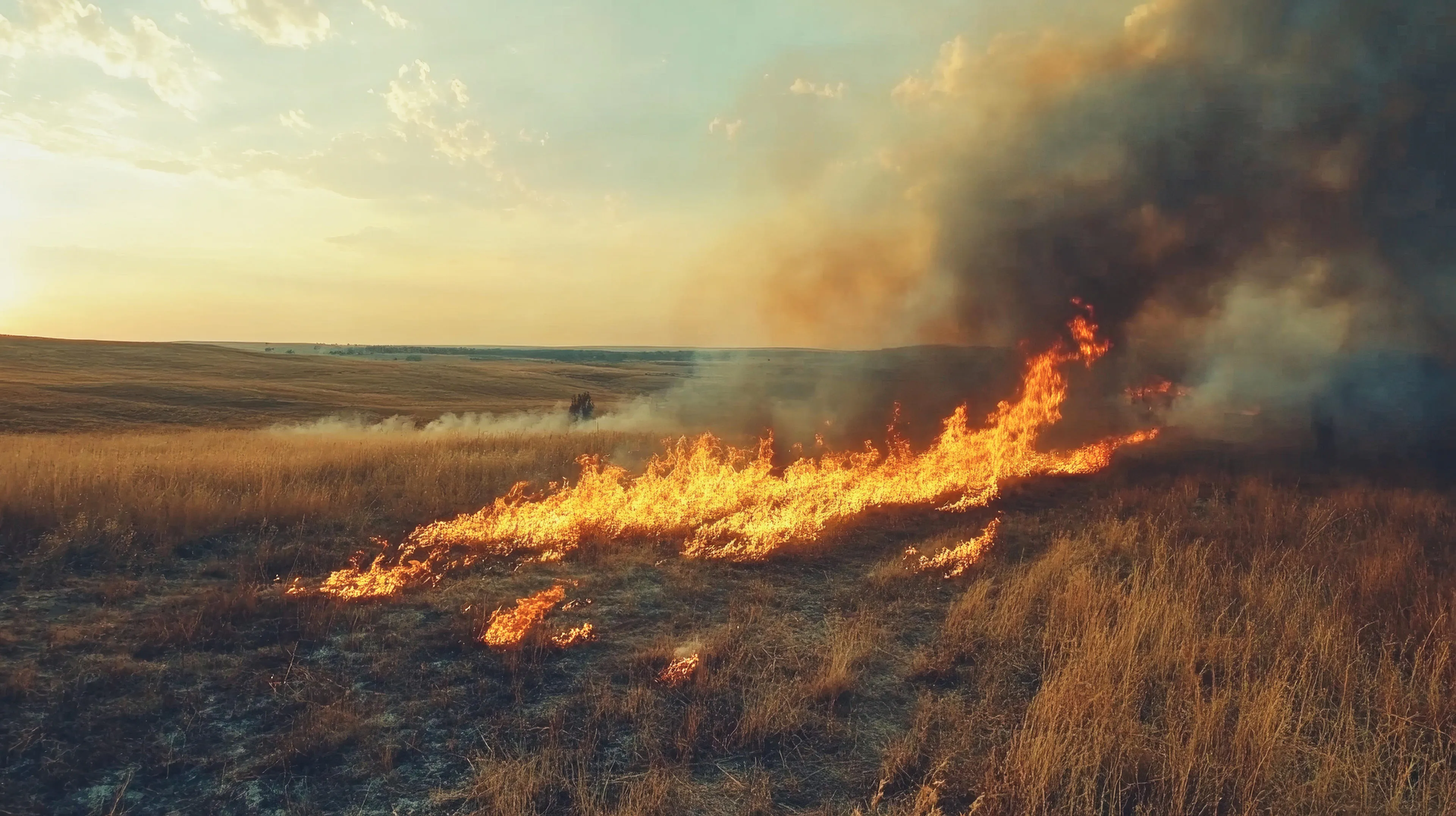
As Britain experiences hotter, drier summers, wildfires are no longer confined to remote moorlands. Increasingly, they’re occurring at the edges of towns and cities—zones where housing and infrastructure meet fields, woodland and open countryside. This shift not only impacts public safety but also has implications for insurance premiums, infrastructure resilience, community resilience and livelihoods.
Recent analysis by Ordnance Survey (OS) reveals that over 1.8 million homes are located within 100 metres of urban boundaries.
“With the UK set to become warmer and more susceptible to drought and extreme heat events, there’s growing recognition of the need to better understand how wildfires behave and how we can mitigate and manage their impact,” says Duncan Moss OBE, Principal Consultant at OS, and Co-Chair of the Natural Hazards Partnership Hazard Impact Science to Services Group.
"Wildfire risk isn’t determined by weather and climate alone — it’s shaped by a complex set of factors, including the type and condition of vegetation, shape of the land (topography and slope), how land is used, and how likely it is to come into contact with potential ignition sources."
These busy transition areas are where fuel and ignition sources, and the potential for high human and economic impact converge. As Moss explains:
“Whether it’s a barbecue in the back garden, a campfire, or unextinguished smoking materials tossed from a footpath, there are far more opportunities for wildfires to start in these busy transition areas.
“The homes identified by OS data are located within a patchwork landscape generally without managed firebreaks, as is common in other parts of the world such as the USA. It’s typical for grassy verges, scrub, farmland, and trees to sit right alongside vital infrastructure like power lines, reservoirs, and transport routes. That mix makes wildfires harder to predict and manage—and their impacts potentially more widespread.”
Where are Britain’s urban edges most exposed?
Over 1.8m homes sit within a relatively short distance (or buffer) of urban edges in Britain, where over recent years, the greatest proportion of fires have taken place. Most of these fires are small (less than 1 hectare) but they can be incredibly disruptive.
While not all these homes are equally vulnerable, their proximity to vegetated land and human activity makes them important to consider in wildfire preparedness planning.
|
County |
addresses within 100m of the edges of towns and cities |
|
Greater Manchester |
107257 |
|
West Yorkshire |
81842 |
|
Essex |
62340 |
|
Kent |
58196 |
|
Lancashire |
54399 |
|
Devon |
50348 |
|
Hertfordshire |
50328 |
|
Greater London |
48098 |
|
Surrey |
45241 |
|
South Yorkshire |
44242 |
|
Hampshire |
41304 |
Supporting emergency services with OS data
Mapping and geospatial data are an increasingly important part of the fire manager’s ‘toolbox’ (which includes good land management practice such as cutting, mowing, prescribed burning, fuel breaks, etc) in helping to reduce the damage wildfires cause, not just in how we respond, but in how we plan ahead. In the middle of an incident, OS data helps emergency services navigate difficult terrain, place resources in the correct locations, create fire plans, coordinate teams, and identify at-risk homes accurately. That level of situational awareness and geospatial intelligence can save lives and protect vital infrastructure. But just as importantly, data can help responders get ahead of the wildfire risk.
Moss explained: “We’re playing a key role in that effort, both through the data we provide to every public sector body through the Public Sector Geospatial Agreement and through our work with the Natural Hazards Partnership, which brings together the science and practitioner community across the natural hazard resilience space to improve readiness and response through scientific advancement and better coordination.”
OS also works closely with the National Fire Chiefs Council (NFCC) in providing geospatial expertise and guidance to practitioners carrying out wildfire analysis and planning aiming to help communities be prepared for wildfire events. By connecting the dots – from local land managers to national agencies – location data provides a clearer picture of wildfire risk and can help authorities and agencies to take the smartest action to reduce it.
Understanding the patchwork of risk
Gareth Clay, Professor of Geography at the University of Manchester and member of the Natural Hazards Partnership Steering Group, highlights the unique challenges of Britain’s rural-urban interface:
“In regions where wildfires are more common, like California, the rural-urban border is carefully managed. It’s easy to see this on maps – there’s often a distinct line where the town ends and a forest begins, sometimes with a firebreak in between. But in the UK, our borders are a much more patchwork mix of landscapes.
“In some ways, this patchwork protects us by breaking up fuel sources. Whether you're in deciduous woodland, on a heath or a grassy field, each landscape has intrinsic properties that make it more or less flammable. But these areas also include vital infrastructure and fixtures of daily life – from village shops and community centres to dog walking routes. The more pressure an area is under, the greater the chances for ignitions.”
Strategic partnerships for long-term resilience
OS plays an important role in national coordination efforts to improve wildfire preparedness. Through its work with the Natural Hazards Partnership, OS works collaboratively with science and practitioner communities to improve readiness and response through better data and collaboration.
“Wildfire risk is growing, and the challenge isn’t just about what happens this summer or in one hotspot; it’s about how we prepare across regions, sectors and services,” Moss explains.
“Ultimately, this is about long-term resilience. With better data and insights, councils and policymakers can make more informed decisions – from where to build and configure new homes and infrastructure to how we better defend what already exists.”
Wildfire vulnerability is a complex matrix to understand. As hotter, drier conditions become more frequent, understanding how fires behave – and where they’re most likely to occur – is essential. By combining rich geospatial data with expert insight and cross-sector collaboration, we can build a more resilient future – one where risk is better understood, communities are protected more effectively, and infrastructure and property are safeguarded through smarter planning and preventative measures.
Sharing the latest news about OS. We can license you to use OS maps in print, online and film format. For more information and resources for journalists, bloggers and media professionals, email pressoffice@os.uk or call 023 8005 5565.
Find more Insights
- Land and property