Britain’s biggest map lover revealed
Press Office
Winner: for a love of maps that’s brought him a life of adventures – Nigel Brown
My interest in paper maps began on Good Friday 1964 when myself, my brother, and my best friend, armed with OS Sheet SE 22 1:25,000 borrowed from the local library, went searching for Haigh Well about two miles from our home. With the aid of the map we found the old well. We were ecstatic and I became hooked on maps.
At Batley Grammar School, we studied OS 1-inch maps in geography and I was fortunate to have two inspirational teachers who reinforced my rapidly developing interest in paper maps. In my teens this was supplemented by youth hostelling trips to the Yorkshire Dales and Scotland, where we loved to navigate our way from hostel to hostel over rugged countryside, always using an OS 1-inch map as our guide. When I first fell in love, this even extended to taking my first girlfriend away on youth hostelling expeditions and I suspect she felt that she came second to my love of maps!
After university, my professional life was spent working as a Chartered Surveyor. I covered a large geographical area in North East England (Tweed to Tees) and maps were an integral part of my job in those pre-satnav days.
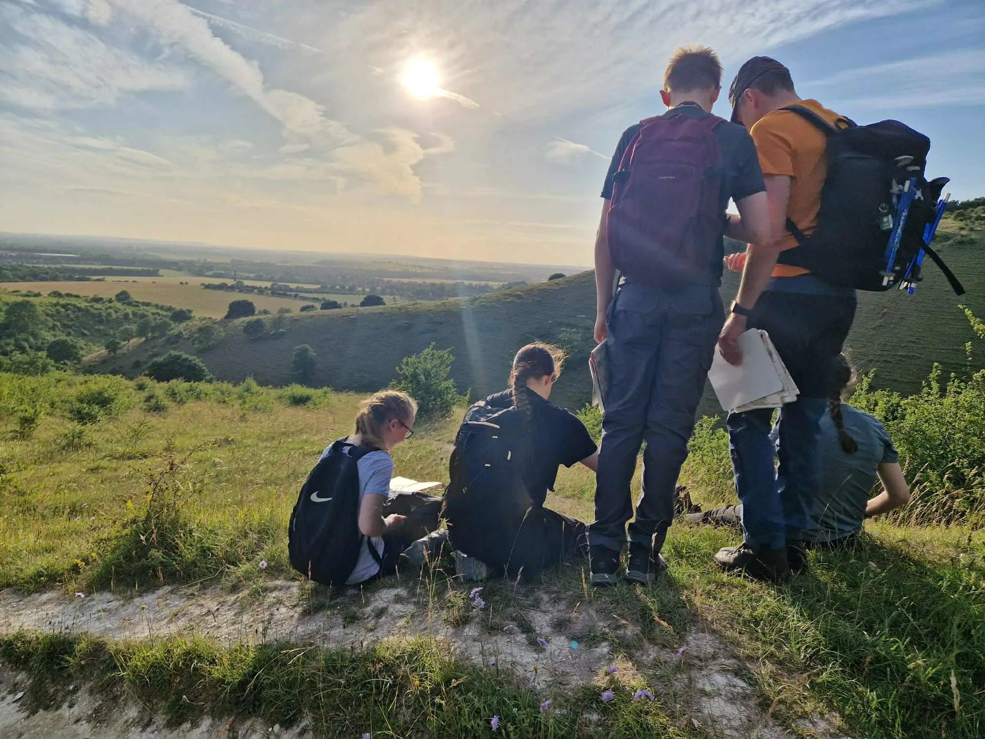
I have always enjoyed hill walking and I am fortunate to be able to continue this hobby in my retirement, regularly walking in the Cheviots and the Borders with a couple of friends. Whilst the OS app is an excellent tool, we have a strict rule that it should only be used as a last resort if we are completely lost. First and foremost we use paper maps. In my opinion there is no substitute for the sheer enjoyment of holding a paper map (even in a howling gale!) followed by the thrill of using its detailed contents to successfully navigate from A to B.
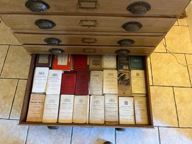
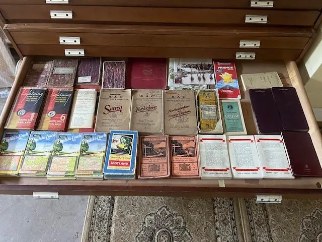
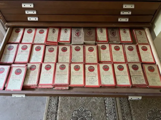
I have been collecting and using paper maps for around 60 years and counting. Well over half of my collection is made up of OS maps ranging from current Explorer maps to examples from the 1800s. My pride and joy is a full set of all 146 OS Popular Edition maps from the 1920s/30s. My other favourites are the OS Tourist maps from that era with the wonderful artwork on the covers by the likes of Ellis Martin and Arthur Palmer. I love comparing these old maps with the current versions to see how roads, railways, industrial features etc have changed over the years. When my wife and I go on holiday, particularly to Shetland and the Outer Hebrides, we always take old maps of the area with us, as well as new ones.
My total number of paper maps is 1,885. If maps contained in vintage OS atlases qualify, make it 2,000!
Honourable mention: for reading maps to relax – Giles Haley
I just had to enter this! My family, friends and cadets (I’m a volunteer cadet instructor) think I’m a total map geek and I love it!
I have the OS App, but nothing trumps a paper OS map. The ability to use that printed information to know exactly where you are and where you�’re going even in the foulest weather is amazing. It’s really exciting out on the hill.
I relax in the evening by reaching for a map, picturing the landscape, planning routes to either navigate myself or look for training routes where my cadets can practice a range of map reading skills. I get maps on holiday and sit browsing them while the family are sunbathing - they even know I’ll get excited when they find one in a shop! They’re not so keen on my giant wall map or my 3D map of Eryri (great for contour instructing) at home, so these have to lurk in the spare room.
What I like the most is sharing a map and enthusiasm, the cadets love being out map reading and even doing night navigation, and I occasionally work with an adult group with learning difficulties, who are fascinated when I lay a map out.
They can think I’m a map geek, but I don’t care. I’m proud of it!
Honourable mention: for covering his Transit campervan ceiling - Simon Clarke
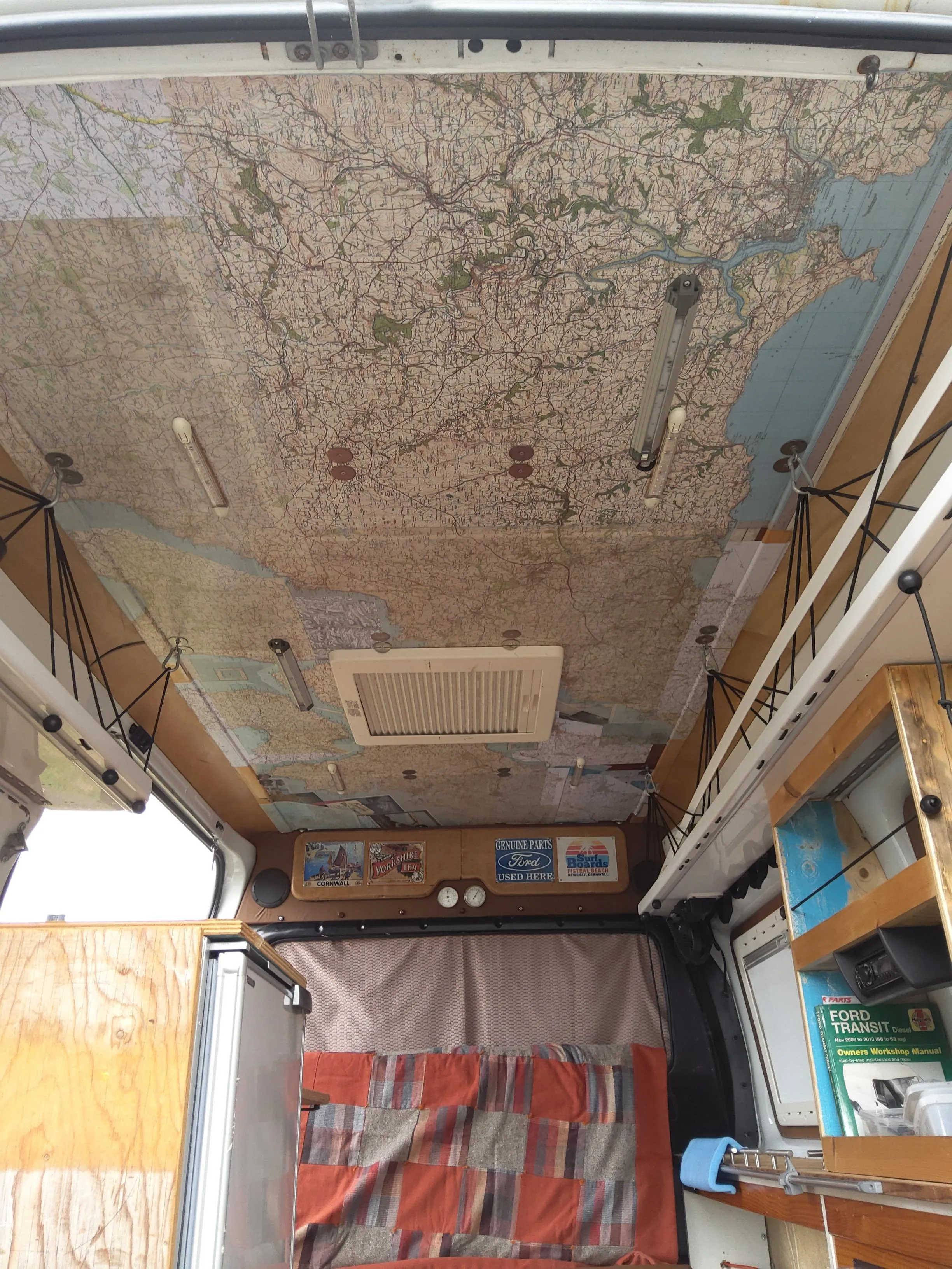
The ceiling of my Transit Mk7 campervan is totally covered in 1:50,000 OS maps.
They are of different ages so show the changes in the transport infrastructure in Cornwall, the Dr Beeching closure of the railways to the dual carriageway of the A30 through the centre of Cornwall, and the growth of housing.
It is great looking at the area you have stopped in whilst drinking tea in my hammock.
Honourable mention: for inventing a paper map game – Lesley Walton
I accidentally created a hilarious game we call Map Charades: look closely at any 1:25,000 map, find a weird place name and do a charade of it. The others in the group have to figure it out. My first charade was of Scratchy Bottom in Dorset and, as they say, the rest is history! It’s a game that can be played any time, any place.
Honourable mention: for her historical map collection – Kathryn Hough
I started my historic paper (and cloth) map collection in January 2008 when I bought a ¼ inch 1946 series 4 OS map of Orkney and the Shetland Isles from a second-hand bookshop. I gradually added to my collection, initially buying maps of places and areas I had visited as I was interested in seeing the changes that had happened over the years including new roads, closure of railway lines, growth and development of villages, and towns and cities.
My oldest map is a cloth 1905 OS revised new series map of Pembroke in remarkably good condition for its age – which only cost £4 in 2023. My newest are some of the Series 7 maps with red covers from the 1970s. I haven’t extended my collection to the metric scales. I have 659 Great Britain historic OS maps series 7 and earlier, seven OS of Northern Ireland and two Ordnance Survey of Ireland maps.
I also own (with my husband) approximately 250 up-to-date metric OS maps that are of course more useful for navigation nowadays. So in total I have over 900 OS paper and cloth maps.
I am trying to have an adventure around each 1:50,000 OS paper sheet – so that’s 204 adventures altogether. Most of them are walking adventures although there are some exceptions such as boating on the Norfolk Broads. I started this just after the first Covid lockdown ended in the summer of 2020, and so far I have covered 154 of them. I’m off to Scotland later this summer and have plans for a few more of my OS adventures while I am there.
Honourable mention: for collecting OS maps three times over – Sheila Ripper
I’ve been a fan of OS maps since way back at school studying geography and probably bought my first 1-inch OS map in 1964 before going walking and youth hostelling in the Peak District. I vowed then to get the entire collection of those 1-inch maps covering all Great Britain.
Back then it was ‘1-inch to the mile’ - a very awkward scale of 1:63360. So my first 30 or so eventually became obsolete and I had to start all over again when OS started going metric.
By then I was at college studying for a degree in geography. I remember the first metric edition was just a simple conversion of the existing contours changed to metre values, which led to another awkward map reading experience of some very odd numbers. When OS eventually completed a total conversion to contours in regular metric values, I had to start all over again. Unfortunately, lack of shelf space enforced disposal of those earlier editions, which I now regret!
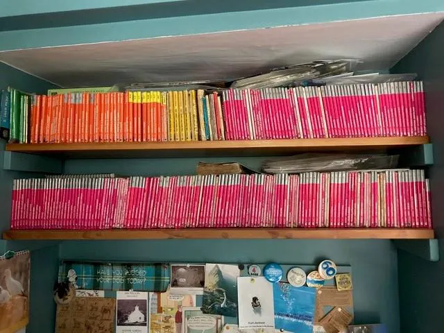
Walking trips in various parts of Britain gradually helped to increase my collection, but there would still inevitably be a few gaps. Finally, around 2015, I managed to buy the last remaining few to complete my collection of the entire coverage of Great Britain, and here they are, readily accessible for frequent reference at any time on my kitchen shelves �– along with an assortment of OS 1:25,000 scale maps and the old 1-inch ‘tourist’ maps of several National Park areas. I’ve not been to all those places of course but I still love to look at them for all sorts of reasons. You can learn so much from them.
Sharing the latest news about OS. We can license you to use OS maps in print, online and film format. For more information and resources for journalists, bloggers and media professionals, email pressoffice@os.uk or call 023 8005 5565.
Explore OS Maps
You can share your walking, cycling or running routes in Great Britain by downloading the OS Maps App on your phone, PC or laptop
Find more news
- Announcements
- General public
- Consumer
- Great Britain
- United Kingdom