The Princess Royal visits emergency services showcase at OS
Her Royal Highness saw how cutting edge data can build a resilient and safe Britain
Press Office
The special guest for the landmark event was The Princess Royal, who was given a tour of the OS head office including an introduction to surveying technology and the role of OS in mapping the nation, and an insight into OS’s work in supporting other nations and tackling climate change.

The tour then focussed on the emergency services with Her Royal Highness being given an exclusive preview of the exciting new OS Emergency Services Gazetteer. This is a new OS product which has been in high demand and keenly anticipated by the emergency services; it is due to be launched in spring.
The OS Emergency Service Gazetteer is a comprehensive and maintained database of locations. It currently contains 1.3 million features (names, places and objects) such as motorway junctions and roundabouts. It is particularly effective in identifying the location of those areas that have no addresses, like named cliffs and named waterfalls. Developed in close collaboration with the emergency services, it is designed to equip responders with the precise location information they need to act quickly to save lives and property during emergencies. The Gazetteer will provide a single, unified source of truth for accurate location information, aiding both those in control rooms and on the front line. It is a living, breathing resource, which will continue to adapt and grow after its launch as new information is added.
During her visit, The Princess Royal also had the opportunity to see a demonstration of the recently launched OS Vernacular Names tool, which will, in future, help power the Gazetteer with colloquial nicknames for features, landmarks and buildings. The tool is fully accessible to all emergency service organisations to input and read names and builds on a previous bespoke tool created for the Maritime and Coastguard Agency, which included over 8,000 vernacular names around Britain’s coastline. It helps emergency services to quickly find the location of callers and incidents by cross-referencing a database of alternative names with official place names.
During the visit, Her Royal Highness added a new colloquial name into the Vernacular Names database - ‘the wedding cake’ - an alternative name for the Queen Victoria Memorial, which is situated opposite Buckingham Palace in London.
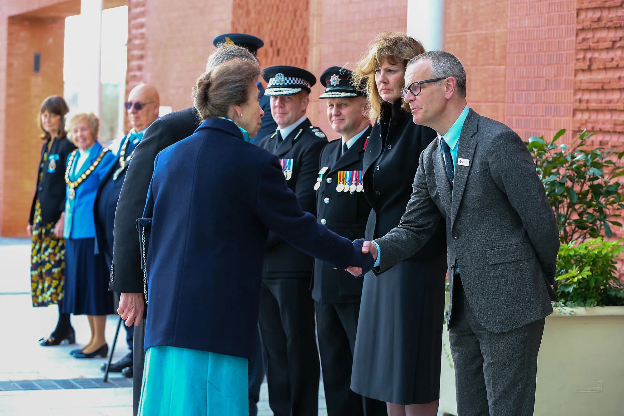
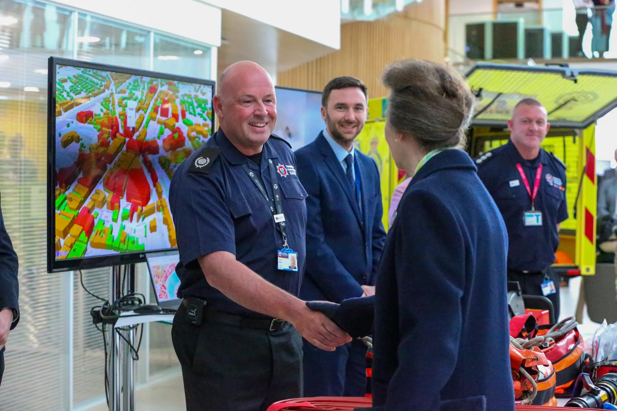
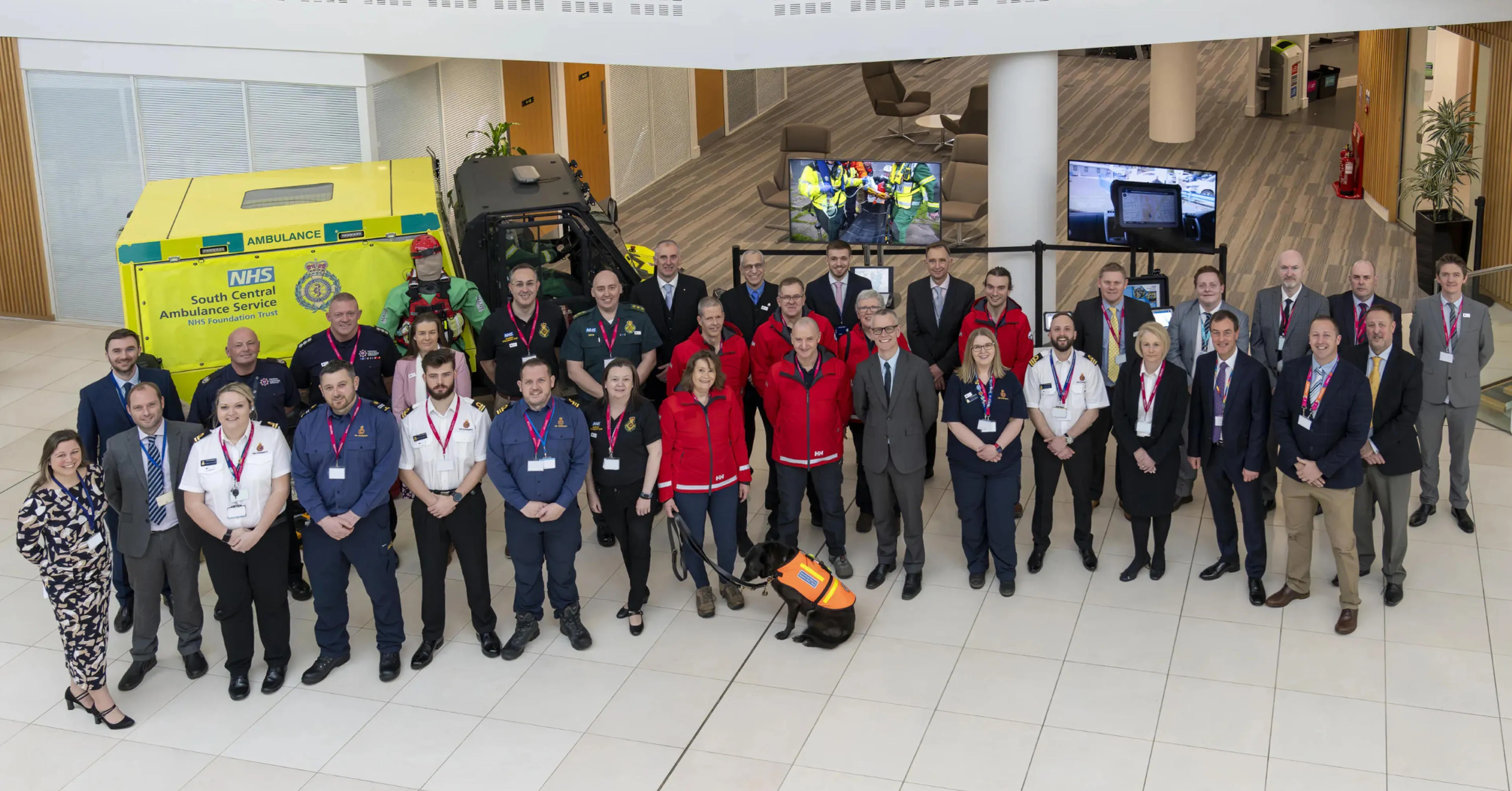
The showcase event was held at Explorer House, in Southampton on Thursday 15 February. The Emergency Services team brought along a fleet of vehicles and specialist kit to demonstrate how they deliver their critical services. This included Devon and Cornwall Police showcasing the state-of-the-art 3D mapping technology used during the G7 summit and Hampshire and Isle of Wight Fire and Rescue Service explaining the role of building height data in managing incidents, alongside colleagues from Mountain Rescue England and Wales, the Ministry of Defence and ambulance trusts.
Other OS services, technology and products were also demonstrated, including how AI is helping to improve location data, emerging markets, initiatives to counter the challenges of climate change and support given by OS to international partners.
"I was incredibly proud to welcome Her Royal Highness to our showcase event, to see at first hand how OS is supporting the emergency services in keeping the nation safe. We have a longstanding and close relationship with the blue light community and this was an excellent moment to reflect on how OS technology, services and products – such as the new OS Emergency Services Gazetteer - are making a difference to the services they provide on a minute by minute basis. The showcase was also a great opportunity to bring a number of communities under one roof – highlighting our first class OS teams who work so hard to collate and improve our data and allowing us to appreciate and further understand the work of the customers we support so closely."

Virginia McVea, Chief Executive of the Maritime and Coastguard Agency, which worked with OS to develop the Gazetteer, said:
“It was a proud moment for our team to talk to The Princess Royal about how HM Coastguard helped trailblaze the OS Emergency Services Gazetteer, created by Ordnance Survey, to support the work we and our fellow emergency services do every day.
"The most important question when someone calls 999 in a coastal emergency is: where? Understanding local placenames can make a lifesaving difference to getting the right help to the right location, fast.
"Action might involve sending an HM Coastguard helicopter; Coastguard Rescue Teams trained in cliff, mud or water incidents; or a lifeboat. When a caller isn’t sure where they are, knowing the lie of the land is vital for our Rescue Coordination Centres to pinpoint where and how to respond."
"It’s wonderful to be here today to meet Her Royal Highness and showcase how the mapping tools which Ordnance Survey has produced help our crews every day when responding to incidents. The systems developed allow us to identify the risk-information for buildings before we arrive on scene, ensuring our teams are prepared for the emergencies they face. The technology is also a vital tool for our firefighters at wildfire incidents, helping them to understand the geography of the land affected."
OS provides its data and services to the emergency services and wider public sector organisations through the Public Sector Geospatial Agreement (PSGA). The PSGA is a contract between the government and OS for the provision of geospatial data across multiple themes, including buildings, transport, structures, addressing and land. The contract delivers key data to public sector members for use in everyday settings to support provision of critical services to the public.
OS also remains on call 24/7 with its mapping for emergencies service, whether for a natural emergency or security threat.
Sharing the latest news about OS. We can license you to use OS maps in print, online and film format. For more information and resources for journalists, bloggers and media professionals, email pressoffice@os.uk or call 023 8005 5565.
Register your organisation for the PSGA
Public sector organisations can start making full use of OS data and services when they register for the PSGA
Find more news
- General public
- PSGA members
- Government and public sector
- National security and resilience
- Great Britain
- United Kingdom