News
The latest news and press releases from Ordnance Survey
Filters (0)
- Page 1

The Great British love affair with maps
New survey results reveal the nation’s fondness for maps continues unabated among British adults – in time for National Map Reading Week.

Duncan Moss awarded OBE in the King's Birthday Honours list
Principal Geospatial Consultant Duncan Moss has been awarded with an OBE for services to technical consultancy and government resilience.

New tool will help local authorities in the north address regional divide in EV infrastructure
Ordnance Survey and Transport for the North have worked in partnership to develop the new tool
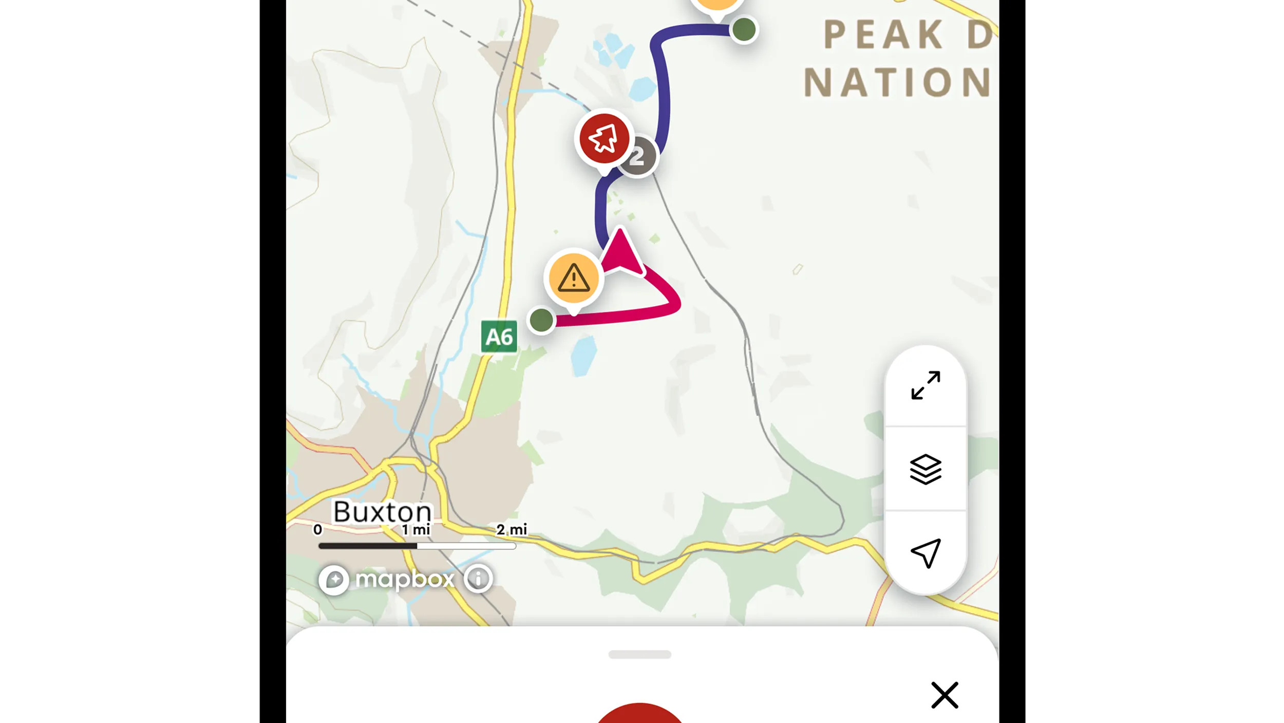
OS Maps leads the way with first ever hazard reporting tool for walkers
Walkers, runners and cyclists alerted to any hazards ahead thanks to unique new system in OS Maps.

OS Maps helping Tour of Britain fans get the most out of each race day
Spectators will get their hands on a special memento when attending Britain’s biggest cycle race this year.
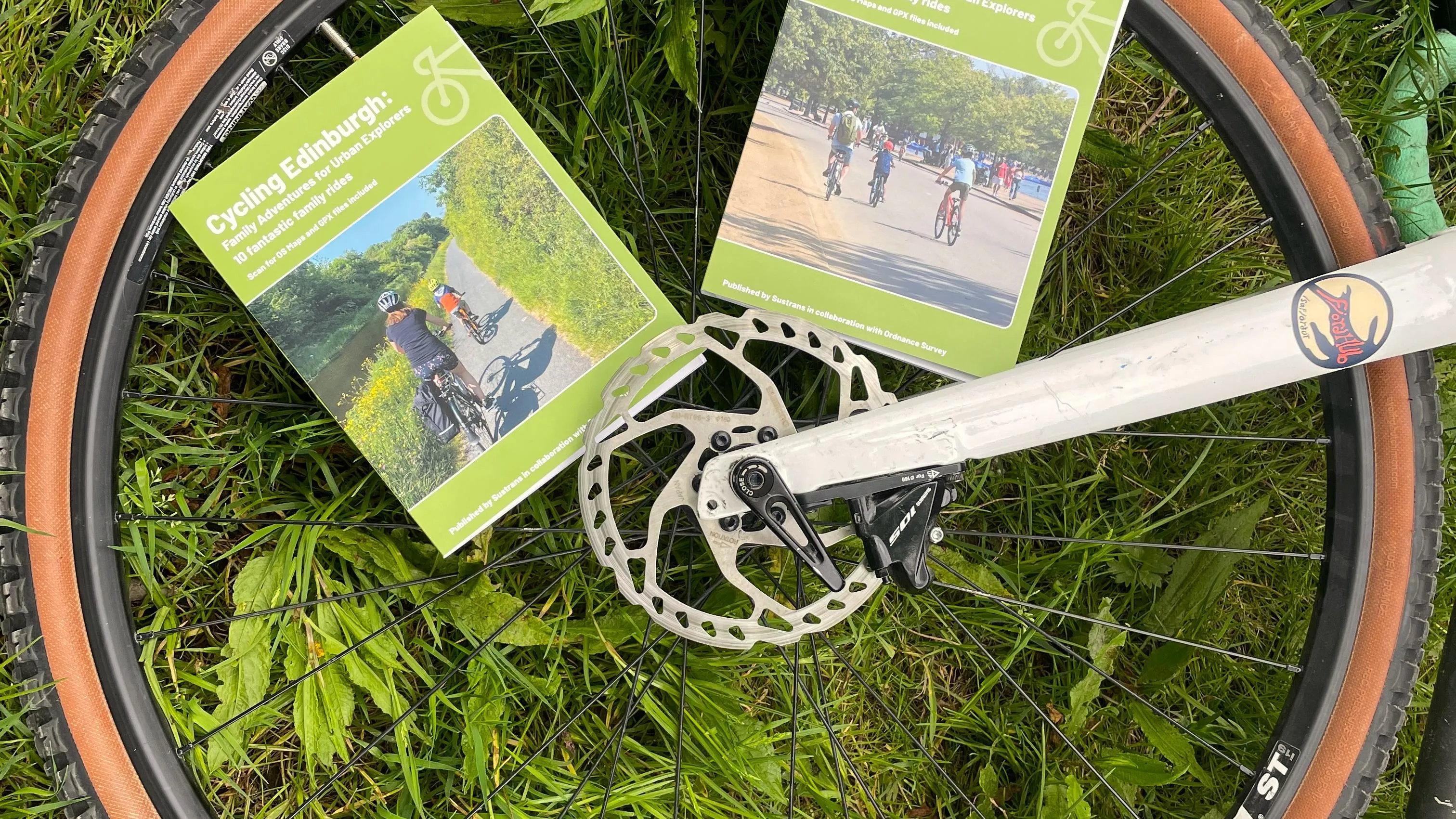
Family adventures for urban explorers
New cycling guidebooks to inspire days out in London and Edinburgh.

Ordnance Survey chooses KOREC and Trimble R980 in nationwide GNSS upgrade
After a successful tender, the KOREC Group will be supplying Ordnance Survey (OS) with 180 Trimble R980 GNSS Receivers.

Geovation announces 20th cohort for award-winning Accelerator Programme
Geovation announces the next cohort for its award-winning Accelerator Programme.
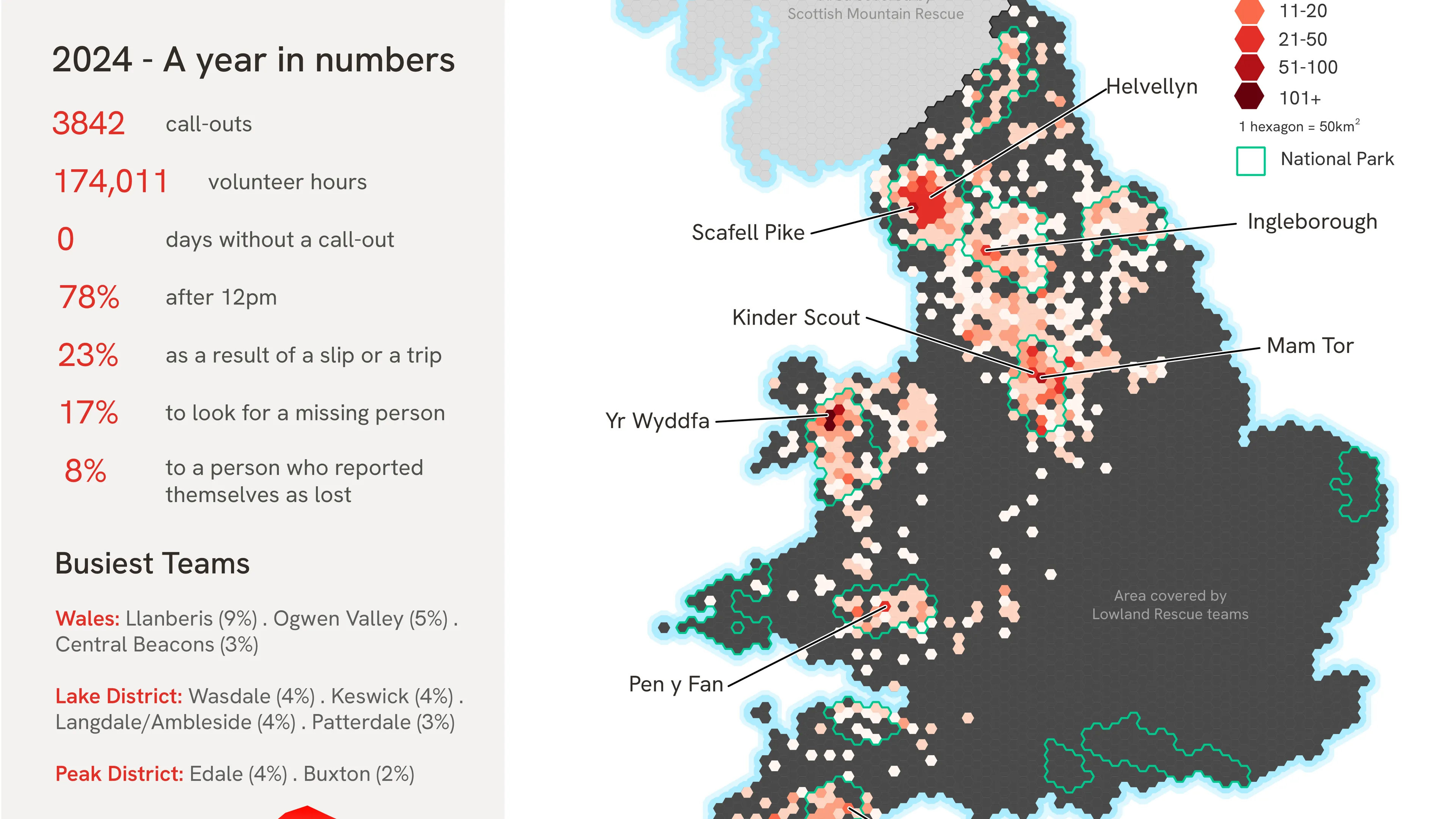
18- to 24-year-olds now biggest age group in need of rescuing by Mountain Rescue England and Wales
Rise in popularity of social media and outdoor apps is behind significant growth in call-outs to honeypot locations in Britain according to rescuers.