News
The latest news and press releases from Ordnance Survey
Filters (1)
Page 1
New national cycle lane data will support local authorities and central Government in promoting Active Travel and public safety
The Government is aiming to increase the number of local journeys being walked, wheeled or cycled by 2030.
- News
New national street lights data shines a light on Britain’s brightest and darkest roads to support safe travel
The new data will support safe walking and cycling routes to important services such as hospitals, train stations and schools.
- News
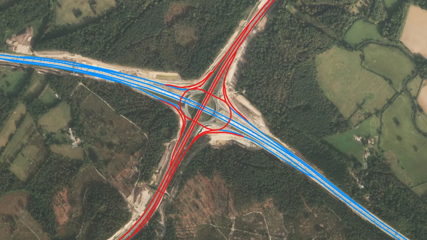
A new model of England’s motorways and A roads will lead to safer and more efficient journeys
The launch of the National Highways Network Model marks the start of a strategic partnership with Ordnance Survey.
- News
OS supports a new vision for local transport
A new report outlines how information technology, data and connectivity can improve local transport.
- News
OS research shows sustainability projects drive better opportunities for software developers
UK efforts to reduce transport emissions has driven up demand for developers who can support the roll out of electric vehicles (EVs) and other forms of sustainable transport.
- News
OS joins UK’s Intelligent Transport Systems Industry Association
Ordnance Survey (OS) has become a corporate member of the UK’s Intelligent Transport Systems Industry Association (ITS (UK).
- News
New OS road maps reflect 9.2% growth of road areas in Great Britain
Ordnance Survey (OS) has published eight road maps to keep pace with the growth of roads in Great Britain.
- News
National Cycle Network paths launched on OS Maps
Charity Sustrans and mapping experts Ordnance Survey join forces to offer comprehensive and user-friendly data on the National Cycle Network.
- News