All about OS MasterMap Topography Layer
As Great Britain’s national mapping service, we are responsible for keeping accurate, up-to-date location data and maps of GB for use by the private, public and third sectors.
We map GB’s topography, also known as “the arrangement of the natural and artificial physical features of an area” (Oxford). Every day a team of surveyors, pilots and analysts explore the country to discover changes to the topography and in doing so, take measurements and record these changes in our database.
After much processing and organising, we make this available as the most detailed, current and comprehensive geographic dataset of GB: OS MasterMap Topography Layer.
What is OS MasterMap Topography Layer?
As the most comprehensive geographic dataset of GB, OS MasterMap Topography Layer was created to provide businesses, governments and other organisations with a detailed understanding of the country. This dataset is utilised by customers ranging from energy and utility companies to logistics firms, insurers, emergency service providers and government offices.
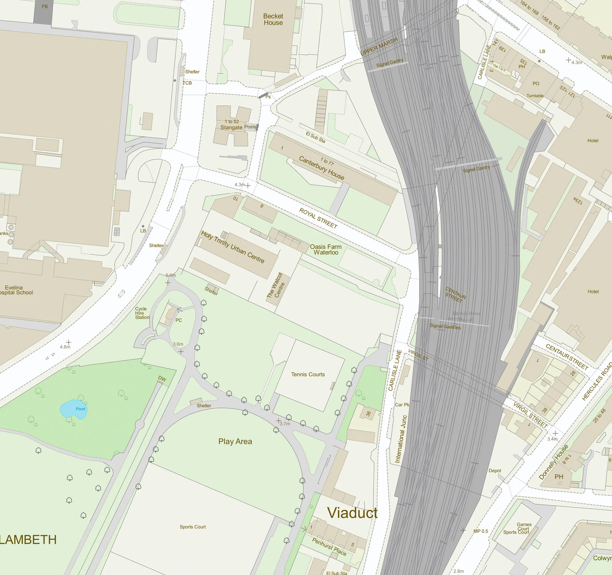
OS MasterMap Topography Layer includes vector features – points, lines and polygons – with high accuracy and rich attribution. This includes information about geographic features like roads, buildings and natural spaces as well as cartographic elements like labels.
Opening up OS MasterMap Topography Layer
As part of the recently announced Public Sector Geospatial Agreement (PSGA), we are providing new ways to access our data, including OS MasterMap Topography Layer. The data will now be made more accessible through the OS Data Hub and a suite of APIs that enables users to access the data they need, when they need it, reducing the overhead of maintaining geospatial databases.
When the OS Data Hub and APIs are launched on 1 July, we’ll be supporting developers and encouraging innovation with up to £1k a month of data (including OS MasterMap Topography Layer) for free to developers creating solutions and apps for use by the public or other organisations..
Let’s look at the data
So, what is in the OS MasterMap Topography layer? Defining some key terms may help.
OS MasterMap Topography Features
Maps represent the world. On maps, both real-world objects (like buildings and forests) and abstract objects (like constituency or ward boundaries) provide context for map users. Mapmakers capture these as location data, represented as ‘features’.
With OS MasterMap Topography Layer, each feature is a record in a database. Each of these records has information about the feature’s position and shape on Earth – its geometry – as well as details about it termed ‘attributes’. Attributes add meaning to the geometry, describing a polygon as a building, road segment or piece of land for example.
OS MasterMap Topography Layer features includes:
• Administrative boundaries like parliamentary constituencies and wards
• Buildings
• Heritage and antiquities sites
• Land and landforms like parks, golf courses, slopes, cliffs, gardens and woodlands
• Railways
• Roads, tracks and paths
• Structures like fountains, pylons, weirs and glass houses
• Triangulation stations and other point height features
• Ponds, lakes, tidal gauges and other water features
Identifying features
OS MasterMap Topography Layer is comprised of 500 million individual features, each assigned a unique Topographic Identifier (TOID). This identifier is connected to that feature throughout its lifecycle and retired when the feature is removed if, for example, a building is demolished. This persistent identifier is useful because it allows analysts, developers and data scientists to cross-reference topographic features across datasets and over time.
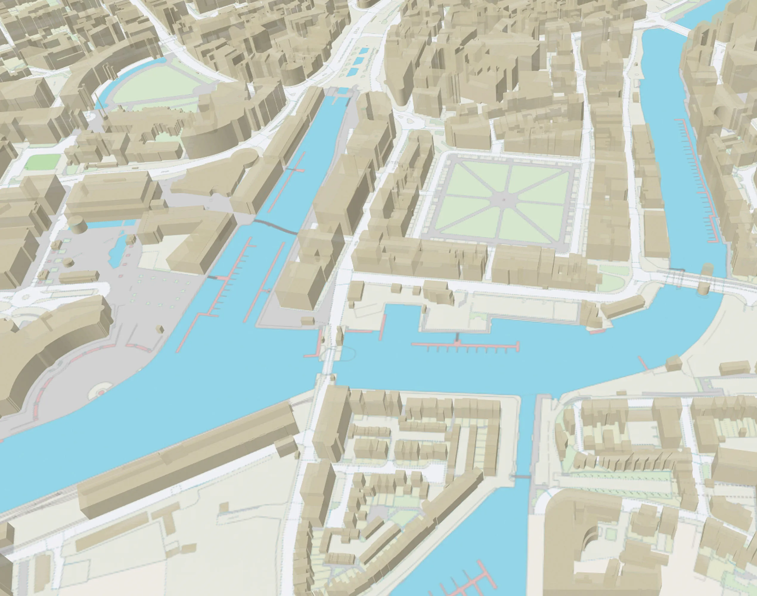
Building Height Attribute
Knowing the height of a building can be useful in many contexts such as analysis and visualisation. So, as a beta dataset, we also offer building height attributes. This information is provided in a separate file with buildings referenced by TOID, enabling the two datasets to be easily joined.
Building height attributes will be available with the geometries via OS Vector Tile API and OS Features API.
OS MasterMap Sites Layer
Our data underpins many functions of services critical for British society to function. We recognised the need for users to have information about key geographic sites, so we created the OS MasterMap Sites Layer. This layer provides details of important sites like schools and hospitals and includes their spatial extents and access points. With this information, emergency services can be more efficiently routed to the scene of an accident, mapping companies can provide more accurate directions and planners can have a better understanding of how a change in the road network might affect traffic. This data will be accessible through OS Features API on the OS Data Hub.
Accessing OS MasterMap Topography Layer
Through the OS Data Hub, it is easier than ever to access OS MasterMap Topography Layer, Building Height Attribution, and OS MasterMap Sites Layer. OS Maps API provides a pre-rendered map on which you can overlay your own data to give it detailed location context. OS Vector Tile API lets users access customisable, scalable, detailed backdrop map data in a lightweight format. OS Features API allows users to access the features they need when they need it, including rich attributes.
If you need the whole dataset, you can download it! Our aim is to help users derive benefit from this rich trove of location data about Great Britain. The OS Data Hub is in trial until 17 June and will be launching on 1 July.
OS for developers
Whether you’re new to geospatial or a GIS data expert, our data platform grants access to our data
Sharing the latest news about OS. We can license you to use OS maps in print, online and film format. For more information and resources for journalists, bloggers and media professionals, email pressoffice@os.uk or call 023 8005 5565.
Products and solutions featured in this blog
OS MasterMap Topography Layer
OS MasterMap Topography layer provides a map dataset of Great Britain's landscape – from roads to fields, to buildings and trees, fences, paths and more.
Find more blog articles
- Products and services
- Developers
- Great Britain