“It's a personal green mission: to get climate data into the hands of the people who need it.”
"Heat is a killer."
The Climate Change Committee has declared heat adaptation a top priority, with heat events becoming both more regular, and more intense around the globe.
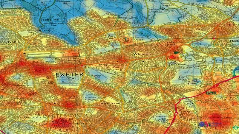
The report covers a project led by Space4Climate, exploring how satellite heat data can be made easily accessible to those developing planning policy – empowering public bodies to make and meet their climate action plans.
"At the moment, people are stumbling around in the dark, not knowing what data they can, and should use... "
Using our know-how, teams like those led by Donna are proactively trying to find the best ways to get good climate science data to our customers, maximising the benefits of climate action.
The teams' research has uncovered the need – and desire – to use space-based climate data in heat adaptation.
Making the data easily accessible could help:
- protect the most vulnerable communities, infrastructure and environments
- add cooling green and blue spaces onto the map for maximum impact
- enable the success of climate solutions to be monitored and best practice shared
Taking climate action
How space-based heat data can power adaptation planning

Our highly accurate geospatial data and printed maps help individuals, governments and companies to understand the world, both in Britain and overseas.
Find more blog articles
- Sustainability
- Innovation
- General public
- Environment