The Green Space Index
Fields in Trust is an independent charity that champions and supports parks and green spaces in the UK by protecting them for people to enjoy endlessly.
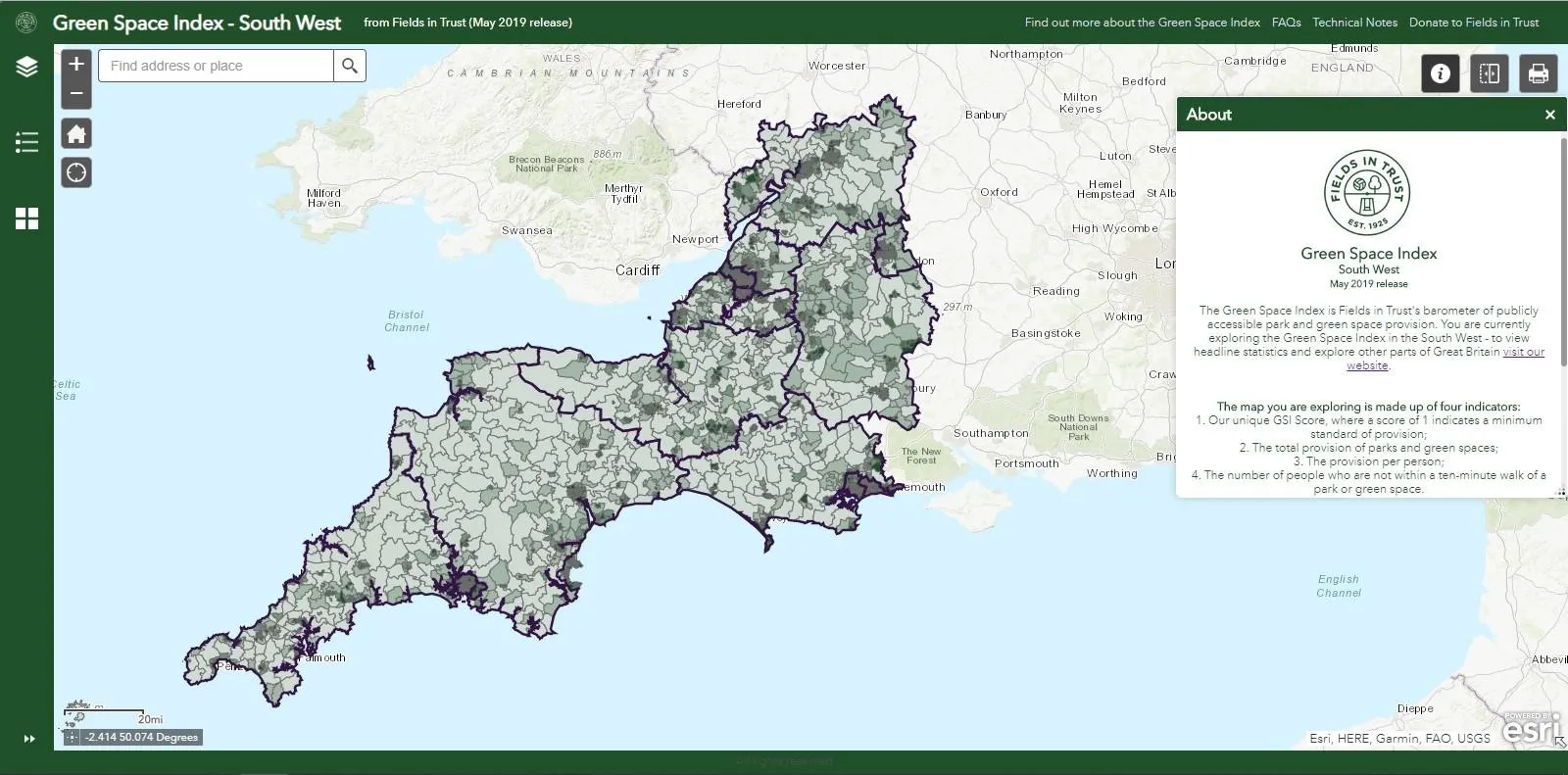
The Green Space Index has enabled Fields in Trust to take stock and analyse publicly accessible local park and green space provision within Great Britain (around 216,000 ha) for the first time. It has been created to support their evidence-led approach calling for parks and green spaces to be revalued for the benefits they contribute to society and protected for future generations to enjoy.
It follows on from their Revaluing Parks and Green Spaces research in 2018 which demonstrated that these green spaces across the UK provide people with over £34 billion of health and wellbeing benefits. Additionally, this product offers the charity a baseline, so future iterations of our greenspace data will enable them to track trends in provision and population over time.
So, just how much publicly available local park and green space provision is there across Great Britain?
Finally, the Green Space Index can offer an answer to this question. It tells us that there are 2.6 million people who don’t live within a ten-minute walk of a park or green space and that across Great Britain, there is around 35 square metres of publicly accessible park and green space provision per person – less than half the size of a six-yard box on a football pitch.
In London for example, only 10,579 people don’t have a park within a ten-minute walk of where they live compared to just under 2.6 million across Britain. However, Londoners have just 20.98 square metres of provision per person – almost half the national average. The capital also falls well short of a minimum standard as measured by Fields in Trust’s GSI Score.
Within the Green Space Index, you can find the numbers for each of Britain’s regions and nations as well as explore the situations near you using the interactive maps.
Technicalities
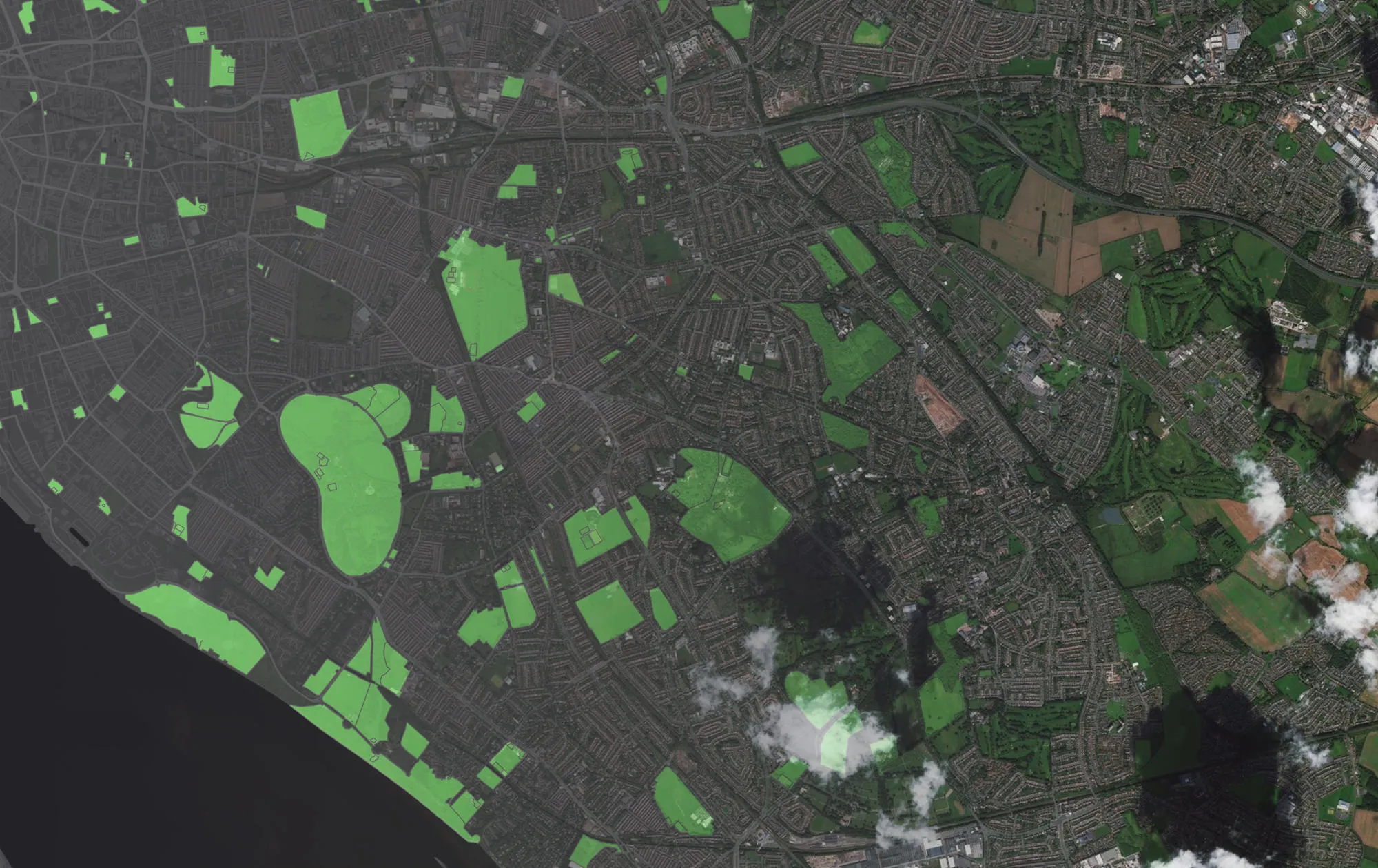
Whilst Fields in Trust already had their own register of parks and green spaces, this often only had a postcode ‘pin’ to represent the locational information. Our Consultancy and Technical Services (CATs) team were able to use OS Open Greenspace and AddressBase Premium to geocode and supplement the Fields in Trust data with a more accurate and detailed view of the location and geometry of sites. Once we had a better joint understanding of greenspaces, we completed some analysis to show how accessible they are to the public. This was based on determining the numbers of addresses that fell inside and outside a range of distance measures within local authority areas.
The Green Space Index is compiled using the OS Open Greenspace product, with the May 2019 release of the GSI using the April 2019 release of OS Open Greenspace.
Within the OS Open Greenspace product, the site extent polygons are used in all cases. From the site extent layer four typologies are excluded which are not deemed to be within scope of the Green Space Index. The excluded typologies are allotments & community growing spaces, cemetery, religious grounds and golf course.
For further details, have a read of Fields in Trust’s Technical Notes.

Our highly accurate geospatial data and printed maps help individuals, governments and companies to understand the world, both in Britain and overseas.
Products and solutions featured in this blog
OS Open Greenspace
OS Open Greenspace is Britain’s most comprehensive Open dataset of greenspace. Find the location of public parks, sports facilities, play areas, allotments and more.
Find more blog articles
- Sustainability
- Products and services
- Great Britain