How digital transformation at Ordnance Survey is delivering new data
One year on from the launch of the OS National Geographic Database, what new data is being delivered, and how is it easier to use and access?
Since then, the OS NGD has kept evolving and growing, with over half a billion geographical features and 20,000 updates each day.
The OS NGD delivers richer data, and makes it easier for users to select just the data they need.
Downloading only the data you need
Via the OS Data Hub, Public Sector customers and Partners can create personalised data packages using our NGD download service, OS Select+Build, and our OS NGD APIs.
Allowing users to select only the data they need means getting to value quicker, with reduced processing time meaning faster answers.
Over
400
organisations have used OS Select+Build so far
We’ve made more than
320
million product updates to the OS NGD since its launch
And there’s been over
1.4
million transactions on the OS NGD Features API
What’s new?
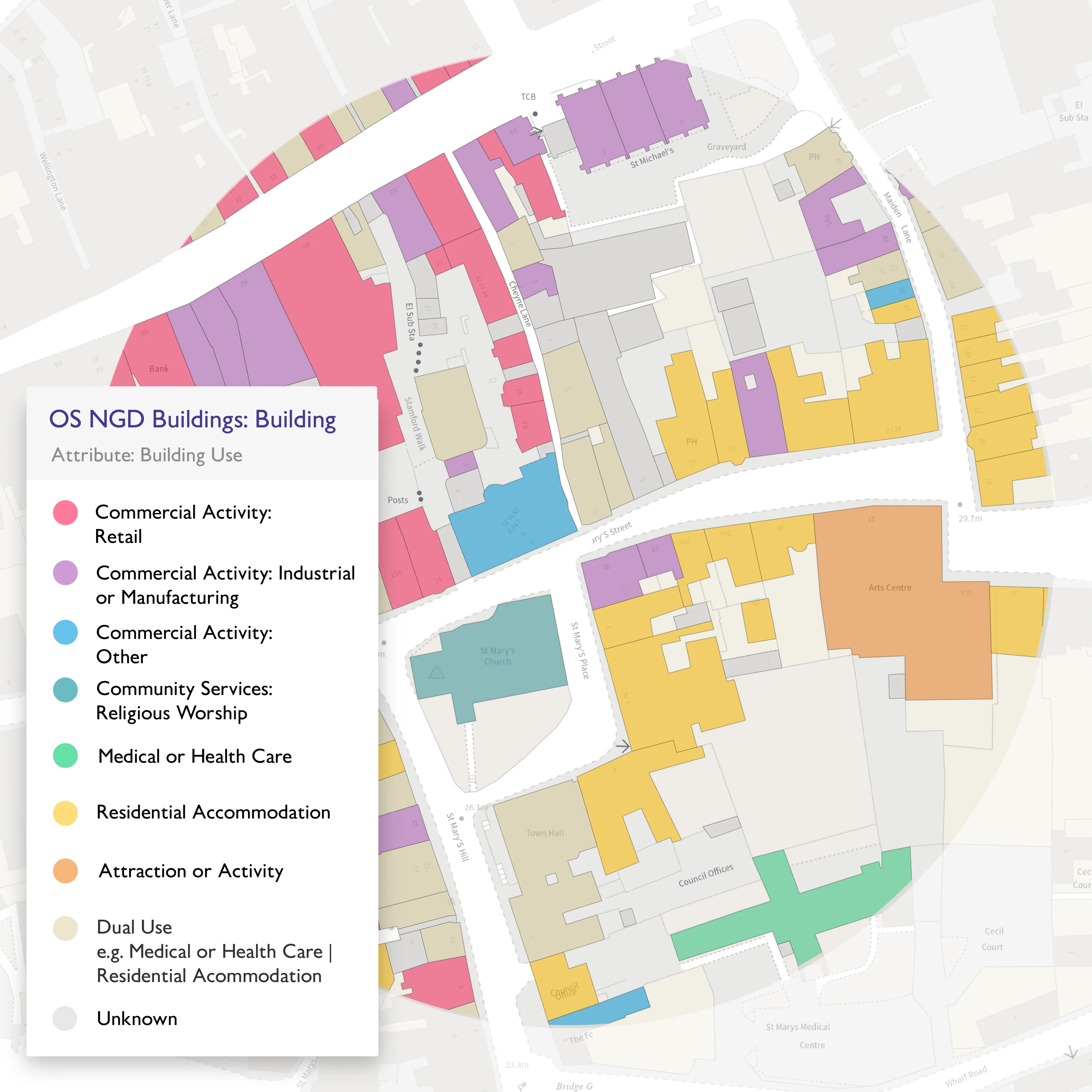
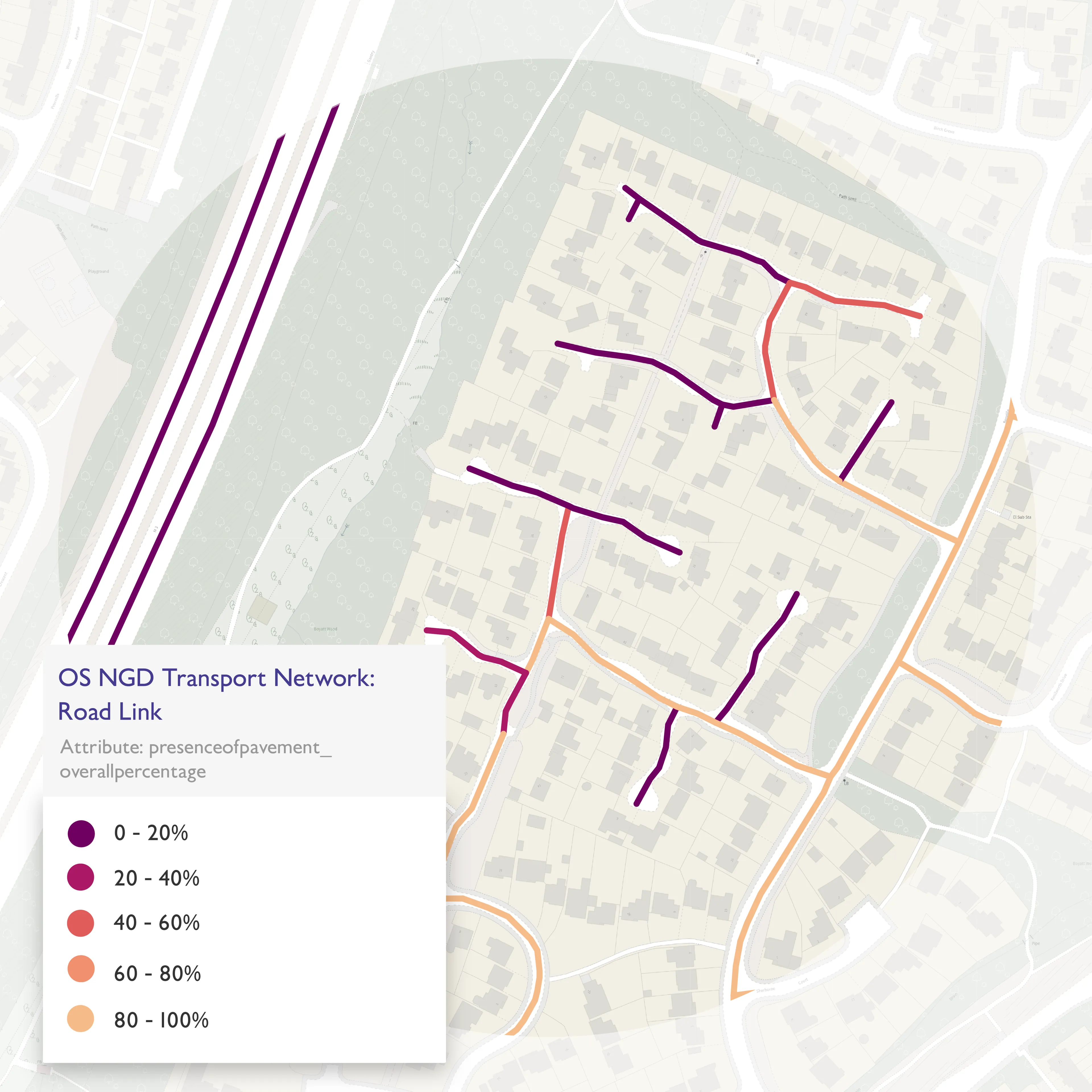
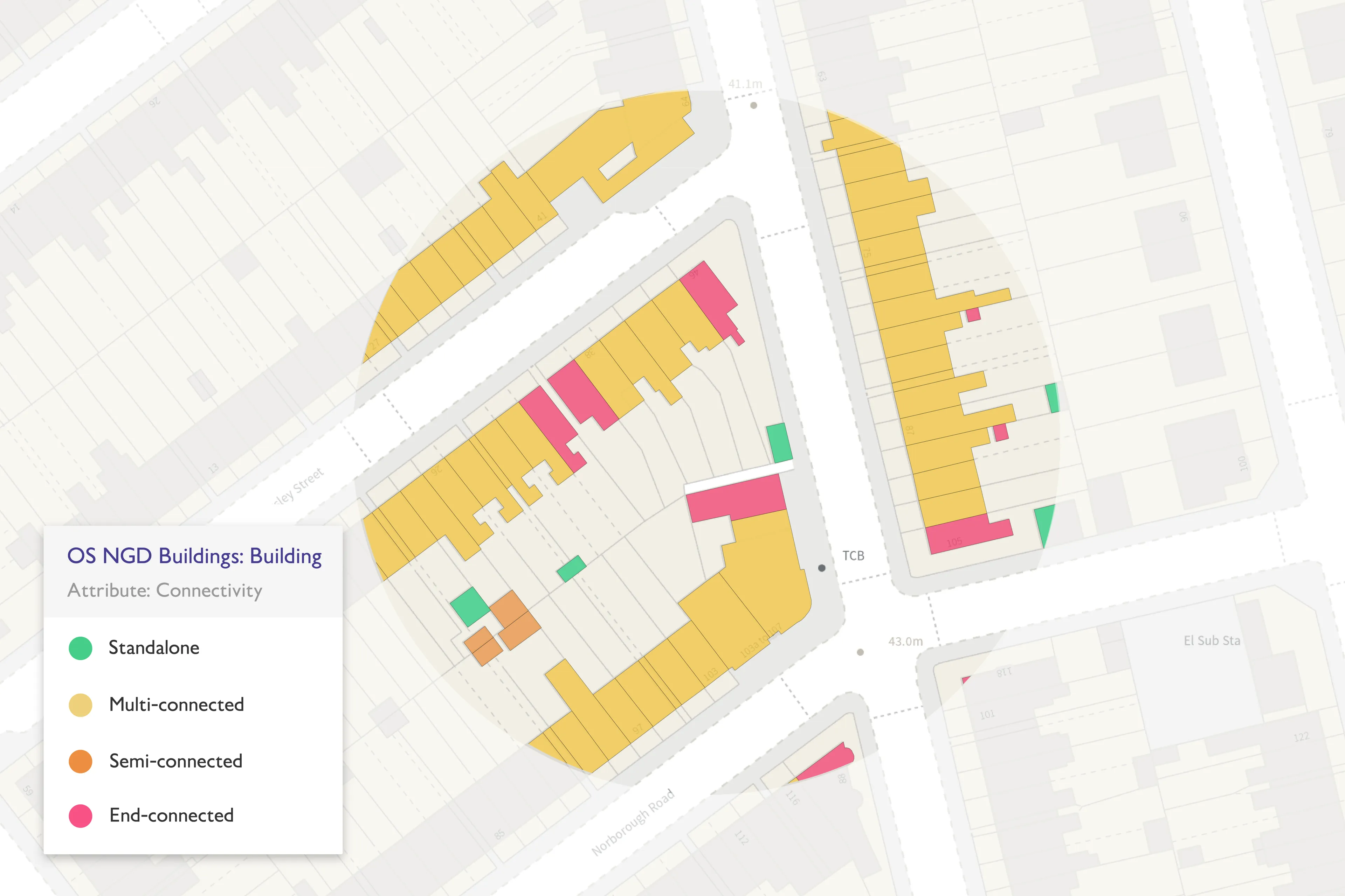
There are now further significant enhancements to the OS NGD data, covering buildings – including a new footprint geometry of all buildings with additional attribution on how the building is being used and is connected to other buildings – and transport, including a railway network, path networks, and pavement presence information.
This new building footprint geometry and new attribute enhancements will have multiple uses. These include supporting our emergency services with their emergency preparedness, as well as responding to incidents. The new data will also provide vital input into risk models for insurance underwriting and peril analysis, and enable local authorities to analyse and investigate the building stock within their area much quicker than ever before.
Firstly, the new transport data gives customers a complete view of Britain’s path network for the very first time, providing organisations with the accurate data they need to encourage walking, and look to make improvements to public health. These projects will also support the aims to reduce traffic congestion, promote local tourism, and improve journey planning in rural areas.
Secondly, the launch of data regarding pavement presence, including their width and presence along roads, will help local authorities support their citizens, including those using wheelchairs, mobility scooters, and pushchairs, with better analysis of walking routes. This data will also support citizen service activities such as asset management activities associated with pavements.
The release of the new data hits a major delivery commitment under the Public Sector Geospatial Agreement (PSGA), which provides public sector organisations with trusted location data for free.
Success stories
Unlocking vital insight in less time
"The additional functionality provided by 'OS Select+Build' will be invaluable in time saved to Fire and Rescue services around the country, to help us keep up to date with our build stock, and work with building owners and residents to ensure their safety."
Following the tragic Grenfell Tower disaster, the Government led a programme of work delivered by Fire and Rescue Services across the country; to make high-rise residential buildings safer, and provide a better understanding of high-rise residential buildings.
As part of the Building Risk Review (BRR) programme, North Yorkshire Fire and Rescue needed to know the numbers of buildings within its area that were over 18 metres or seven floors in height. OS Select+Build enabled them to do this in three minutes, instead of three hours, with accurate data for further analysis.
How the British Army use OS NGD API-Features for battlefield training
"We found OS data to be extremely useful and saved us time by using the API to build out maps that would normally be done manually. "
To immerse soldiers in accurate and realistic ‘mission scenarios’, the 47 Regiment of the British Army is pioneering high fidelity mapping to create realistic training scenarios.
During exercises, operators enter a virtual battlespace in 3D. This immersive training environment is created using data from the National Geospatial Database, which contains the most detailed information of Britain’s landscape.
The simulation platform includes the buildings, roads, surface and elevation data via an API providing an automated basemap for the training area.
The bigger picture
From blue lights to streetlights, OS location data makes a positive difference to public services and high-level decision-making every day. OS data also supports commercial customers and OS Partners, from global tech companies to transport and logistics providers.
As a trusted provider of location data, OS supports customers to make informed decisions and support government policy development, help solve challenges such as sustainability, deliver public services and build the infrastructure that meets future demand, with valuable insights and accurate location data at their fingertips.
The OS NGD contains the accurate data organisations and governments need, fast. In a rapidly changing world, that means organisations and governments can understand challenges, identify solutions and respond to transform people’s lives quickly, efficiently and effectively.
Delivering data that works for you
Discover more
Our improved data structure and categorisation makes the data you need easier to search, find, and analyse.
Easier access
OS Select+Build lets you download just the data you need; OS NGD APIs provide online access via OGC standards.
Up to date
The data you rely on for crucial analysis, delivered with daily updates.
Improved connectivity
OS NGD data makes it easier than ever before to link, share, and analyse our data.
PSGA members and OS Partners can get direct access to the OS NGD through the OS Data Hub using our download service OS Select+Build, OS NGD API – Features and OS NGD API - Tiles.
Latest NGD enhancements
Read about how Ordnance Survey has launched new data, including significant buildings and transport enhancements, in the OS National Geographic Database (NGD).

Our highly accurate geospatial data and printed maps help individuals, governments and companies to understand the world, both in Britain and overseas.
Products and solutions featured in this blog
OS NGD API – Features
Perform powerful geospatial analysis. Filter the data to receive exactly what you need, as and when you need it.
OS NGD API – Tiles
Create beautiful, responsive, and interactive vector maps powered by the OS National Geographic Database (OS NGD).
Find more blog articles
- Products and services
- OS
- General public
- Partners
- PSGA members
- Great Britain