Surveying Ben Nevis – The 49ers
It’s nearly 70 years since we carried out the last full survey back in 1949. Now we know in 2016 that the surveyors of a bygone age were just centimetres out in their calculations – testament to their extraordinary efforts and application.


In 1949 theodolites and other antiquities of surveying were the best friends of those mapping every nook and cranny of the British landscape. Now highly refined measuring devices, linked to an intricate network of land stations and a sky-full of satellites (yes up to 15 Russian, American and European ones) have been used to re-check the height of the mountain taking three surveyors just two hours to gather what it took an expeditionary force of surveyors 20 days to complete.
“It’s given our current OS surveyors a new found respect for the class of 1949” says Mark Greaves, our top Geodetic expert.
So how did they do it?
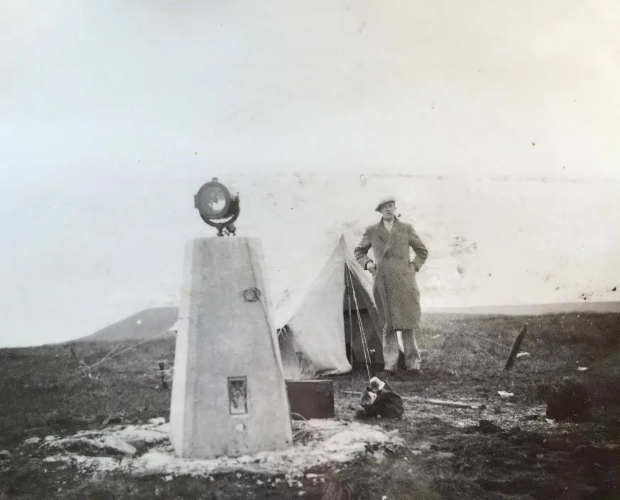
It required a seven-man team to lug 200 lbs of kit to the top of the summit every day for three weeks, leaving at seven in the evening and returning at five in the morning. The array of equipment included surveying equipment, tents, provisions and cooking utensils and stoves. This was being mirrored on other summits surrounding the highest peak too (Ben Lomond, Ben Lawyers, Ben Cruachan, and Ben Alder).
Night-time was the surveyors best friend because the readings from their Cook and Troughton theodolite would lock on to massively powerful light beacons which other surveyors were shining at the Ben Nevis summit from the other peaks. It was the most accurate pin-point way to fix their measurements at the time.

It was a military exercise in co-ordination and time-keeping to ensure everyone reached their station at the right time. And how do you keep several beacons of search light intensity powered? Every night they also hefted massive car batteries (see photo) up and then down for recharging which OS surveyor hearsay suggests burnt their coats when the acid leaked.
Bernard Willis, the team leader was quoted in the papers at the time, “One one night we experienced a blizzard. Our tent was covered in snow. Last night the Ben was clear and we could pick out the beacon on Ben Lomond distinctly.”
We’ve been mapping changes in the British landscape for the last 225 years and now those changes are on a digital map, in our database of 500 million features, within weeks, which is about the same time and the same deliberation and attention which drove the class of ’49 to map Ben Nevis whatever conditions could throw at them.
Ready to explore Great Britain?
Explore our range of map products from the practical to the weird & wonderful
We offer paper maps for all purposes, from simple road maps to the fun & quirky.

Our highly accurate geospatial data and printed maps help individuals, governments and companies to understand the world, both in Britain and overseas.