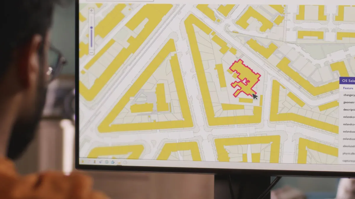
The GIS stores information about:
- Geometry: the shape and location of the objects.
- Attributes: the descriptive information known about the objects, normally displayed on a map through symbology and annotation.
Find the best GIS software providers for your needs
The GIS stores information about:

The GIS stores information about:
GIS software has evolved from a combination of two well-established types of electronic mapping software packages:
A professional GIS user must be able to understand the disciplines of both these types of software, as well as appreciating geographic principles.
Before choosing your GIS software, here are some points you should consider:

Ordnance Survey is partnered with several GIS software and service providers. They and other GIS mapping companies in the market provide GIS applications and mapping tools, to help with different mapping software needs.
The following solutions help you minimise your costs.

QGIS is an open-source GIS that helps you visualise, manage, edit, analyse data, and compose printable maps.
If you and your organisation have a good understanding of GIS and its potential, look at the following providers.

Europa works with public sector clients to simplify access to data covered by mapping agreements.

Basemap offers a wide range of products and consultancy services. Their aim is to provide the best solutions for different organisations in both the public and private sectors.

thinkWhere offer a broad range of GIS services covering the entire GIS lifecycle, from hosted services and consultancy, through to training and support.

allmapdata from CACI provides map-based analysis software and services including GIS, digital mapping, sales and marketing applications, and logistics planning solutions such as territory optimisation or routing and scheduling.
The following providers supply software for large scale projects and deployment patterns.
MapInfo® Pro, from Precisely, is a powerful mapping and geographic analysis application. It helps you visualise the relationships between data and geography.
ArcGIS is a comprehensive system for designing and managing GIS solutions from ESRI. It gives you deeper insights, so you can make better business decisions.
NEC Software Solutions is a UK-based developer and supplier of GIS and web mapping software. Their cost-effective solutions help public sectors organisations get the most from geographic information.
Use GIS to manage work with third parties.

If you need to licence and manage multiple contractors, Idox Geospatial’s ContractorLink service can help. Idox Geosptial, an OS Partner, manages and distributes mapping data.
Our network of Ordnance Survey's Licensed Partners can help you to find the right solution for your geospatial needs and help you to get the most value from OS data.
Access accurate geospatial data through data products by Ordnance Survey, a major GIS data provider for Great Britain.
Explore the potential of GIS with real-world examples, from GIS in healthcare and emergency services, to local government and utilities.
Discover the differences between raster and vector data and its uses.