Adding value with OS AddressBase Islands
Our Geospatial Consultants give us a run down of a technical challenge they've seen recently
Ordnance Survey
The product comes in two varieties; Plus and Premium which follow the same broad definitions as the main AddressBase products. Your customers may ask, how do I begin adding value from the more complex Premium dataset into my GIS system?
In response, follow this 4-step process to convert the downloaded data into a format of choice that combines all the available attribution, with geometry that can be spatially viewed:
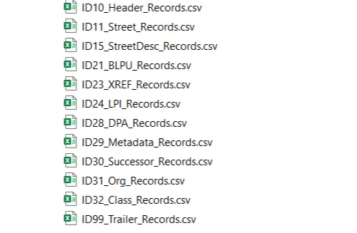
- The first step is to extract all the necessary additional look up tables from the raw downloaded data (in this example, we have used the .CSV file format). Following the preparation instructions in the Getting Started guide we have used the provided Python script to process all the files and output new files as shown here.
-
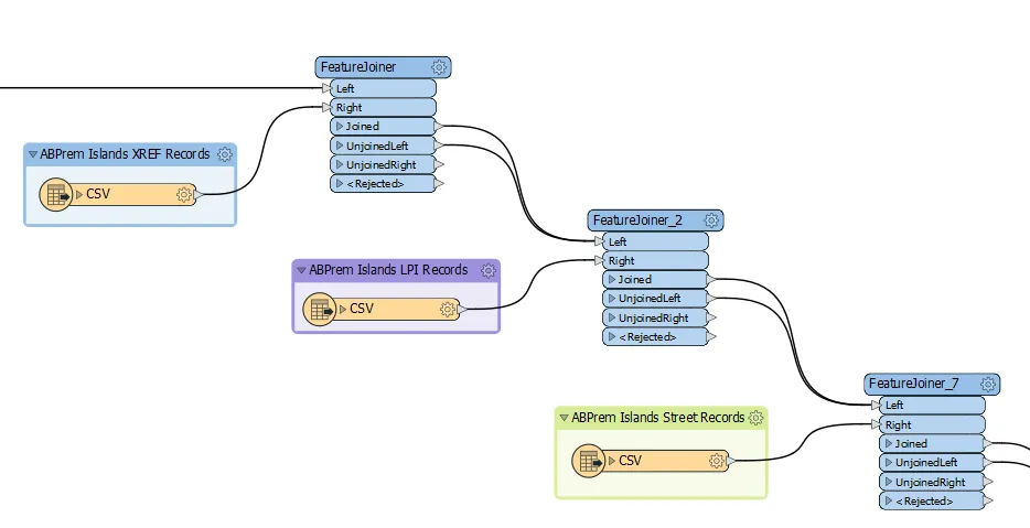
Now that all the necessary files are available, we can join them together using the ‘UPRN’ of each record as the common key column. There are multiple platforms you may want to use to create these joins but, in this example, we will be using a common ETL (extract, transform, load) platform called FME.
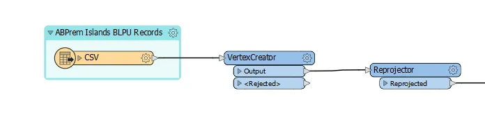
As the ‘BLPU’ table holds the relevant geometry to go with each location record, we shall use this dataset as the main table to build from. Initially we have used a ‘Vertex Creator’ transformer (to transform the co-ordinates into usable geometry) and then a ‘Reprojector’ transformer (to convert the geometry projection from WGS-84 to British National Grid).
3. Afterwards, we are now able to join each of the remaining tables of data using the ‘UPRN’ field as stated in step 2. Using the ‘Feature Joiner’ transformer, we can specify the key field (UPRN) in both sets of data and this results in the attributes for each being combined. The process is repeated for every additional table available.
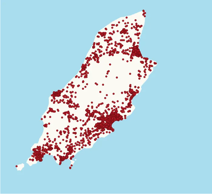
4. With these joins complete, we now have a complete dataset with all available attribution appended. This allows us to output the result into a GIS software format for visualisation alongside the core AddressBase Premium GB product to have a complete gazetteer of addresses.

Our highly accurate geospatial data and printed maps help individuals, governments and companies to understand the world, both in Britain and overseas.
Products and solutions featured in this news article
AddressBase Premium Islands
An addressing gazetteer offering full lifecycle information of a property for Northern Ireland, Isle of Man and the Channel Islands.
Find more news
- Announcements
- OS
- Products and services
- PSGA members
- Partners
- Government and public sector
- Land and property
- Great Britain
- United Kingdom