News
The latest news and press releases from Ordnance Survey
Filters (1)
Page 1
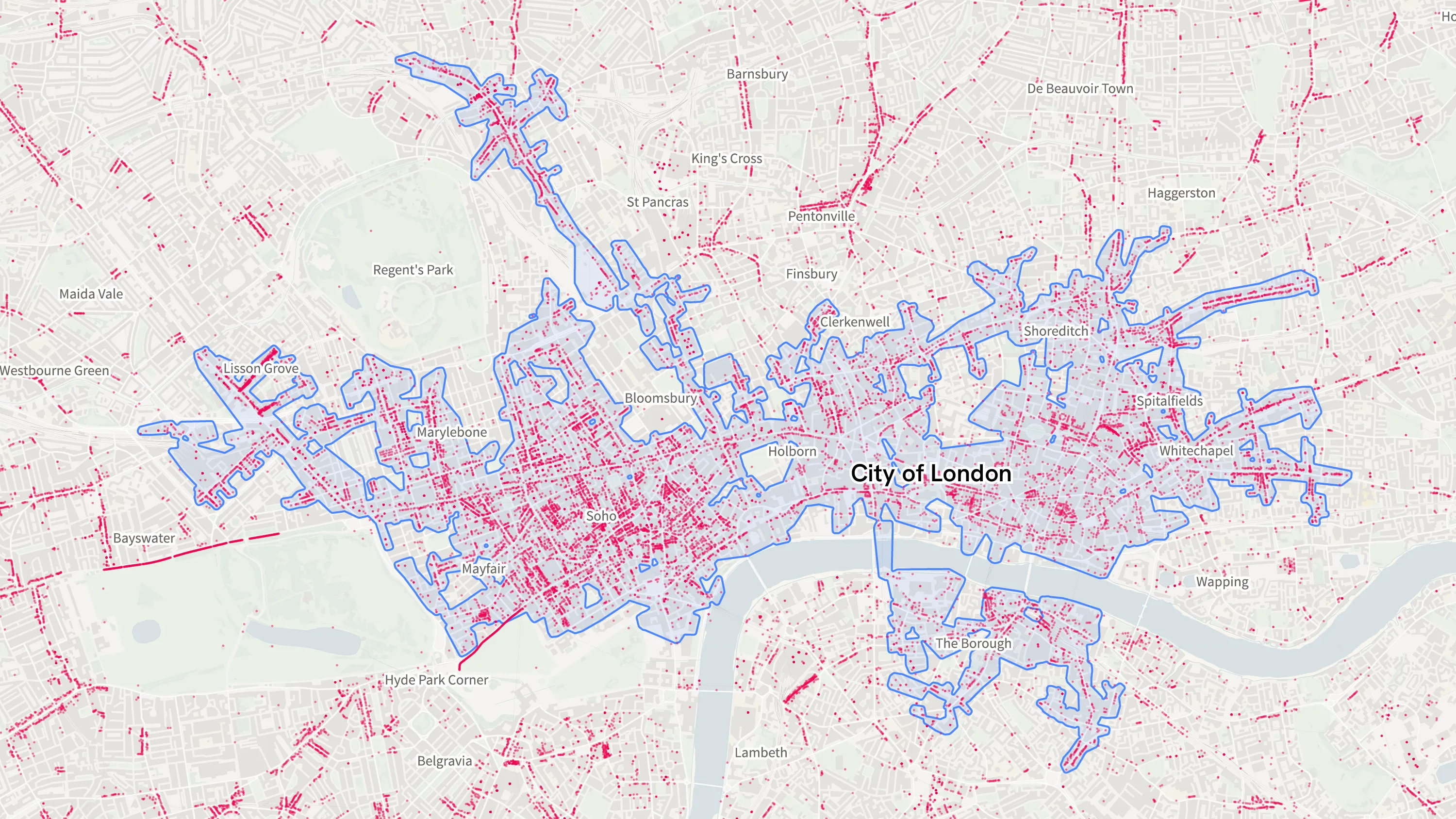
Ordnance Survey’s new national retail area data confirms London is the country’s biggest shopping destination
The new data will enable users to build a wealth of insights into the economic areas of Great Britain.
- News
Openreach joining the National Underground Asset Register ‘a giant step forward’
NUAR has over three million kilometres of buried infrastructure mapped on the platform, now that Openreach has joined.
- News
New national street lights data shines a light on Britain’s brightest and darkest roads to support safe travel
The new data will support safe walking and cycling routes to important services such as hospitals, train stations and schools.
- News
Ordnance Survey launches national survey of geography teachers
Ordnance Survey (OS) has launched a national survey of thousands of geography teachers to better understand how mapping is taught in the classroom.
- News
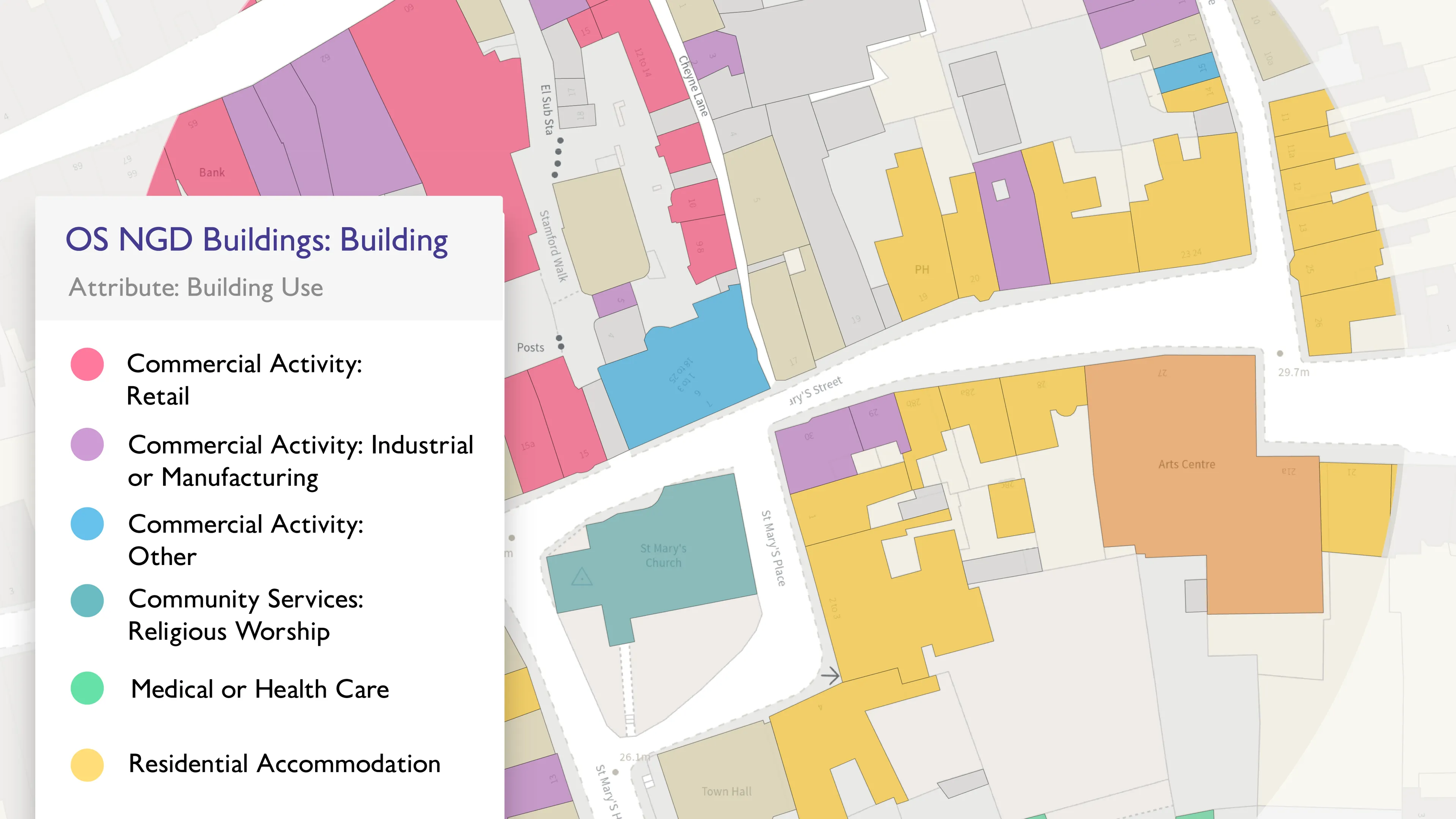
Ordnance Survey launches significant buildings and transport enhancements
Ordnance Survey has launched new data enhancements in the OS NGD. These cover transport - railway and path network - and buildings.
- News
New head of Geovation
Gareth Sumner is the new head of Geovation – a community of innovators and collaborators who use location data to create solutions that address global challenges.
- News
Ambulances set to benefit from new in-cab mapping technology
A new life-saving in-cab navigation application, underpinned by Ordnance Survey mapping, is being rolled out across all Ambulance Trusts in Great Britain.
- News
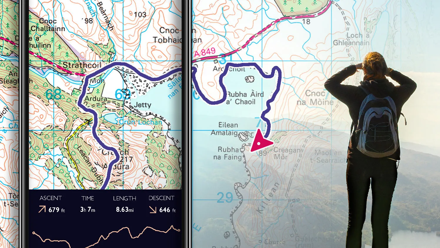
Get ready, get set, get outside...
Following user feedback, OS Maps has been updated to expand the service of one of its most popular features – Snap-to-path.
- News
British Cycling and Ordnance Survey team up to share cycling routes in the West Midlands
British Cycling and Ordnance Survey team up to share cycling routes in the West Midlands.
- News