Speed Data added to the OS National Geographic Database
Further supporting the public sector in enhanced route analytics and planning
Press Office
The new speed datasets will make it easier to analyse travel times, enhancing routing analytics and providing accurate insight for safety and infrastructure policy decisions.
The data produced and maintained by Basemap will be available to all Public Sector Geospatial Agreement (PSGA) members, ranging from local authorities to the emergency services.
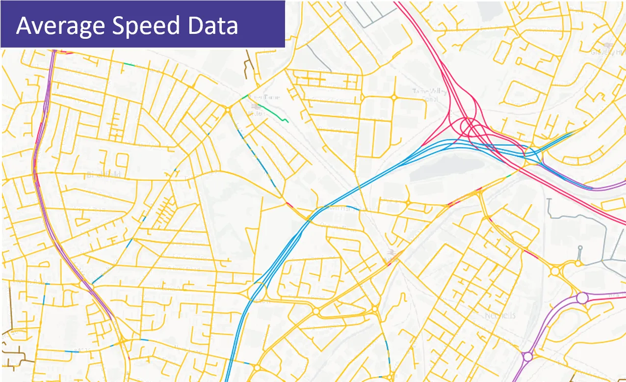
Basemap, an OS Partner, are a specialist provider of transport data solutions. Basemap’s average speed data is collected from in-vehicle telematic systems throughout the day and linked to OS MasterMap Highways Network - Road data. The Indicative Speed data shows the maximum speed, as displayed on the speed limit street sign, for every road in Great Britain.
The addition of the speed data for PSGA members will deliver a range of benefits including:
- Ease of use – the speed data will be supplied as a new feature type which can be accessed via the recently launched OS Select+Build or OS NGD API - Features. This removes issues around data management and utilises unique identifiers enabling greater and more precise linking to road networks. The API delivers an easy-to-use interface for users to work with the road data and combine their own information to deliver valuable insight.
- Improved detail to aid planning and decision making – through the OS NGD users will now have access to data for eight time periods within a single day from Monday to Friday. This compares to the previous release of five time periods. At weekends this will also increase to five time periods from the standard one time period.
- Greater currency - through the OS NGD Average Speeds datasets will be released twice a year compared to the current annual update.
- Efficiencies – the addition of speed data into the PSGA will deliver valuable savings to members who have previously licenced the data under commercial terms.
"We are delighted to be adding speed data to the OS NGD for all PSGA members to access and support their decision making and operations. The national road network is a critical piece of infrastructure impacting all areas of the public sector, from routing public transport to planning new community services and infrastructure. The addition of speed data will enable greater location intelligence capabilities to users of OS MasterMap Highways Network. We are already seeing a number of use cases where the combination of speed data and OS mapping is delivering big improvements and efficiencies."
The addition of speed data is expected to support a range of operations and underpin decision making across the public sector. This includes calculations of journey times for different times of day supporting public transport planning and safe routing, efficient deployment of field staff, response time analysis for emergency vehicles, risk assessments for work being undertaken on the road network and future infrastructure planning.
Examples of how organisations are benefiting include Leicestershire Tri-Service Fire and Rescue who are saving 270 hours of work each month and saw an annual staff saving of over £85,000 since adopting Average Speed data. By using Average Speed data alongside OS MasterMap Highways Network the Fire and Rescue service has improved its capability in predicting potential attendance times, allowing the central mobilisation system to instruct the nearest and quickest resource to attend the incident.
NHS England used OS road data and speed data to accurately calculate journey times from population centres to proposed Covid-19 vaccination sites. It was vital that vaccination sites could be accessed safely and quickly by the public and by using the data it delivered detailed analysis on travel times to the proposed sites.
"We believe that providing free access to speed data will be a game-changer for planning and decision-making. The use of speed data across the public sector isn't new with various organisations already benefiting from its analytical powers. This new addition to the OS NGD should drive innovation and open up access to organisations such as parish councils where cost was previously prohibitive. I am excited to see how this data is utilised over the next 7 years, I am hopeful it will help improve road safety, traffic flow and help reduce emissions allowing our roads to run more smoothly."
Sharing the latest news about OS. We can license you to use OS maps in print, online and film format. For more information and resources for journalists, bloggers and media professionals, email pressoffice@os.uk or call 023 8005 5565.
Ordnance Survey National Geographic Database
Find more news
- Announcements
- Connectivity
- OS
- Products and services
- PSGA members
- Government and public sector
- Transport
- Great Britain
- United Kingdom