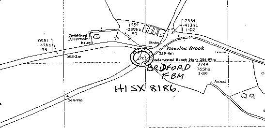
Overview
- Type of mark
- FBM
- Flush bracket
- Not Available
- Grid reference
- SX811865
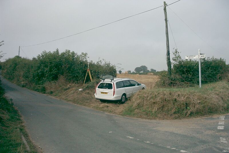
- Access to mark
- 2WD Vehicle
- Keys required
- No
- On Landranger sheet
- 191
Click to buy - On Explorer sheet
- 110
Click to buy - Permission required
- Yes
Coordinates of this station
ETRS89 Cartesian
- X
- 4042663.1784
- Y
- -260187.7780
- Z
- 4910321.7172
ETRS89 Geodetic
- Latitude
- N 50 ° 39' 57.861386"
- Longitude
- W 3 ° 40' 57.019188"
- Ellipsoid height
- 308.928
National Grid (Transformed by OSTN15/OSGM15)
- Eastings
- 281191.192
- Northings
- 86507.875
- Height
- 257.000
NB: If 'permission required' is Yes at top of this form, the land owner or agent's permission must be obtained before accessing the mark.