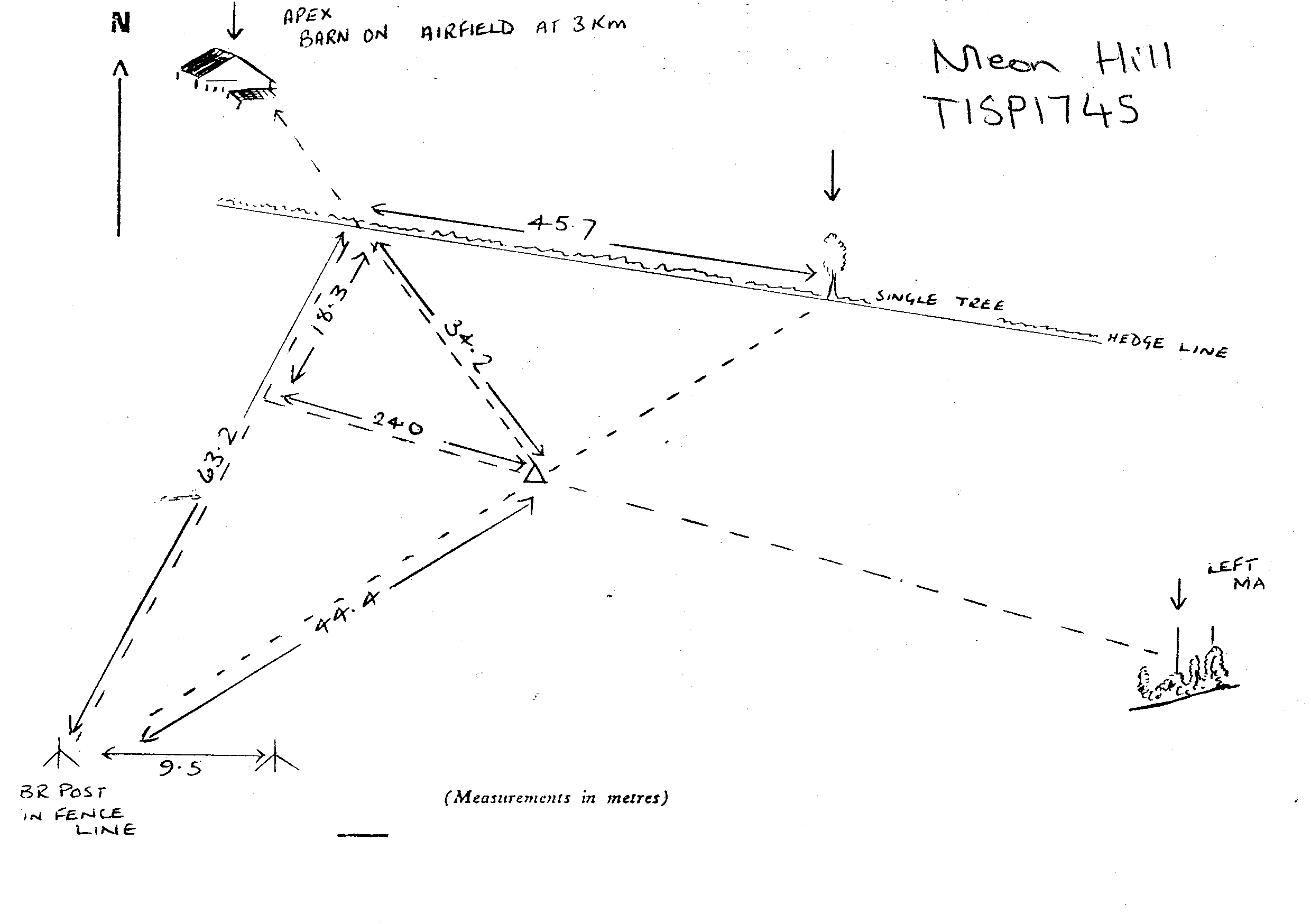
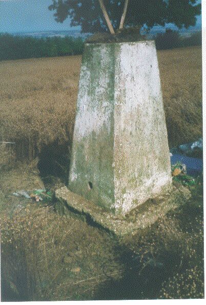
Overview
- Type of mark
- Pillar
- Flush bracket
- S4374
- Grid reference
- SP175453
- Access to mark
- foot
- Keys required
- No
- On Landranger sheet
- 151
Click to buy - On Explorer sheet
- 205
Click to buy - Permission required
- Yes
Coordinates of this station
ETRS89 Cartesian
- X
- 3923990.4214
- Y
- -119525.2683
- Z
- 5010246.3854
ETRS89 Geodetic
- Latitude
- N 52 ° 6' 21.531203"
- Longitude
- W 1 ° 44' 40.911298"
- Ellipsoid height
- 242.745
National Grid (Transformed by OSTN15/OSGM15)
- Eastings
- 417581.863
- Northings
- 245323.661
- Height
- 194.008
NB: If 'permission required' is Yes at top of this form, the land owner or agent's permission must be obtained before accessing the mark.