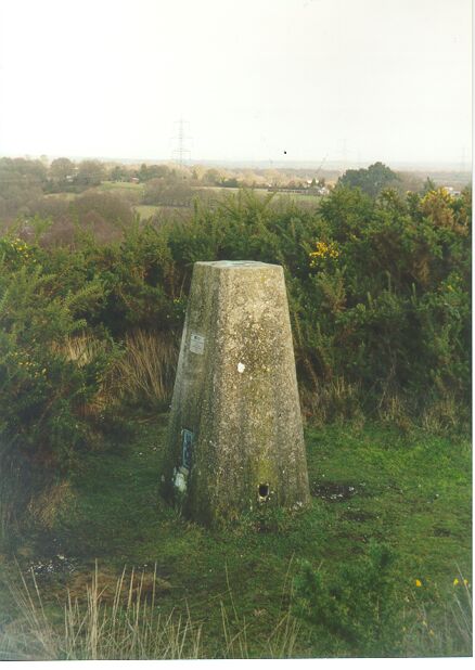
Overview
- Type of mark
- Pillar
- Flush bracket
- S2589
- Grid reference
- SU055050
- Access to mark
- foot
- Keys required
- No
- On Landranger sheet
- 195
Click to buy - On Explorer sheet
- 22
Click to buy - Permission required
- No
Coordinates of this station
ETRS89 Cartesian
- X
- 4033203.9711
- Y
- -135388.1832
- Z
- 4922761.6473
ETRS89 Geodetic
- Latitude
- N 50 ° 50' 42.284867"
- Longitude
- W 1 ° 55' 21.379474"
- Ellipsoid height
- 104.601
National Grid (Transformed by OSTN15/OSGM15)
- Eastings
- 405544.688
- Northings
- 105065.656
- Height
- 57.260
NB: If 'permission required' is Yes at top of this form, the land owner or agent's permission must be obtained before accessing the mark.