Overview
- Type of mark
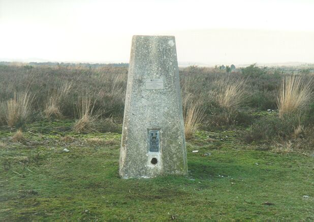
- Pillar
- Flush bracket
- S2704
- Grid reference
- SU185135
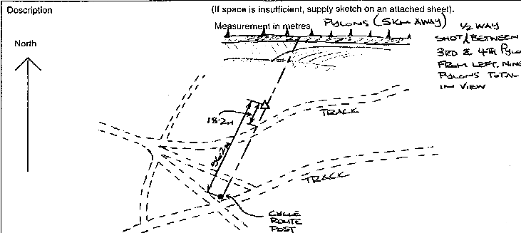
- Access to mark
- foot
- Keys required
- No
- On Landranger sheet
- 195
Click to buy - On Explorer sheet
- 22
Click to buy - Permission required
- No
Coordinates of this station
ETRS89 Cartesian
- X
- 4027082.3114
- Y
- -122198.9348
- Z
- 4928134.0927
ETRS89 Geodetic
- Latitude
- N 50 ° 55' 16.163625"
- Longitude
- W 1 ° 44' 17.038168"
- Ellipsoid height
- 146.875
National Grid (Transformed by OSTN15/OSGM15)
- Eastings
- 418507.371
- Northings
- 113555.498
- Height
- 99.938
NB: If 'permission required' is Yes at top of this form, the land owner or agent's permission must be obtained before accessing the mark.