How to assess education facilities using OS MasterMap Sites Layer
Ordnance Survey
OS AddressBase product suite contains around 29 million Royal Mail postal addresses which are matched with Unique Property Reference Numbers (UPRNs) to provide addresses with a geographic element. This enables AddressBase data to be viewed in a Geographic Information System and allows users to link additional information about an address to a single delivery point. AddressBase Plus, Core and Premium offer additional attributes that, when cross-referenced with OS MasterMap Topography, can be used to link address labels to objects. As a result, the data can be viewed within a wider geographic context.
OS MasterMap Sites layer is a national dataset of important locations such as schools and airports. It represents how the public views one of these locations, with the site being the main feature, not its address. The layer’s purpose is to improve the analytical capabilities of OS MasterMap Topography Layer. It can also show where the main points of access to a site are, enabling more detailed planning for emergency situations, for example.
The UPRN contained within AddressBase can be utilised by acting as a reference key for users to join related address records from different datasets. In this case it can be connected to Topographic Identifiers (TOIDs) within the sites layer to pull out individual types of sites.
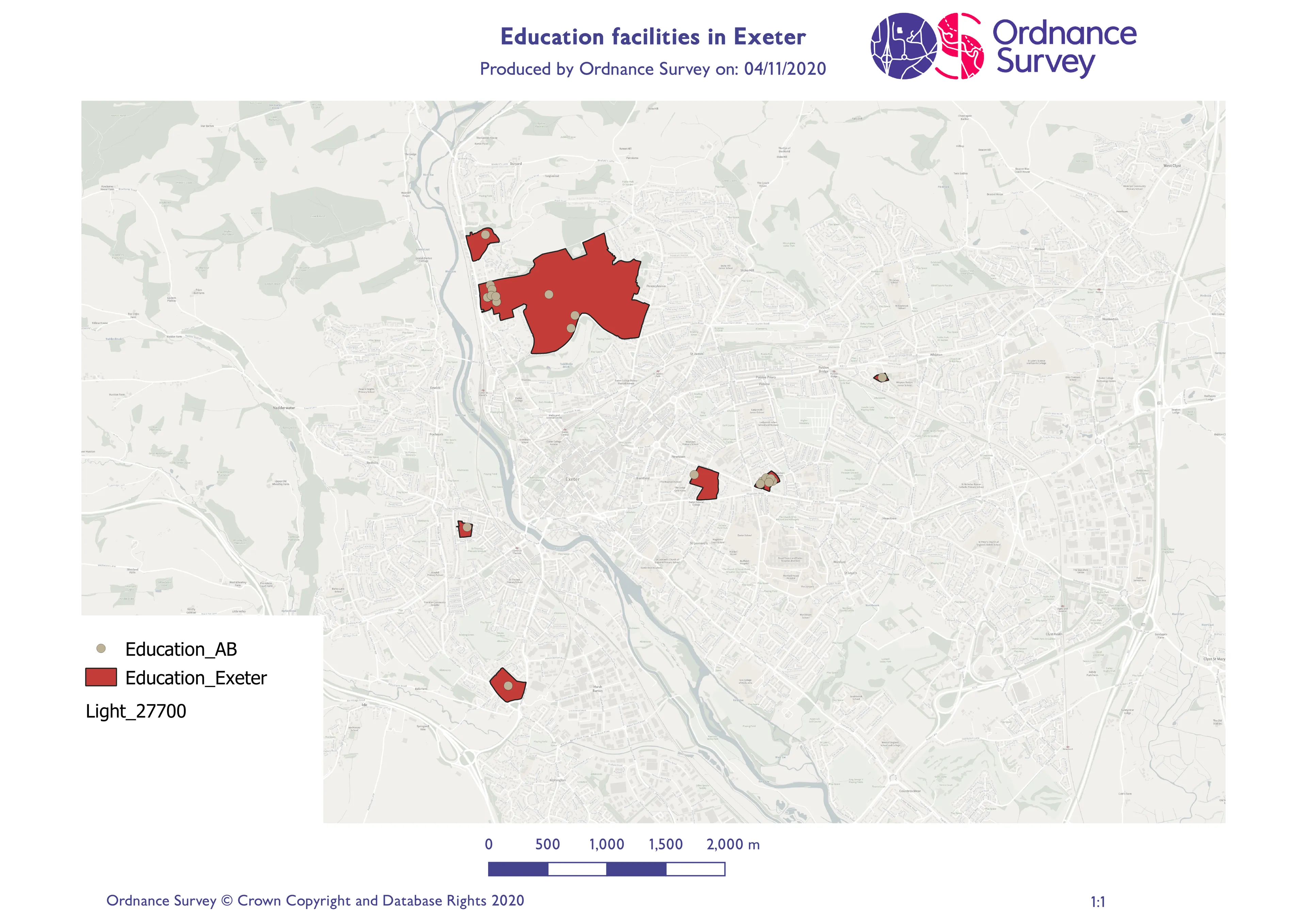
As with previous articles, to put this into context we will investigate an example of a user who would like to assess the distribution of education facilities in Exeter City.
For the initial preparing of the data, users can be directed to OS’s Getting Started Guide for AddressBase, Address Plus and AddressBase Plus Islands or for AddressBase Premium.
Questions the user may need support with include:
- How can I join OS MasterMap Sites Layer to AddressBase?
- How do I know which method to use?
- How do I isolate education facilities from all sites in the layer?
- What value do I get out of linking AddressBase and the sites layer?
How can I join OS MasterMap Sites Layer to AddressBase?
As explained earlier, the UPRN in AddressBase can be linked to the TOID in the sites layer. There are two methods to achieve this. The first is through using the OS Open Linked Identifiers and the second is to undertake an intersect query. In this example an intersect query was used, which is the spatial method out of the two. An intersect query allows the overlap between two datasets to be extracted as its own layer. As a result, the two layers are joined.
An alternative method is to use OS Open Linked Identifiers. The first step is to join the identifiers to the sites layer. This can be undertaken in a partner software using a table join. The datasets are linked through the common reference TOID. The second step is to link the sites layer to AddressBase. In this example AddressBase Plus was used. The common reference here is the UPRN. This means that the sites layer and AddressBase have now been joined.
How do I know which method to use?
OS Open Linked Identifiers is a substantial dataset, and if the user is limited on resources or does not have access to a database, this method may not work for them. This is due to the user being unable to extract an Area of Interest from the OS Open Linked Identifiers. As a result, an intersect query may be the most efficient method for them.
How do I isolate universities from all education sites in the layer?
On opening the attribute table in a partner software, it is possible to select features by expression, and use SQL code to select universities.
For example: "SiteFunction"= ‘Higher or University Education’;
What value do I get out of linking AddressBase and the sites layer?
A geographical element is added to the AddressBase data, which does not have geometry in its raw form. Linking the sites layer to AddressBase enables the filtering of AddressBase data to specific sites such as education facilities. While in this case Exeter was focussed on, this can be undertaken on a county or country scale, leading to increased efficiencies where the filtering of data is required.

Our highly accurate geospatial data and printed maps help individuals, governments and companies to understand the world, both in Britain and overseas.
Products and solutions featured in this news article
OS MasterMap Sites Layer
OS MasterMap Sites Layer is a nationally maintained view of the detailed extents of locations like airports, schools, hospitals, utility and more.
OS MasterMap Topography Layer
OS MasterMap Topography layer provides a map dataset of Great Britain's landscape – from roads to fields, to buildings and trees, fences, paths and more.
AddressBase Premium Islands
An addressing gazetteer offering full lifecycle information of a property for Northern Ireland, Isle of Man and the Channel Islands.
AddressBase Premium
AddressBase Premium offers full lifecycle information of a property that can be used within geographical information systems & database systems.
OS Open Linked Identifiers
An open dataset of cross-referenced identifiers between various OS data products.
Find more news
- Announcements
- Built environment
- Housing and land use
- Infrastructure
- OS
- Products and services
- Partners
- PSGA members
- Education and recreation
- Government and public sector
- Land and property
- Great Britain
- United Kingdom