Blog
Read location data and geography related stories and commentary
Filters (1)
Page 1
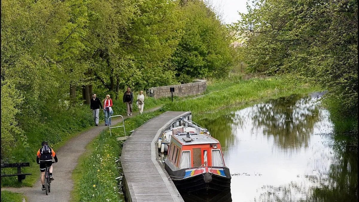
Why canal towpaths are good for people, the environment, and local economy
Scottish Canals have used Ordnance Survey (OS) data to help manage and maintain Scotland’s historic 141-mile canal network, providing numerous benefits for local communities.
- Blog
How the use of geospatial data is transforming climate action
New UN report highlights how the use of geospatial data is transforming global climate action and can help with climate resilience, adaption and mitigation
- Blog
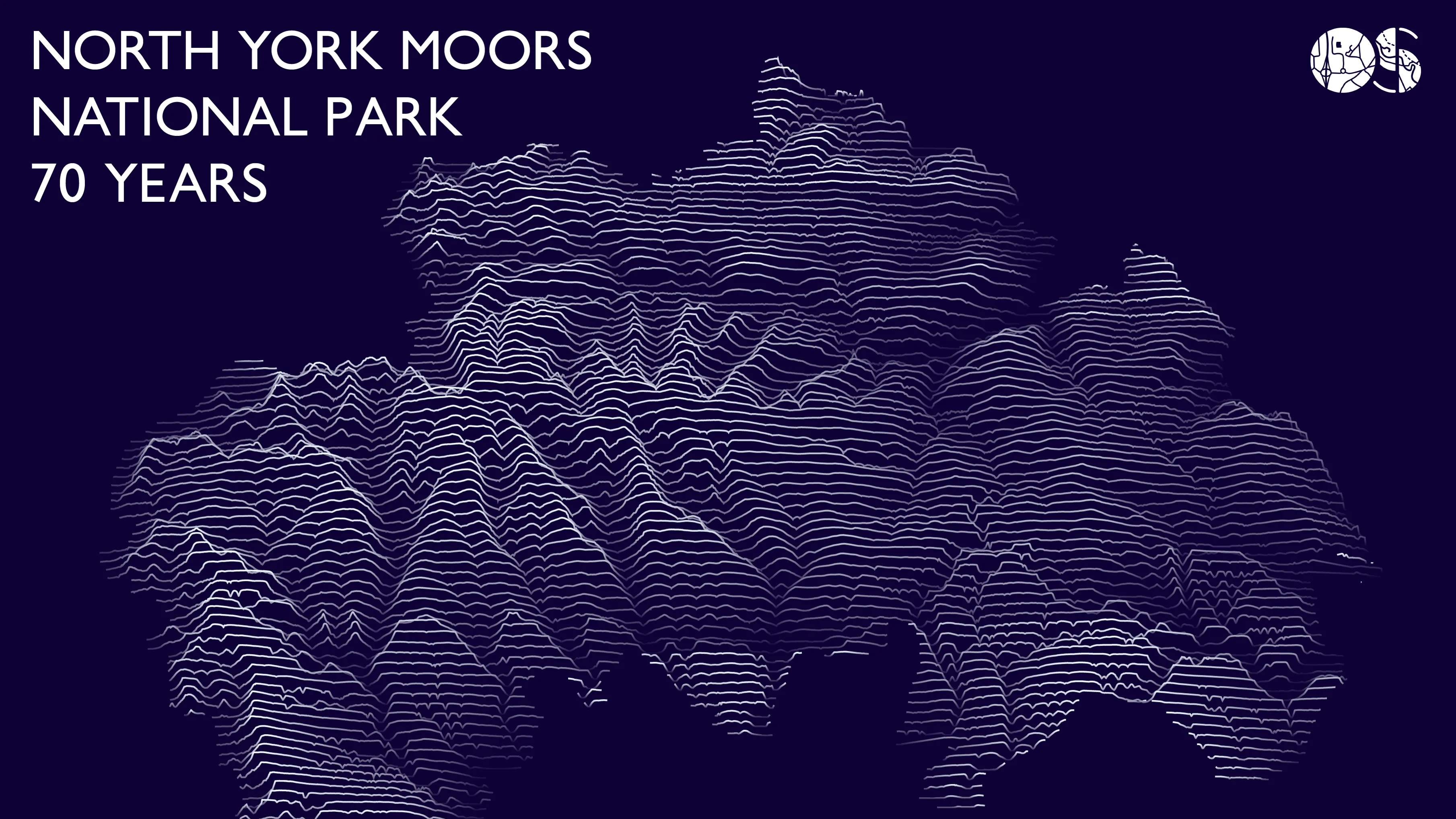
Celebrating 70 Years of the North York Moors National Park
OS tech consultant Hannah Wright explains creating a 'Joy Division' inspired data visualisation of North York Moors National Park.
- Blog
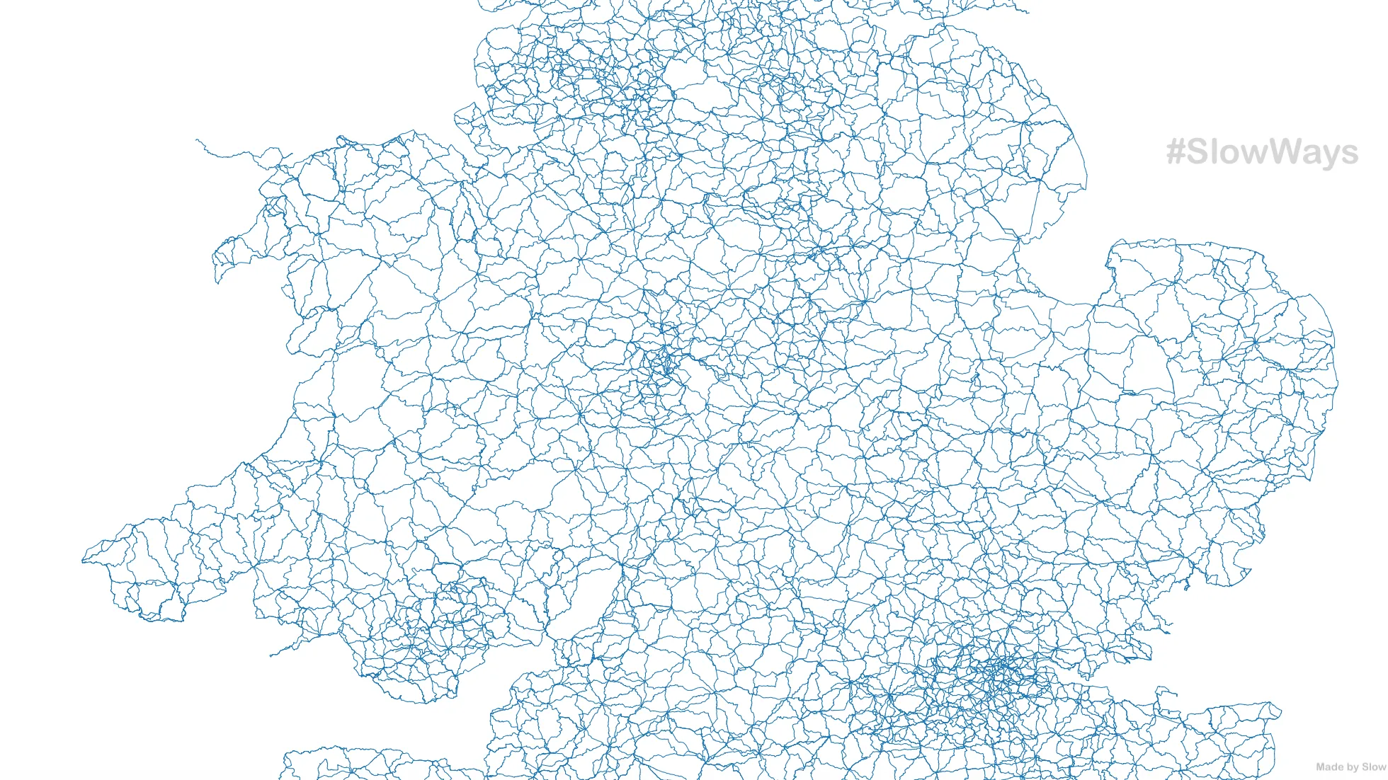
The Slow Ways project continues
Slow Ways is a national network of walking routes that connect Great Britain's towns and cities. OS GetOutside Champion Dan Raven-Ellison explains.
- Blog
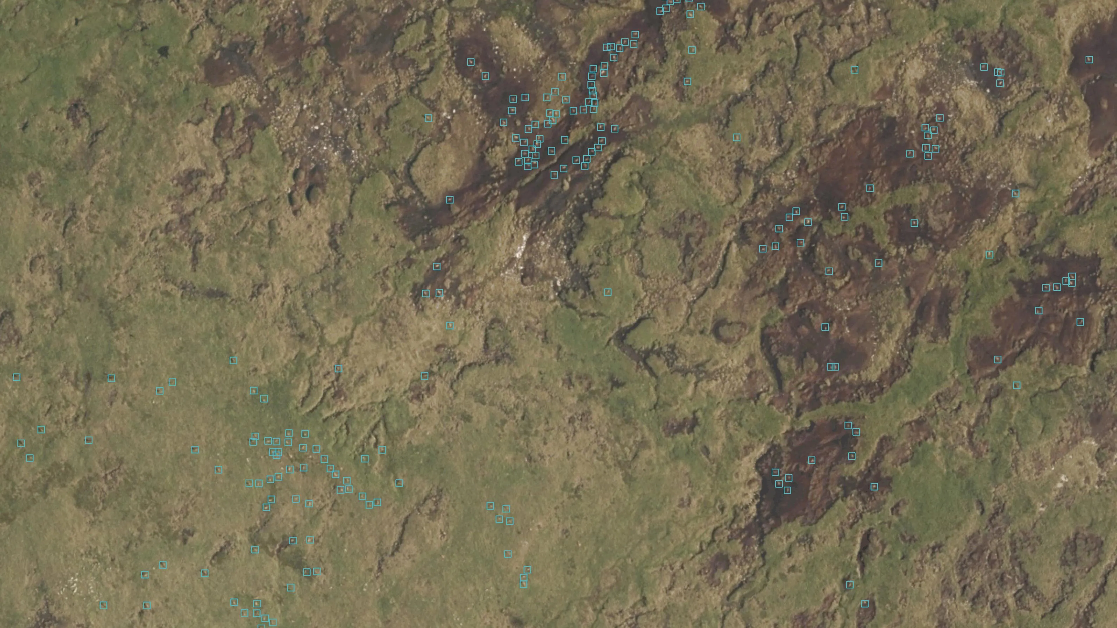
Geovation Scotlands’s EOLAS Insight are the first UK company to detect animals using satellite imagery
Since its launch in 2009, Geovation, Ordnance Survey’s (OS) geospatial innovation hub, has welcomed and supported a plethora of innovative and sustainably focussed start-ups.
- Blog
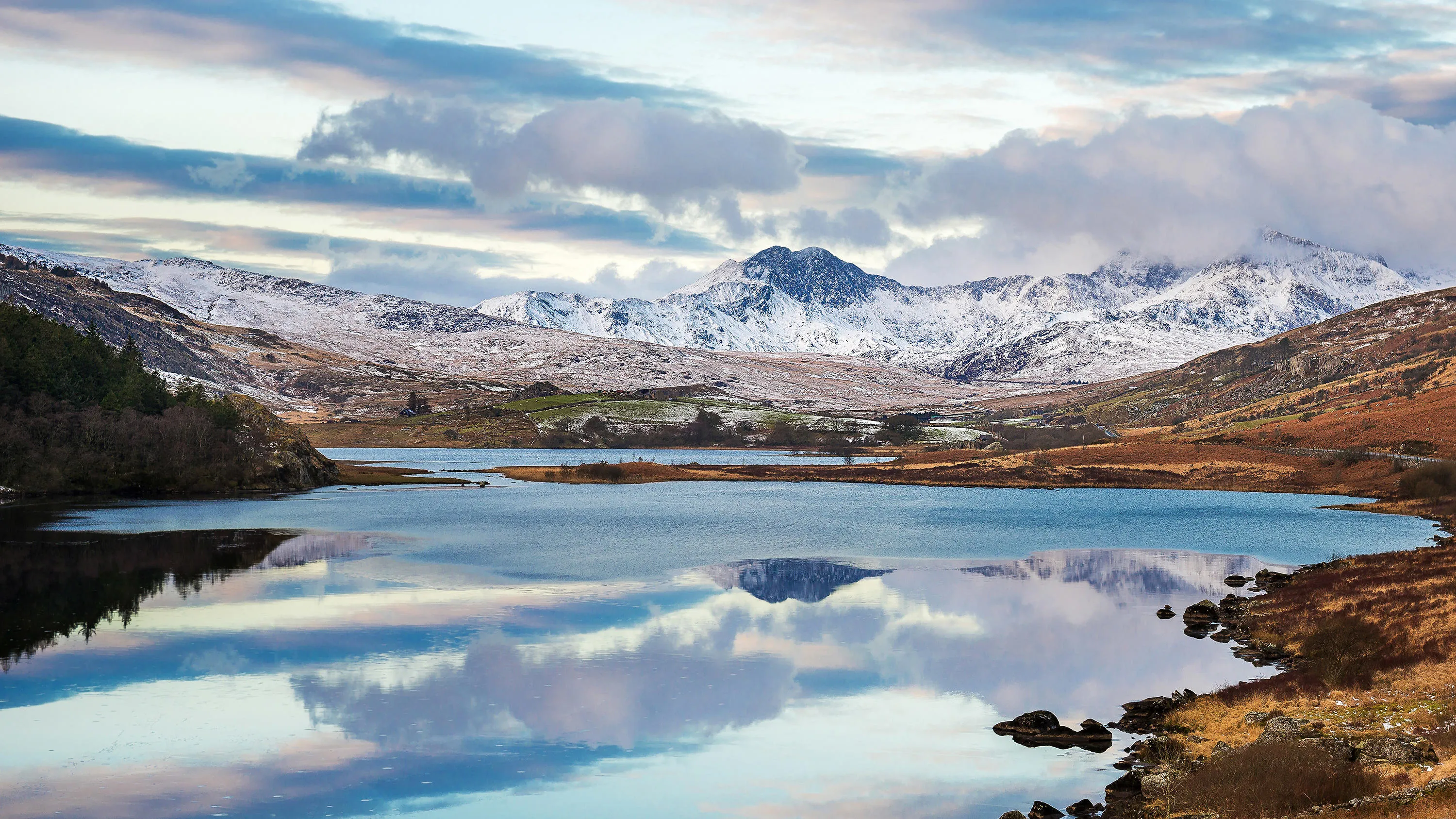
“We need that incredible level of accuracy – we just have to have it.” Safely exploring Snowdonia National Park
Why Snowdonia National Park Authority customise OS Vector Tile API to provide user-friendly online mapping.
- Blog
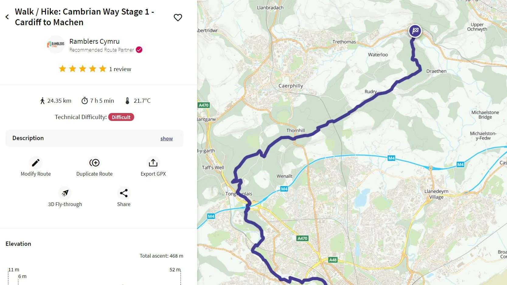
OS maps out Wales’s most challenging walk
A 300-mile walking path which grew a mythical reputation among the hiking community in Wales has been officially mapped by OS.
- Blog
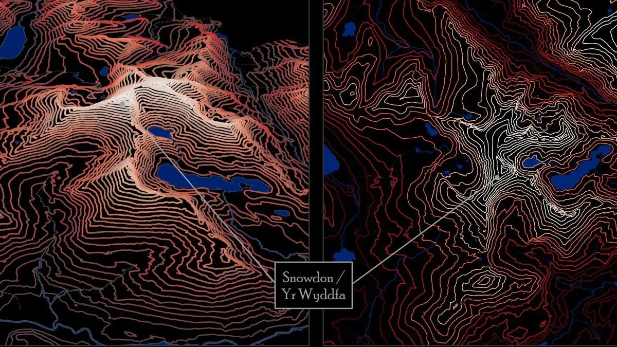
Celebrating 70 years of Snowdonia National Park
Beautiful new data visualisations of Snowdonia have been produced by OS - here's how it was done.
- Blog
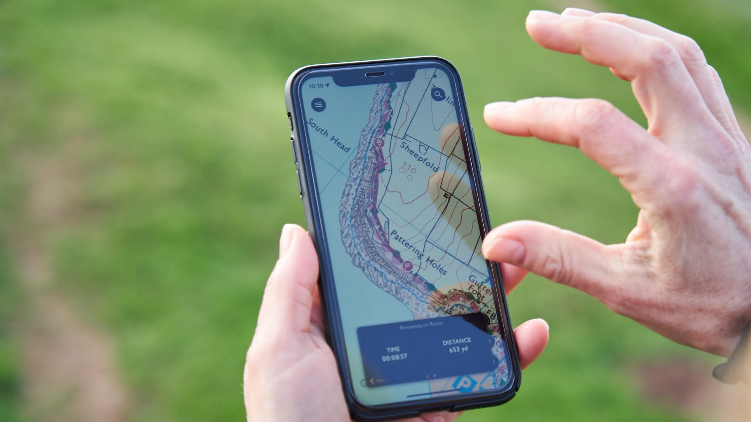
Get outside while staying local with OS Maps
January 2021 saw a significant increase in people plotting local routes with OS Maps for their daily exercise and weekend rambles.
- Blog