Insights
Explore expert geospatial insight and thought leadership
Filters (1)
Page 1
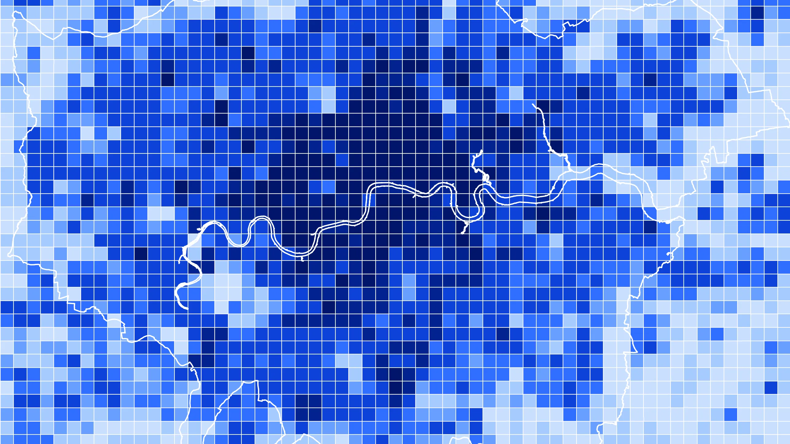
The British National Grid - now in Python and R
Discover how Ordnance Survey’s British National Grid powers modern geospatial analytics, with open‑source Python and R tools for GB‑centric data science.
- Insight
OS Postcodes: a smarter view of Britain’s postcode geography
Following the release of OS Postcodes, our experts discover surprising facts about Britain’s postcodes - biggest, smallest, roundest, wettest - and unlock deeper insight.
- Insight
How OS data can help underwriting for newly built properties
Speed up and strengthen newbuild underwriting with OS location data and UPRNs, enabling confident risk assessment from planning approval through to completion.
- Insight
Unlocking smarter property valuation with location data
Unlock smarter, future‑ready property valuations using precise OS location data to assess climate risk, energy efficiency, desirability, and long‑term lending resilience.
- Insight
Improving CHAPS payment compliance with accurate address data
Improve CHAPS compliance with ISO 20022-ready, structured address data from Ordnance Survey, anchored by UPRNs to strengthen AML, KYC, and fraud checks.
- Insight
How OS location data can help to keep gas networks safe
Discover how location data can help utilities organisations deliver faster responses, reduce costs, identify opportunities, improve customer satisfaction, and much more.
- Insight
How OS can support in meeting clean energy demand
With OS data and OS Partner, electricity companies can access geographic intelligence, enabling more efficient planning and deployment of renewable assets.
- Insight
How Ordnance Survey supports agriculture and land management through innovation and trusted, authoritative data
The use of accurate geospatial data has become essential in modern agriculture, whether for farm management or environmental reporting.
- Insight
Improve customer satisfaction in telecoms with location data
Discover how accurate location data can unlock tailored services that align with regulatory requirements and customer needs.
- Insight