10 new Short Walks Made Easy guidebooks out now
Press Office
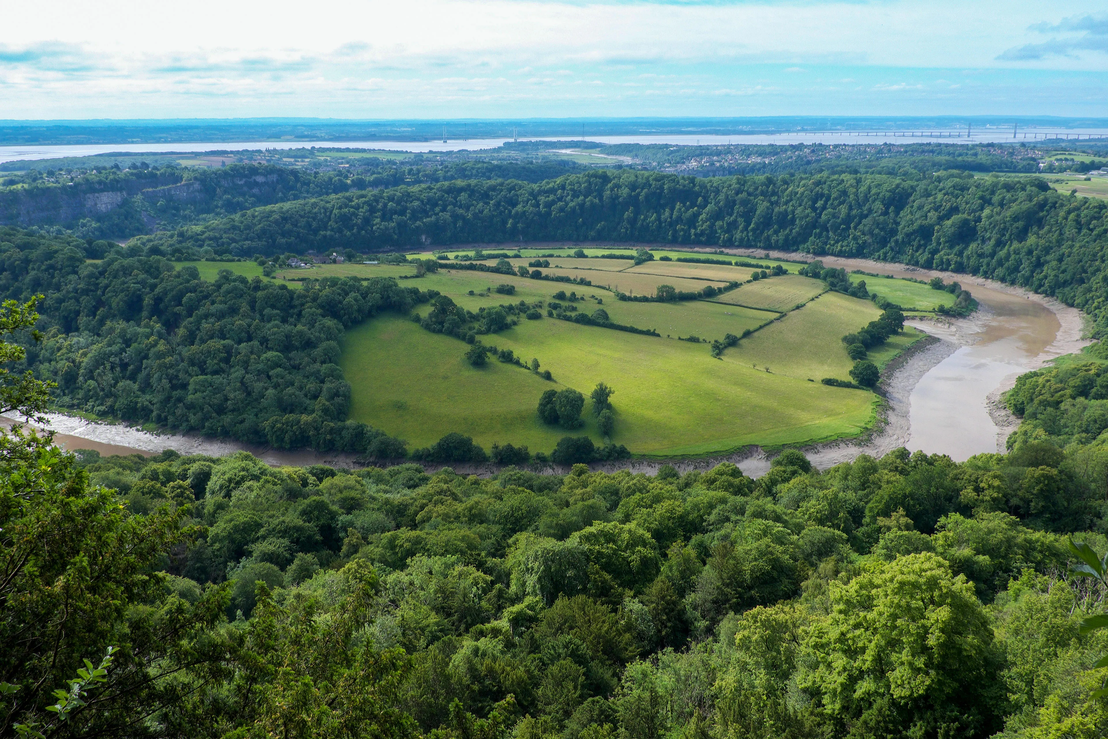
Short Walks Made Easy are guidebooks carefully curated by Ordnance Survey (OS) and feature 10 leisurely walks ranging from one to five miles. The routes inside are a comfortable way to pick and choose a stroll to the finest viewpoints and historical locations Britain has to offer, whether it be the castle ruins of Arundel and Bramber in the South Downs, the unforgettable sight of Symonds Yat Rock across the Wye Valley, or the grassy slopes and chalk cliffs of Tennyson Down on the Isle of Wight.

They have been specifically written for those with little walking experience, people less able, or anyone short on time. They highlight accessible paths and multiple ways to follow the routes. Each walk includes easy-to-use simplified mapping, walk profiles, turn-by-turn instructions, and route photography. The 80 pages of each edition are packed with essential information detailing public transport, parking, amenities, places to eat and drink, nature notes, and the stories behind each walk.
Ten Short Walk Made Easy books include:
- OS Short Walks Made Easy North York Moors
- OS Short Walks Made Easy Anglesey
- OS Short Walks Made Easy Mull & Iona
- OS Short Walks Made Easy Wye Valley & Forest of Dean
- OS Short Walks Made Easy Suffolk & Essex Coast & Heaths
- OS Short Walks Made Easy Quantocks, Mendips and Somerset Levels
- OS Short Walks Made Easy Isle of Wight
- OS Short Walks Made Easy Bakewell & Dovedale
- OS Short Walks Made Easy Greater Manchester
In addition to these new titles, Ordnance Survey is pleased to announce the re-launch of the second editon of its OS Short Walks Made Easy South Downs, which features a refreshed front cover, QR codes, and updated map sheet numbers.
"Short Walks Made Easy books are perfect for anyone with little or no walking experience, and busy families who don’t want to spend the entire day out on a hike. It’s a fantastic way of making the outdoors accessible to everyone. The walks in this book are always between one and five miles, with very little or no steep gradients to overcome. Many are ideal for taking dogs out too. The book takes the hassle out of planning routes yourself. Just follow the instructions and you’re guaranteed a rewarding trip out discovering the beautiful countryside each time you use it. "
The books have been written by a team of experienced outdoor writers and photographers. They are priced at £8.99 and are available from the OS Shop.
OS has now published 33 Short Walks Made Easy books covering routes across England, Scotland and Wales.
Outstanding Circular Walks: Isle of Wight
For walkers who want something more challenging, OS has published a new Outstanding Circular Walks book for the Isle of Wight. It features 28 circular walks around the island which are longer in length, ranging between three and 14 miles. Each of these routes have been meticulously researched and make use of the Isle of Wight’s excellent network of 500 miles of footpaths and bridleways. All walks are accompanied by clear, large-scale Ordnance Survey route maps and GPS references for all waypoints, ensuring easy navigation.
Nick added: “This new guide to the Isle of Wight replaces the old Pathfinder Short walks book. It contains a much more comprehensive selection of walks, from The Needles to Bembridge and from Ryde to St Catherine’s Point.
“There’s something for everyone in this book. That’s why we’ve arranged the walks in the book by completion time. There are 12 shorter and easier routes in the first ‘green’ chapter between three and five miles, progressing through to nine half-day ‘blue’ walks up to seven-and-a-half miles, and finishing with seven longer outings in the ‘orange’ chapter for the true hiking lovers that go up to 14 miles long.”
The Outstanding Circular Walks has been written by expert author Fiona Barltrop and is priced at £12.99.
Sharing the latest news about OS. We can license you to use OS maps in print, online and film format. For more information and resources for journalists, bloggers and media professionals, email pressoffice@os.uk or call 023 8005 5565.
Explore OS Maps
You can share your walking, cycling or running routes in Great Britain by downloading the OS Maps App on your phone, PC or laptop
Find more news
- Leisure
- General public
- Consumer
- Great Britain
- United Kingdom