OS and Ramblers UK join forces
Aim to inspire outdoor exploration and maintain healthy lifestyles
Press Office
Ordnance Survey (OS) has announced a new partnership with Ramblers UK, the country’s leading walking charity, to celebrate the joys of walking in the British countryside and encourage more people to keep fit and healthy.
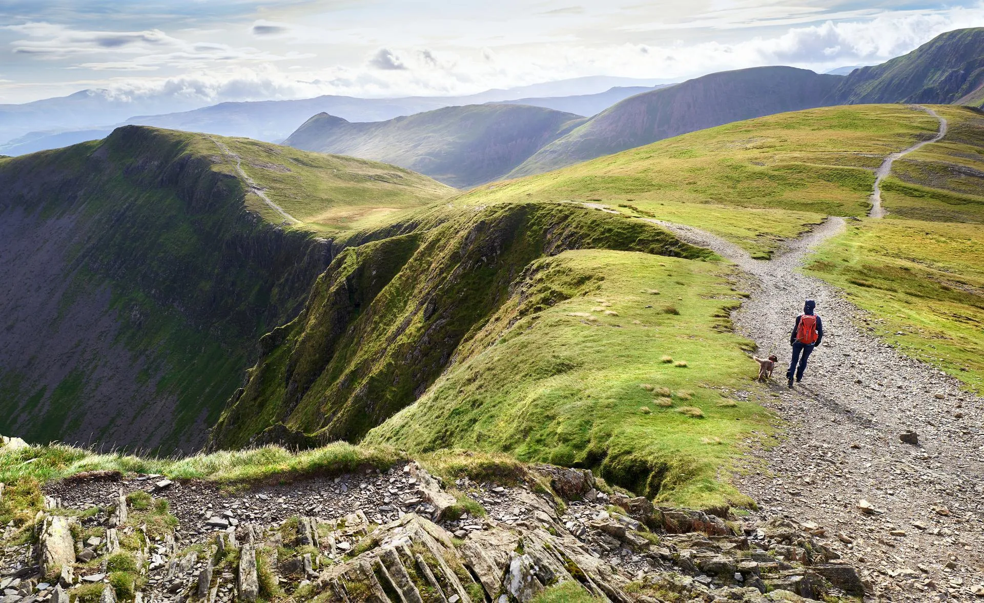
The partnership hopes to capitalise on the latest data revealed by OS, which showed that between April 2022 and March 2023, people were walking over a third of the distance further compared to the previous 12 months. As people increasingly seek solace and adventure in the great outdoors, OS and Ramblers UK want to work together to provide guidance, support and inspiration for those looking to explore rural landscapes, look after their physical and mental well-being, and reconnect with nature.
The data from OS Maps App highlighted a significant change in British walking trends over the past year, with people returning to explore rural, such as National Parks and Areas of Outstanding National Beauty (AONB) in greater numbers compared to urban routes, effectively reversing the trend observed during the coronavirus pandemic.
Nick Giles, MD for OS Leisure, said: “We are thrilled to work closely with the Ramblers UK to encourage more people to experience our wonderful countryside first hand, and inspire a healthier and more active nation.
“Our latest route data tells us people are walking further than before. Not only does this demonstrate the growing popularity of walking, it also highlights the positive impact that it is having on walker’s physical and mental well-being.
“During the Covid-19 pandemic we saw an increase in people using OS Maps to discover new walks and places to visit in their neighbourhoods. It’s great to see more people starting to use their new found love of the outdoors and begin to venture further and explore the many wonders of Great Britain. We are seeing our walking route data show the similar hotspots to the pre pandemic locations with National Parks topping the list.”
He added: “We are committed to working alongside the Ramblers UK to empower more and more walkers to lead healthier, more fulfilling lives.”
Ross Maloney, CEO of Ramblers UK said: “The Ramblers and OS share a passion for helping people enjoy the outdoors, and together we recognise the incredible value of Britain’s paths, tracks and trails. Our new partnership will champion walking and help more people from all backgrounds access the outdoors, enjoy it safely and see the many benefits of making walking part of everyday life.”
Top 10 walks:
OS also published the top 10 most popular walks followed by the public in OS Maps App over the last year. The nation’s 10 favourite walks were calculated by OS through data collected from the app:
1. The Yorkshire Three Peaks, North Yorkshire
Start: Horton-in-Ribblesdale car park
Distance: 38.5km
Time: 12hr 10mins
Difficulty: Moderate/Hard
Map: OS Explorer OL2
2. Bottom Wood Route, Chiltern Hill, Oxfordshire
Start: Dashwood Arms car park
Distance: 8.25km
Time: 2hr 20 mins
Difficulty: Easy
Map: OS Explorer 172
3. Grasmere to the Langdale Pikes, Lake District National Park, Cumbria
Start: Broadgate, Grasmere
Distance: 18.5km
Time: 6hr
Difficulty: Moderate
Map: OS Explorer OL7
4. Cloceanog Forest, Ruthin, Wales
Start: Bod Petyral Picnic Site, Cloceanog Forest
Distance: 11.8km
Time: 3hr 30 mins
Difficulty: Moderate
Map: OS Explorer 264
5. Wanderlust Way, near Grimsby, Lincolnshire
Start: Bradley Woods car park
Distance: 33km
Time: 8hr 47mins
Difficulty: Easy
Map: OS Explorer 284
6. The Great Ridge, Castleton, Derbyshire
Start: Back Street, Castleton
Distance: 10.1km
Time: 3hr 14mins
Difficulty: Moderate
Map: OS Explorer OL1
7. Surrey Three Peaks Challenge, (Box Hill, Holmbury Hill, Leith Hill), Surrey
Start: Old London Road car park, near Mickleham
Distance: 34km
Time: 10hrs
Difficulty: Easy
Map: OS Explorer 146
8. Goodrich Castle, Herefordshire
Start: Goodrich Castle Car Park
Distance: 13.5kms
Time: 3hr 30mins
Difficulty: Easy/Moderate
Map: OS Explorer OL14
9. Carpenters Arms Walk, Tonbridge, Kent
Start: Carpenters Arms, Parkers Green
Distance: 9.2kms
Time: 2hr 20mins
Difficulty: Easy
Map: OS Explorer 147
10. Redbrook, Monmouthshire/Gloucestershire
Start: Tinmans Green, Redbrook
Distance: 11km
Time: 3hr 37mins
Difficulty: Moderate
Map: OS Explorer OL14
Sharing the latest news about OS. We can license you to use OS maps in print, online and film format. For more information and resources for journalists, bloggers and media professionals, email pressoffice@os.uk or call 023 8005 5565.
Explore OS Maps
You can share your walking, cycling or running routes in Great Britain by downloading the OS Maps App on your phone, PC or laptop
Find more news
- Leisure
- General public
- Consumer
- Great Britain
- United Kingdom