Challenge
Torfaen’s Forward Planning Team needed an interactive mapping dataset that captured all land cover types to support Call for Sites consultation, TAN16 Open Spaces Assessment, and online RLDP web map. Their existing data - a green infrastructure study from 2018 - was outdated, lacked detail, and offered only partial coverage.
"To have that accuracy and granularity is a real gamechanger."
Solution
The council has used OS NGD data to get a greater understanding of the areas it covers, to make the maintenance of land it manages more efficient, while providing greater value for money for the public.
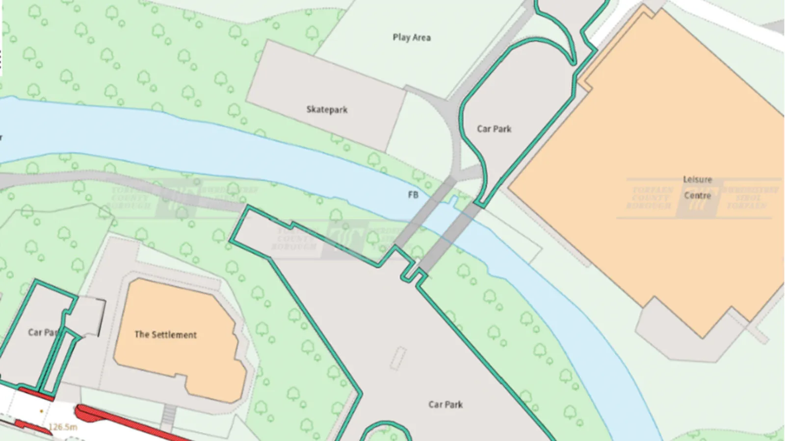
Works have included calculations such as the area of paths, pavements, car parks, and road edges – key information that was previously estimated from paper plans. The council is now also able to understand land cover types, define roads, tracks, paths and pavements, as well as understand the value of each project, facilitating contract tenders.
The team defined a clear typology of requirements and worked with OS to source the right data. Using Select & Build, they downloaded NGD data packages and, with OS support, refined their selection to include four key themes: Roads, Water, Land Cover, and Sites. These were processed into a GeoPackage, queried in GIS to extract Green Infrastructure classifications, and exported as individual shapefiles for publication via OPUS Maps.
Result
The council has also used OS NGD data to gain an up-to-date view of its green infrastructure, with an interactive base map now live on its website – giving residents an easy way to explore greenspaces, and understand how land is used in their area. It also provides housing developers and planners with a trusted, detailed reference layer for designations and constraints, helping them make informed decisions and support sustainable development. By combining accessibility for the public with precision for professionals, the map has become a vital tool for engagement and planning in Torfaen.
Future plans include using OS NGD data to help maintain the area’s greenspaces, such as parks, including trees, flowerbeds, hedgerows and shrubs, as well as for planting in the spring – for the benefit of the both the public and local biodiversity. They also plan to use the data to manage bluespaces, such as lakes and ponds, again benefitting people and wildlife alike.
The council also intend to explore using the data to calculate land-based carbon emissions for annual Welsh Government reporting.
"It’s been a huge leap forward for us – the OS NGD data has improved efficiency at all stages of the process. The improvement in accuracy of the data has made such a difference, and we can now confidently say that the contracts are providing value for money for our residents."