New basemap styles added to OS NGD Tiles API
The OS NGD Tiles API is OS’s modern vector tile service, built to deliver rich, scalable basemaps out of the National Geographic Database (NGD) – OS’s most detailed and up-to-date view of Great Britain. Designed for flexibility and performance, it supports both British National Grid and Web Mercator coordinate systems for mapping, making it ideal to developers for everything from web apps to desktop GIS.
At its core, the API provides access to curated geographic features—buildings, roads, water, landforms, and boundaries—across multiple zoom levels. You can view maps of Great Britain from national level to building level whilst ensuring a seamless experience when you pan, zoom or tilt the map.
But what truly brings these maps to life are the styling of its basemaps.
The importance of basemaps
Basemaps act as the background to a map. They give your data geographic context. Having the right basemap is key to ensuring your data is understandable and usable. By providing a basemap, the user can orientate themselves and see the relationships between datasets and geographical features shown on your map.
The style of basemap needs to be carefully selected to give the right amount of context without overpowering your own data. The right style makes everything easier to read and understand. The basemap style you choose will depend on what you’re trying to communicate to the user. For example, being able to see the road network is key to helping users understand development proposals for new cycle lanes, or being able to see greenspaces would be vital for showing accessibility to parks. Often however, a simple, paired back basemap, in Black and White style, provides just enough geographic context to allow your data to shine.
Using OS NGD API – Tiles as a basemap
Three new basemap styles have been added to the OS NGD API – Tiles. We’ve introduced a new Black & White style, designed to provide a clean, minimal backdrop that works especially well for overlaying your own data. We’ve also recreated our popular ‘house’ styles Road and Light which were already found within the (raster) OS Maps API. These now sit alongside our existing Outdoor style.
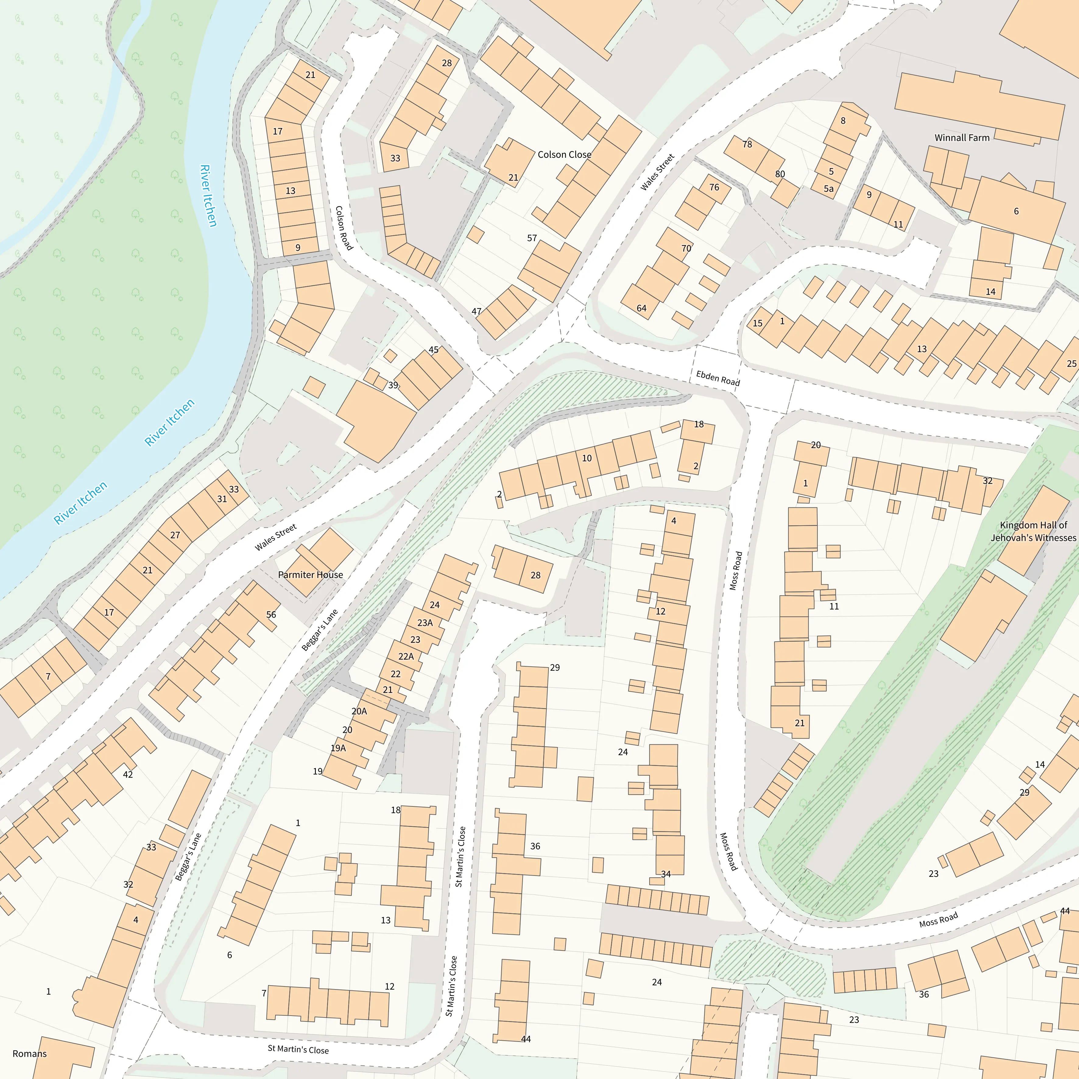
NEW! Black and White:
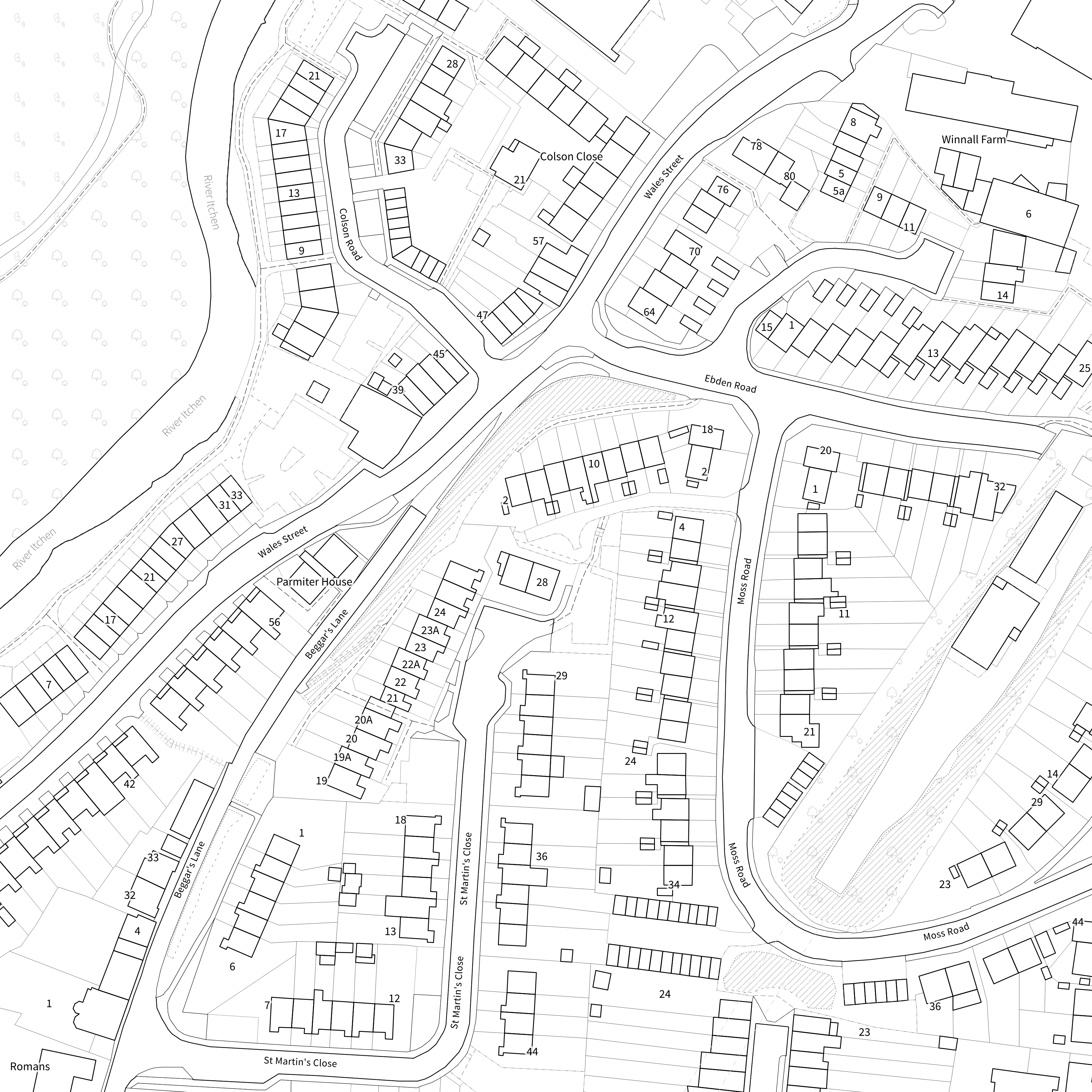
Our new house style has been designed with data overlay and accessibility in mind. With no fill colours at the large scales (NGD building level), this basemap style provides a clean and clear base over which to showcase your own data.
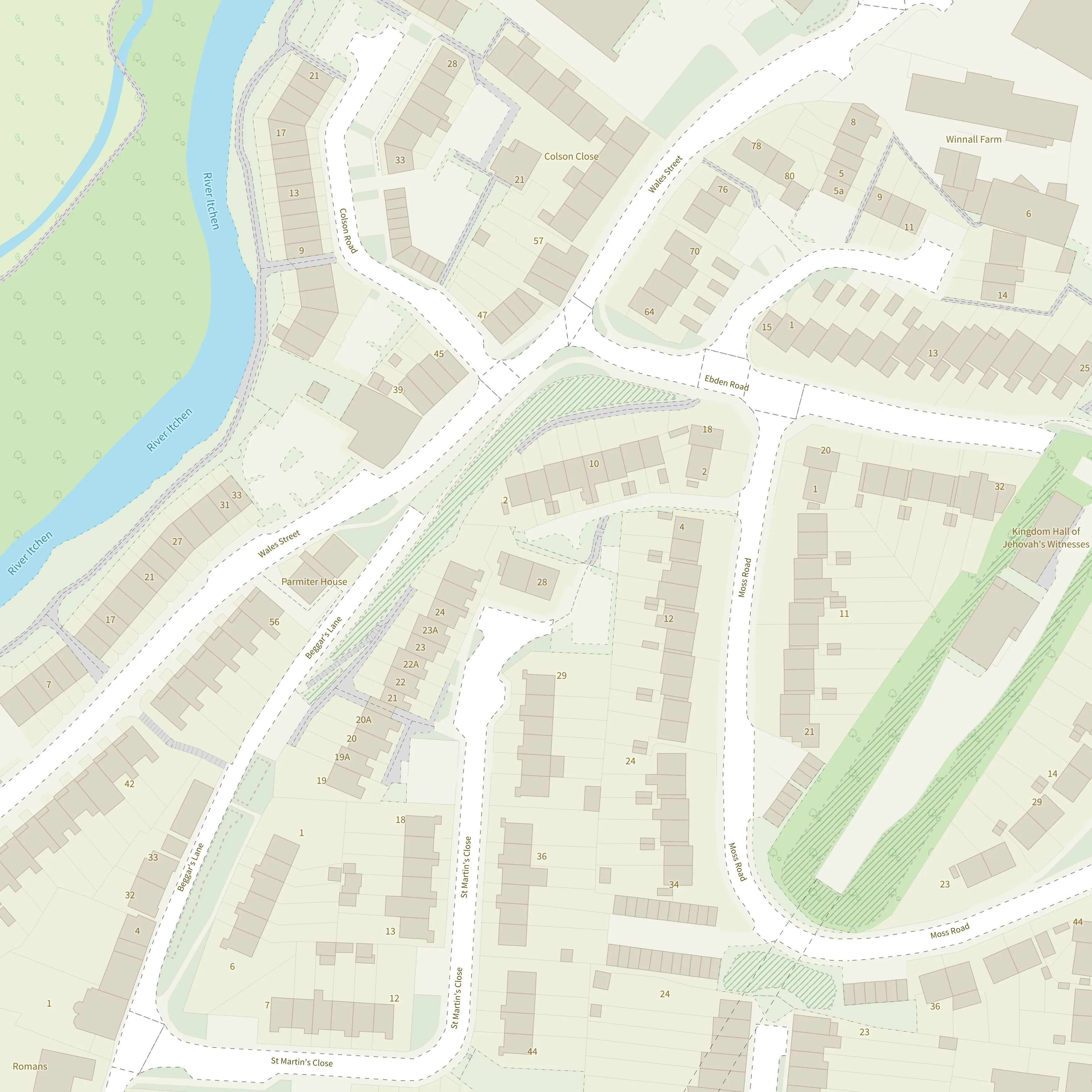
Light:
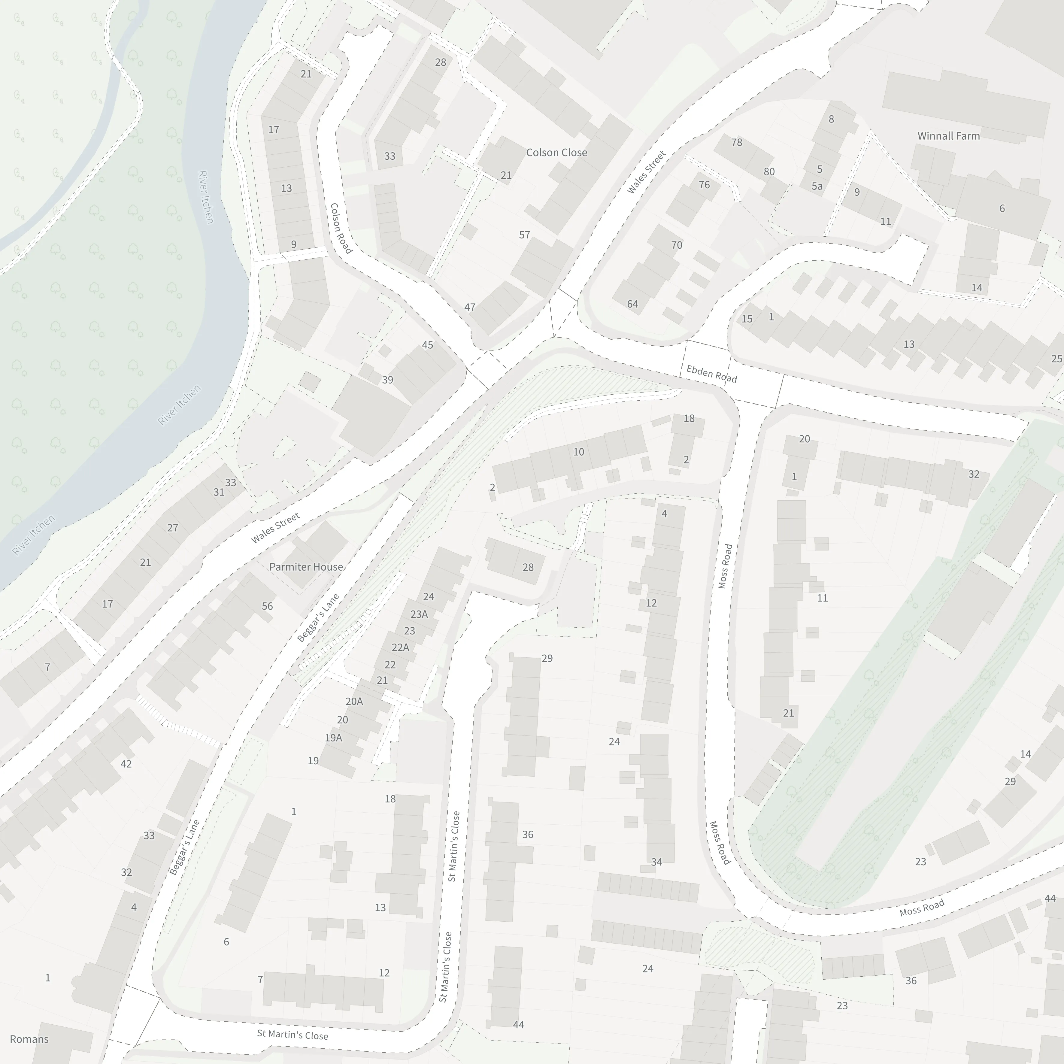
This style has been designed specifically for data visualisation. It has a subtle colour palette, providing just enough geographic context whilst allowing your own data overlays to shine.
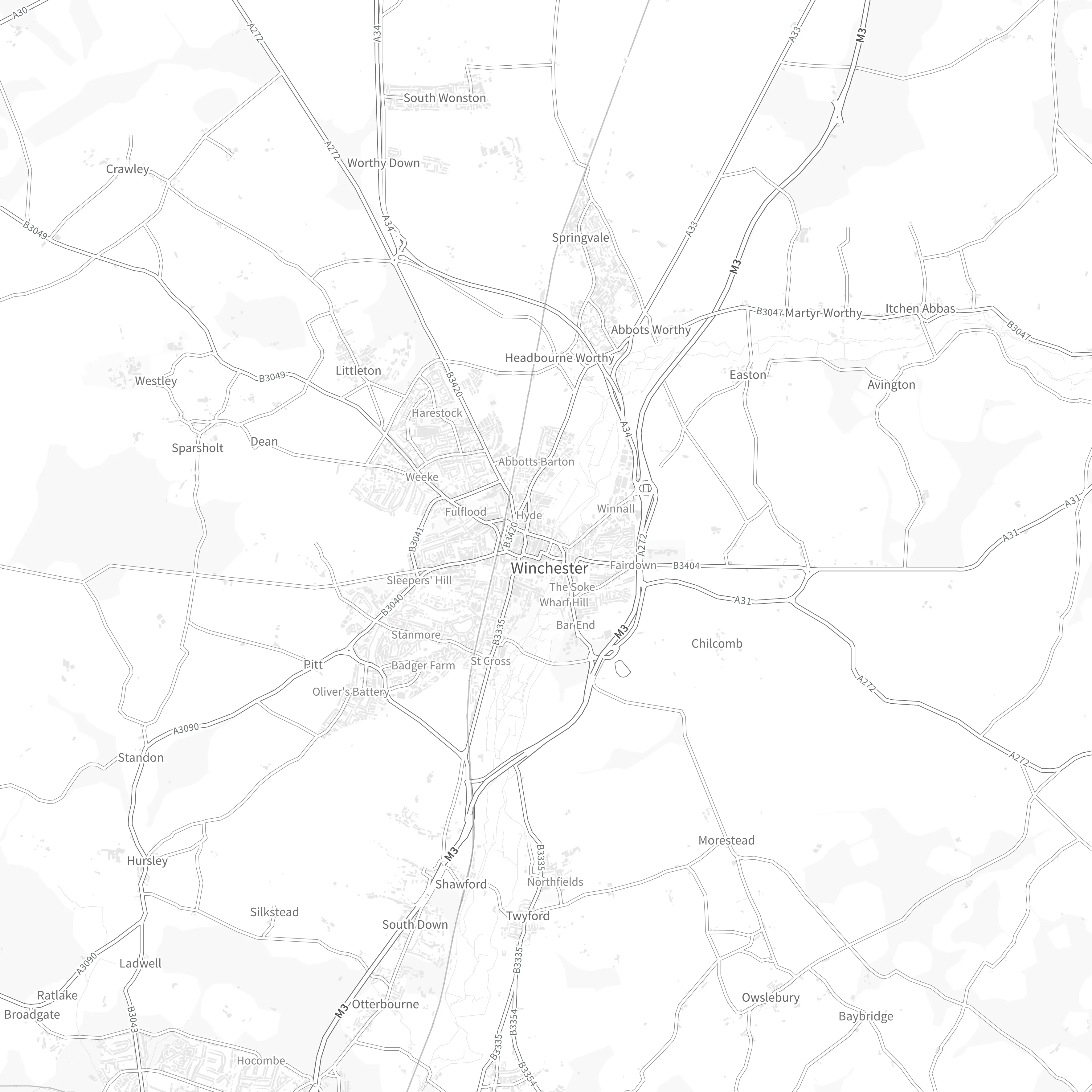
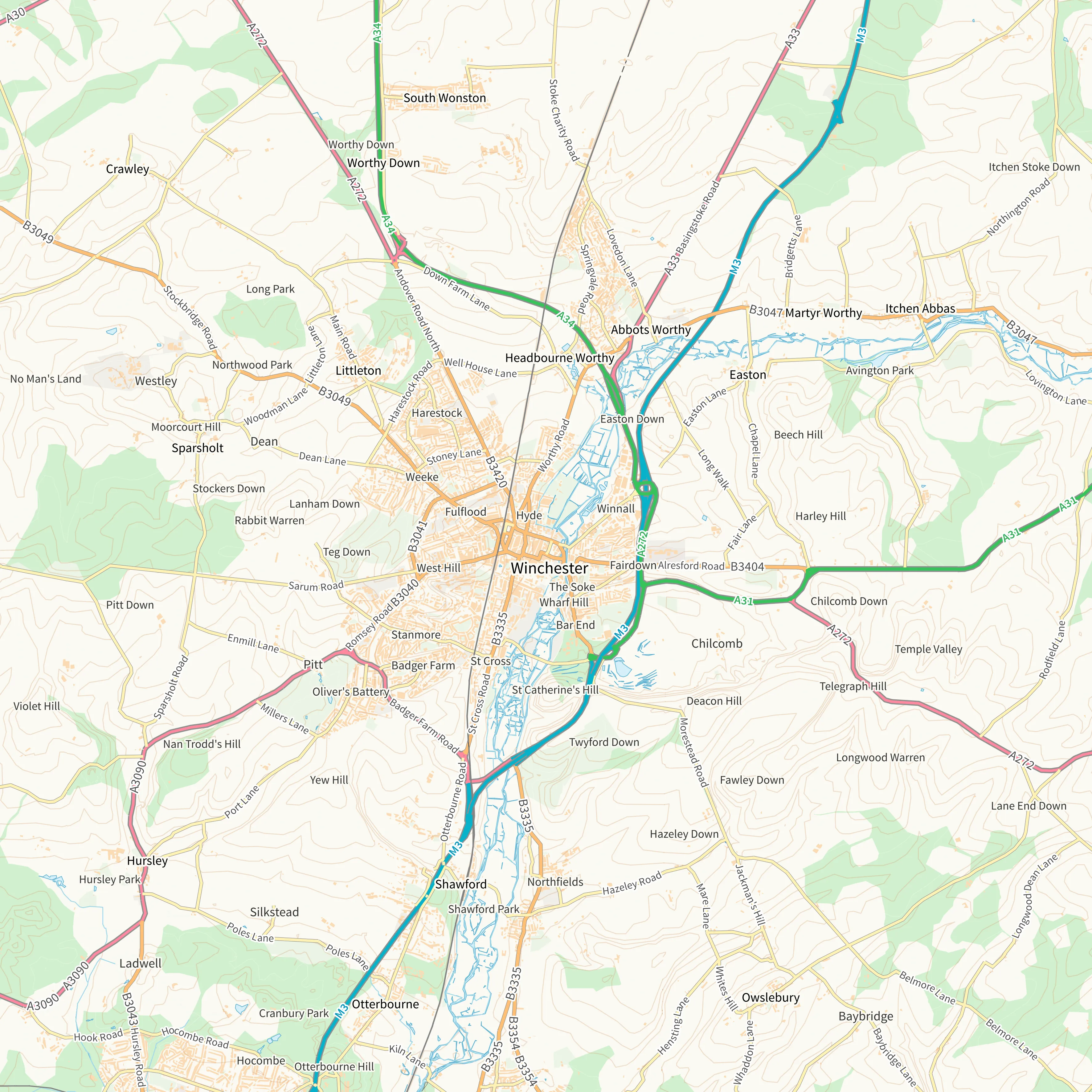
Road:
This style has the look and feel of a traditional OS map and focuses on transport networks - specifically highlighting the Great British road network. Being high in contrast with lots of detail and colour, this style is great at providing a clear overview map which is similar in style to that of traditional OS maps and for applications where seeing the road network is important.
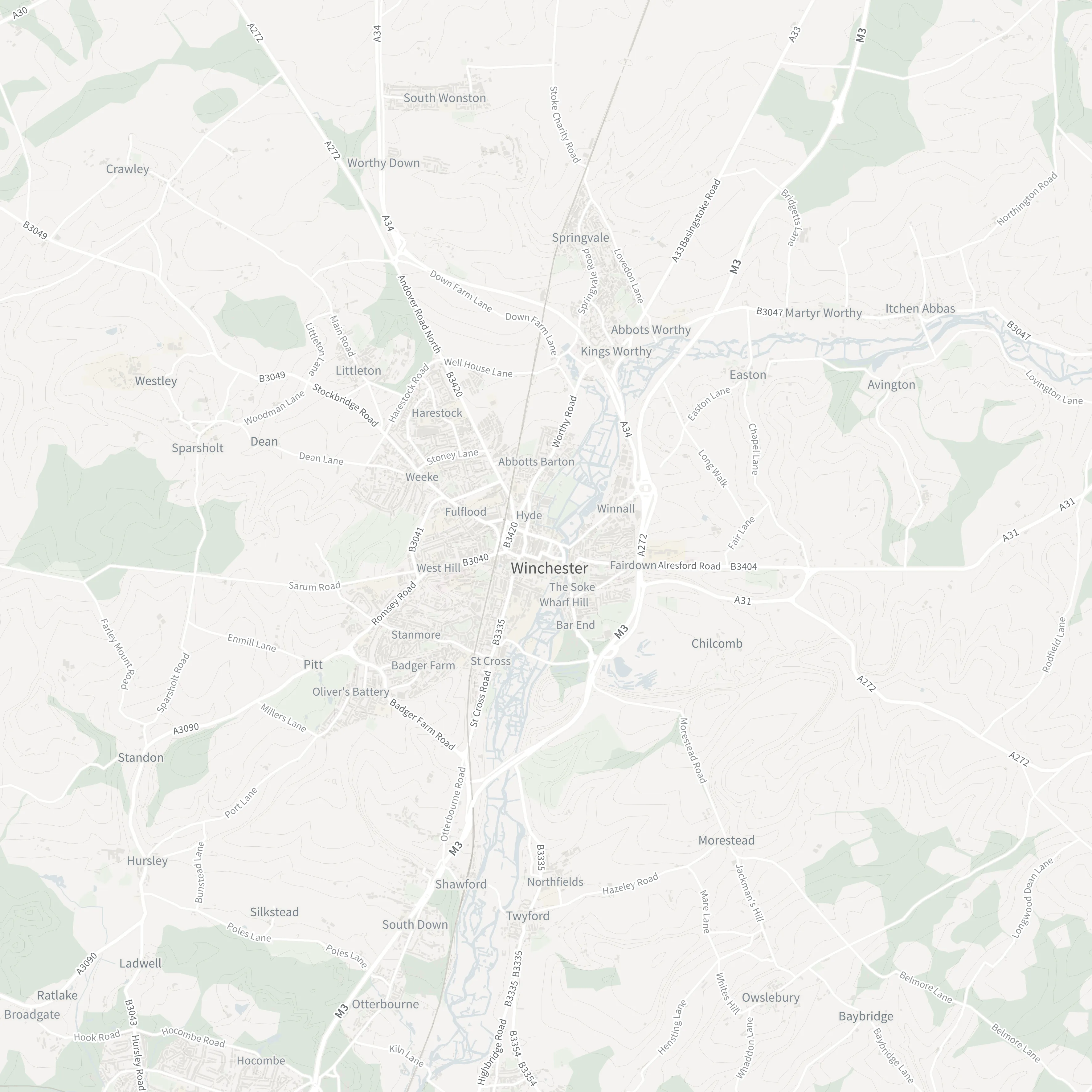
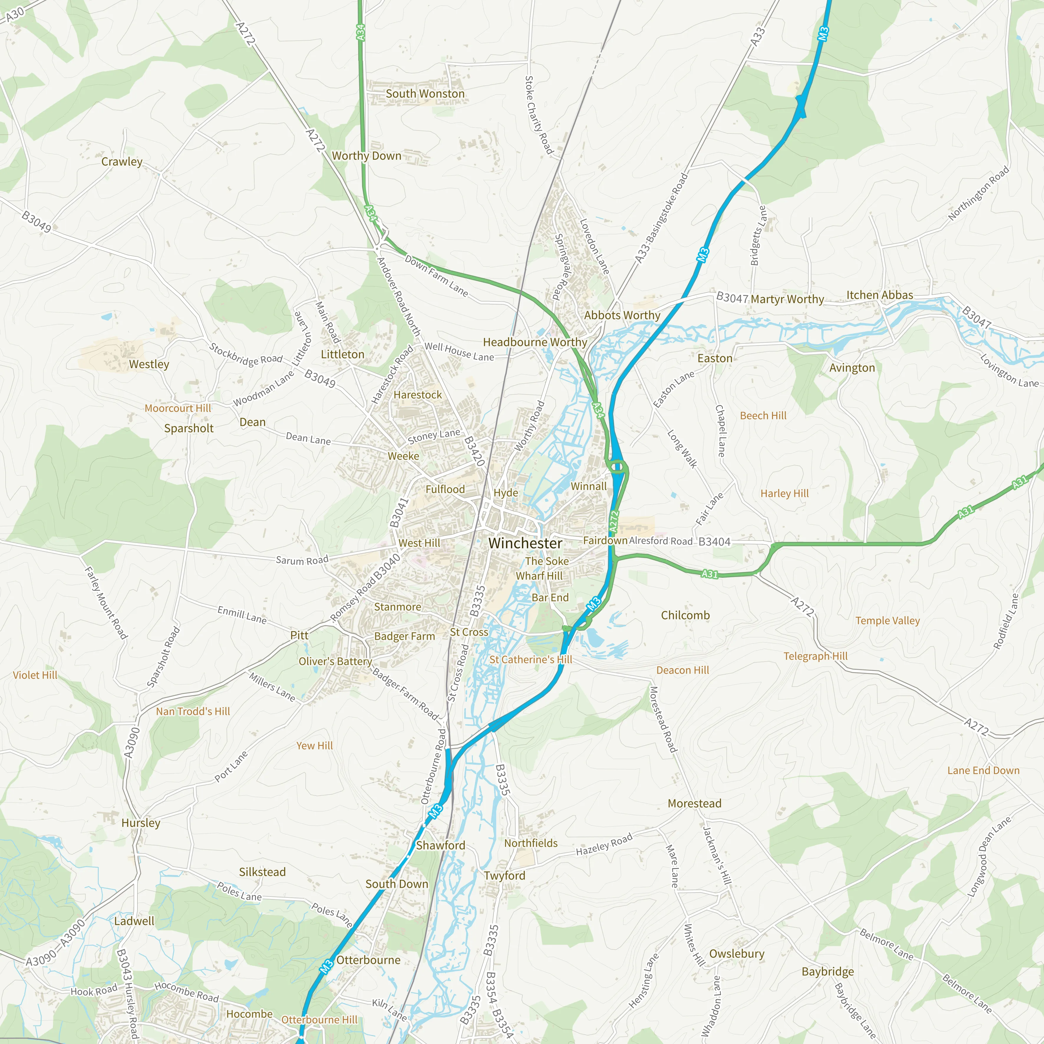
The Outdoor basemap style was already in OS NGD API - Tiles. This style was designed for outdoor leisure uses.
Borrowing certain design elements from our traditional paper maps this style focusses on terrain and land cover. It has a minimal colour pallet so can be used alongside your own data without competing with the colours of your own data overlays. This style is great for use cases where understanding the topography and land cover is important.
Using raw OS NGD data to create your own customised basemap
You can use OS NGD raw data directly to build a fully flexible and customisable basemap tailored to your needs. To make this easier, we’ve developed a set of pre-designed stylesheets in four styles: Light, Road, Outdoor, and Black & White.
These stylesheets are available in multiple formats to suit your preferred platform:
- QGIS (.qml)
- ArcGIS Pro (.lyrx)
- ArcMap (.lyr)
- SLD for web mapping applications
You can download all stylesheets from our GitHub repository. See the list of specific OS NGD data layers required to build the basemap.
Bespoke styling
In addition to the pre-designed house styles outlined above, with OS NGD API – Tiles, you can customise the style to match your brand and unique needs and make your map more appealing and informative. You can change everything from the colours to the features shown to which text labels appear at different zoom levels. Style editing can be achieved in free to use applications such as Maputnik. Follow our ‘How to’ guide to get started with editing your OS NGD API – Tiles style in Maputnik.
Further information
OS NGD API – Tiles is perfect for creating interactive web maps and is compatible with most web mapping libraries including OpenLayers, MapLibre GL JS and Leaflet. It can also be used in some GIS software and provides a beautifully designed, responsive base map.
We have a wealth of information about getting started with the API on our OS Docs Platform. This includes code examples and instructions for getting started with the API in some GIS Software.
What is the OS National Geographic Database?
The OS National Geographic Database (NGD) is a single store of Ordnance Survey’s authoritative data for Great Britain. It’s built for analytical uses and is designed to be the bedrock of more intelligent solutions. It reduces the complexity towards insight and getting the answers you need.
Data from the OS NGD can be accessed via the OS Data Hub using our OS Select+Build configuration and download service or via APIs.

Our highly accurate geospatial data and printed maps help individuals, governments and companies to understand the world, both in Britain and overseas.
Products and solutions featured in this blog
OS NGD API – Tiles
Create beautiful, responsive, and interactive vector maps powered by the OS National Geographic Database (OS NGD).
Find more blog articles
- Products and services
- OS
- Developers
- PSGA members
- Partners
- Government and public sector
- Great Britain
- United Kingdom