How Ordnance Survey supports agriculture and land management through innovation and trusted, authoritative data
A few weeks ago, the Department for Environment, Food and Rural Affairs launched the Land Use Framework policy paper on how England can best coordinate multiple demands on the use of land to develop more resilient landscapes and deliver a more prosperous future. OS, as providers of foundational national geospatial data, along with other partners, will work with Defra over the next 12 months to understand user needs when increasing access to richer land data, and to test options for improving data accessibility and interoperability for decision-making.
Use of trusted OS data
OS provides up to 30,000 updates to the OS National Geographic Database (OS NGD) every day. The OS NGD themes include Land, Buildings, Land Use, Structures, Transport, and Water and contains land information data which can also be seen in the OS MasterMap Topography and Sites products.
In recent years, OS has released the new Field Boundary layer into the OS NGD, beneficial for a variety of uses, from understanding and assessing biodiversity net gain, to supporting Environmental Land Management Schemes. It is also valuable for a range of environmental sector customers, environment agencies, major landowners and farmers, as well as both local and central government in delivering net zero ambitions. OS has also released enhancements to the land cover information in the OS NGD, by linking to habitat classification schemes and providing percentage coverage information for natural land cover features. In the last year, OS has released a new beta product, Enhanced Land Cover, which provides enhanced ecology mapping for England using UK habitat classifications.
OS Land Use data is widely used by central, devolved and local government bodies. Agencies such as the Rural Payments Agency also use OS MasterMap daily in its mapping. OS has recently worked with the Scotland’s Rural Payments and Inspections Division to understand their field management systems and develop models that support their specific requirements. This work is vastly reducing the hundreds of thousands of land parcels sent off for checking after change detection finds new or altered fences or boundaries, delivering a faster, smarter and more accurate way to manage agricultural land information. By automatically detecting potential parcel changes, the new workflow removes redundant manual tasks, targets effort where it matters most, and significantly improves data quality. This streamlined, data-driven approach supports more efficient subsidy administration, strengthens compliance, and helps the organisation meet business plan commitments without additional resource.
OS is constantly looking to provide a greater and richer variety of data to customers and in May 2024 added third party datasets from the British Geological Survey – the leading provider of the UK’s scientific earth data – which has extended the offering to OS customers significantly.
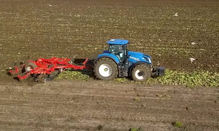
Smart farming – the game-changing use of driverless tractors
Long-term partner CNH, which is parent company to the Case IH, New Holland and STEYR agricultural equipment brands and Raven technology brand, worked closely with OS to support their ultra-precise positioning of farm machinery, specifically tractors. The approach was to power them by OS Net – OS’s GNSS system of 118 base stations covering the whole of Britain – enabling Real Time Kinematic positioning information. The auto-guided tractors were proven to operate at centimetre accuracy ensuring more efficient seed sowing, pollination, fertiliser distribution, and pest control. This accurate guidance system provided optimum signal availability no matter what the topography, helping eliminate the inaccuracy, downtime and stress that can be caused by signal loss, as well as reducing labour needs with longer periods of operation.
Since those first trials, the use of driverless tractors has grown exponentially in Britain. Up to 2024, 11,500 – 12,000 were registered annually, dropping last year to just under 9,000, with East Anglia and the South West of England seeing the highest number of new tractor registrations a year. CNH continues to be a leader in precision agriculture technology.
Driverless tractors increase efficiencies, saving cost, and optimise yields throughout the complete crop cycle of planting, spraying, harvesting, and cultivation, and allow year-to-year accuracy for repeat tasks. The driverless vehicles are operated with the aid of a supervisor monitoring progress at a control station or more usually with a manned tractor ahead.
Nurturing innovation
OS has also nurtured innovation in land management through Geovation, an initiative in association with HM Land Registry, which grows and supports GeoTech and PropTech start-ups.
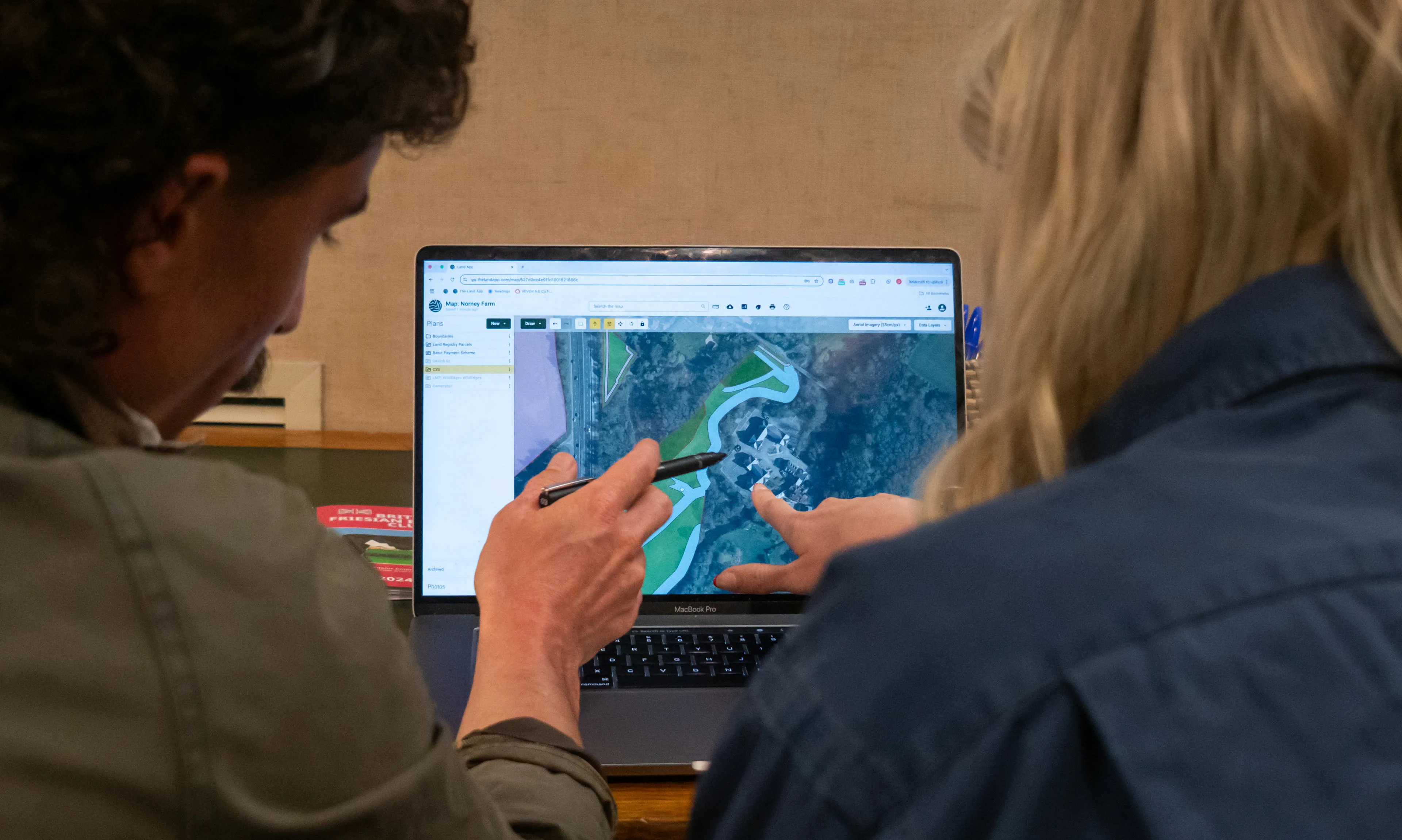
One of the start-ups in the inaugural Geovation Accelerator programme in 2015 was Land App, founded by fourth-generation farmer Tim Hopkin. He saw how hard it was for a family farm to survive when vital information was stuck on paper maps in cupboards or in complex, expensive software. He realised that if one 90-acre farm couldn't find a clear way forward, the entire land economy was at a standstill.
His solution was Land App, the essential, easy-to-use digital mapping platform that helps land managers unlock the full potential of their land. A cloud-based platform, Land App uses OS data to allow landowners, planners, and developers to manage and visualise land data, facilitating efficient planning and land use decisions.
Ten years on and Land App is a trusted national platform on which 80% of England’s agricultural land is already mapped. Land App works with corporate and government partners, including the Forestry Commission, UK Centre for Ecology & Hydrology (UKCEH), Sainsbury’s and Waitrose, to help farmers and suppliers improve land quality, restore biodiversity, and build long-term resilience.
“At Land App, we envision a future with better food security, more diverse landscapes, and healthier people. By giving the rural sector the tools to plan with confidence, we are helping to ensure that the heritage I fought to save on my own farm is protected for generations to come across the globe,” said Tim Hopkin.
Geovation has continued to support innovation in the agricultural sector; another recent start-up Soil Benchmark focuses on the role of sustainable soil management in tackling major environmental challenges. To date, around 14% of England’s agricultural land is included in its app. The platform uses both OS NGD in terms of field parcels and also OS Water data extensively; this helps drive a lot of the environmental risk and compliance calculations.
The latest to join the Geovation Accelerator programme is Oko Ag (oko.ag). Its founder Alexandra Simmons has one aim: to simplify agricultural funding. By combining geospatial intelligence with AI, the platform makes it quicker and easier for farms to see what public and private funding is available to them.
She said: “Agricultural funding is vital to the financial stability and long-term resilience of farm businesses. It helps de-risk on-farm changes, but the system is incredibly complex, with hundreds of funding opportunities that are constantly changing. We’re starting with the basics by creating a central directory of public and private funding. Using geospatial intelligence, we match farms with relevant opportunities and help farmers navigate schemes so they can make more efficient and effective decisions.”
How OS helps to connect rural communities by supporting the 5G roll-out
Effective telecoms in any sector is essential with a current market focus on building out 4G and 5G coverage to help hit government targets. OS supports faster and more reliable broadband in more rural areas by providing highly accurate and detailed geospatial data for the prospective location of new telecom masts, as well as for radio planning, highlighting where structures or the natural environment could obstruct signal through line-of-sight. The Shared Rural Network has already delivered mobile broadband to 96% of the UK, improving 4G coverage in the areas that need it most. However, despite national progress in connectivity, there is still a lag in rural areas.
As well as supporting the smart technology outlined above, farms in more remote locations need better broadband for day-to-day living, from accessing online services to enabling their participation in a modern, digital agricultural economy, to supporting educational needs for families living on farms.
As 5G networks are expanding across the country, a new and innovative use of 5G in agriculture is as a sensing ability. Telecom providers can use radio waves from a mast, and if the signal can be interrupted by moving herds, this can show their location, making herd management easier and reducing labour demands.
Tom Stabb, Customer Development Lead for Telecoms at OS, said: “OS is really making a difference in the telecoms sector by bringing clarity to operations, which we do through our highly detailed and accurate location data. The insights from our data strengthen decision-making, improve the effectiveness of network designs, and remove the likelihood of costly mistakes, whilst also addressing the digital divide by supporting the delivery of more advanced connectivity to rural and hard to reach areas. Wherever telecoms networks are needed, whether in dense cities or remote communities, we play a vital part.”
The ongoing need for trusted location data
As land use pressures intensify and the farming sector embraces significant advances in technology, location data is becoming an essential enabler of more efficient, sustainable land management. As the sector continues to evolve, OS data and expertise remain central to driving innovation, improving productivity and delivering long-term resilience across agriculture.

Our highly accurate geospatial data and printed maps help individuals, governments and companies to understand the world, both in Britain and overseas.
Explore the OS National Geographic Database
A single store of our authoritative data for Great Britain
Products and solutions featured in this insight
OS Land Features
Explore detailed land cover data, and visualise the land cover make-up of Great Britain, including both manmade features and natural land features.
OS Land Use Features
Visualise and analyse geometric representations of different types of land use, land use sites, and site access data.
OS Building Features
Access data on buildings and building features, including building heights, lines, and access points, across Great Britain.
OS Water Network
Conduct water mapping with a three-dimensional structured link and node network of watercourses across Great Britain.
OS Water Features
See water network and river network data across Great Britain, including water area features such as watercourses, lakes, drains, springs, and intertidal watercourses.
OS Structure Features
Our comprehensive list of structure features - manmade constructs that are not buildings: dams, bridges, chimneys, post boxes, and many more.
OS Transport Network
A visual representation of Great Britain's transport networks including road, ferry, rail, and path networks, and the connectivity between them all.
OS Transport Features
Visualise transport features including roads, tracks, railways, and paths across Great Britain. Analyse streetlight coverage to support safe, well-lit, active travel routes.
Find more Insights
- Products and services
- Autonomous vehicles
- Land administration
- Businesses
- PSGA members
- Telecoms
- Land and property