New national cycle lane data will support local authorities and central Government in promoting Active Travel and public safety
Press Office
The new data is highly detailed, telling users where cycle lane infrastructure is located, and other key information, such as direction of travel, modal width and minimum width, and where it links to associated roads or paths. Cycle lane descriptions have been aligned to government guidance on cycle infrastructure design where possible.
For the first time, OS has released partial coverage, allowing early access to data that has already been captured, rather than waiting for all of GB to be complete. From September last year, the coverage is being increased on a month-by-month basis to full GB coverage by the end of March 2026. Approximately 67% of coverage (approximately 4,140 miles) has already been released into the OS National Geographic Database (NGD) as shown here - OS NGD Improvements.
Local authorities are expected to be the main users of the new data, using it for asset management - understanding the length and width of current lanes - and connectivity, helping them make the most of investment by infilling infrastructure gaps. They can also use it to plan safer cycle routes by having an understanding of segregation from traffic. This supports Active Travel, ensuring access to key public services and reducing congestion and carbon emissions. The data will also be available to Active Travel England, the Department for Transport and Transport Wales to support road safety analysis, measure policy success and support national cycling statistics. It will also allow the assessment of suitability for new cycle lane funding submissions.
"Encouraging more people to walk, wheel and cycle is vital for healthier communities and greener travel. Ordnance Survey’s new cycle lane data gives local authorities the insight they need to plan and manage safer, better-connected routes – helping make active travel the easy choice."
The new cycle lane data, which has mostly been created using aerial imagery, captures sections of roads or paths that are designated for cyclists, either segregated by a physical feature, or identified by painted or other signage, or by a different colour of tarmac or surface type. Therefore, routes that are part of the National Cycle Network are not captured as cycle lane features unless designated infrastructure is present that meets the criteria.
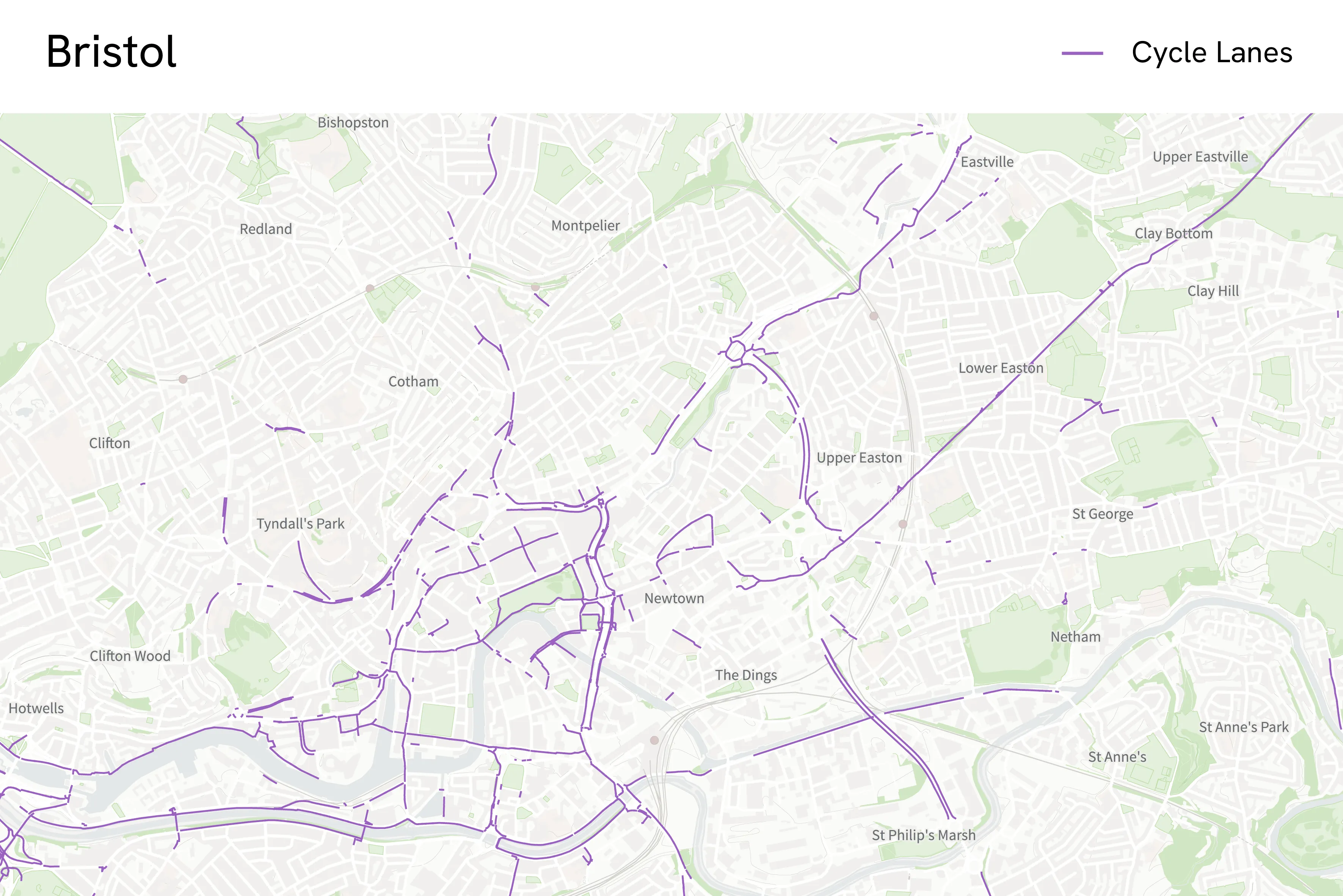
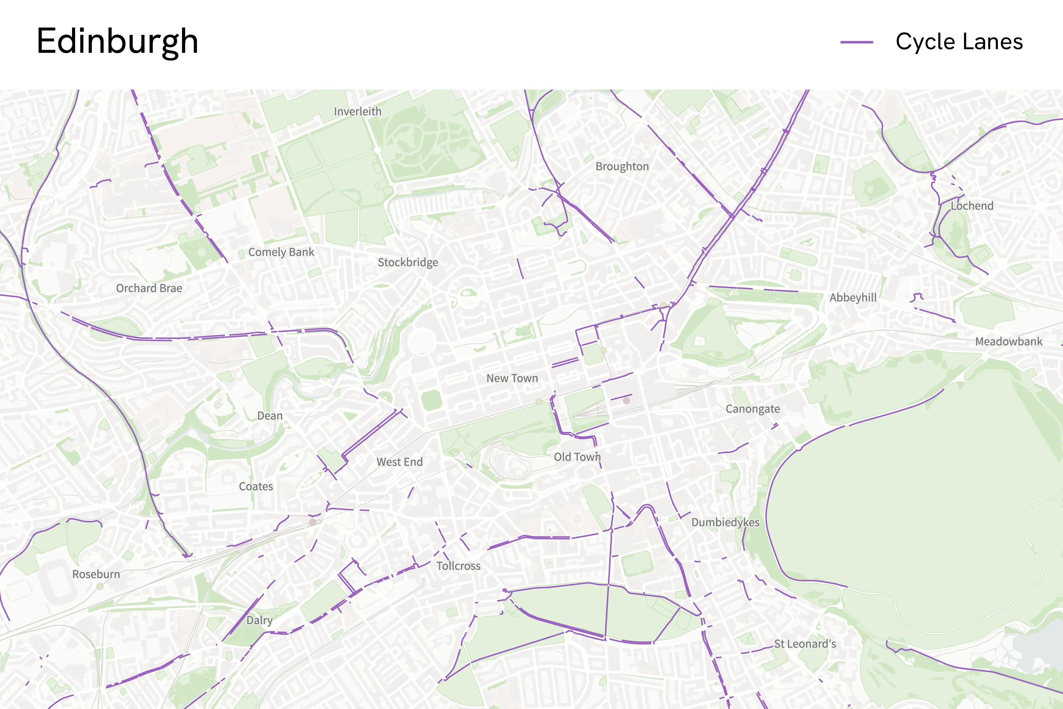
To highlight the benefit of the new data, OS has analysed cycle lane data in Bristol, officially named as England’s first cycling city back in 2008, and Edinburgh, also known for its cycling culture and cycling infrastructure. OS has captured a total of 62 miles of cycle lanes in the City of Bristol, which equates to roughly 6% of the road network in the city. Approximately 15 miles of these cycle lanes are advisory lanes (designated by a broken white line on the road carriageway), while two miles are fully segregated from the road carriageway. These insights can support analysis of where more segregated cycle infrastructure could be implemented to provide continuous physical segregation from traffic to improve safety. In the City of Edinburgh, OS has captured 113 miles of cycle lanes. This is approximately 8% of the 1,447 miles of road network in the city.
The new data has been released as part of the Public Sector Geospatial Agreement (PSGA). This is a contract between Government Digital Service, managed on behalf of the UK Government, and OS for the provision of geospatial data and services to the emergency services and wider public sector organisations, free at the point of use.
Bus lanes are also new to the OS NGD Transport dataset and will reach full GB coverage in March alongside cycle lanes.
Sharing the latest news about OS. We can license you to use OS maps in print, online and film format. For more information and resources for journalists, bloggers and media professionals, email pressoffice@os.uk or call 023 8005 5565.
Explore the OS National Geographic Database
A single store of our authoritative data for Great Britain
Find more news
- Announcements
- Transportation infrastructure
- PSGA members
- Government and public sector
- Transport